Tropical Storm Francine forms in Gulf of Mexico, to hit Louisiana as a hurricane

Add Axios as your preferred source to
see more of our stories on Google.
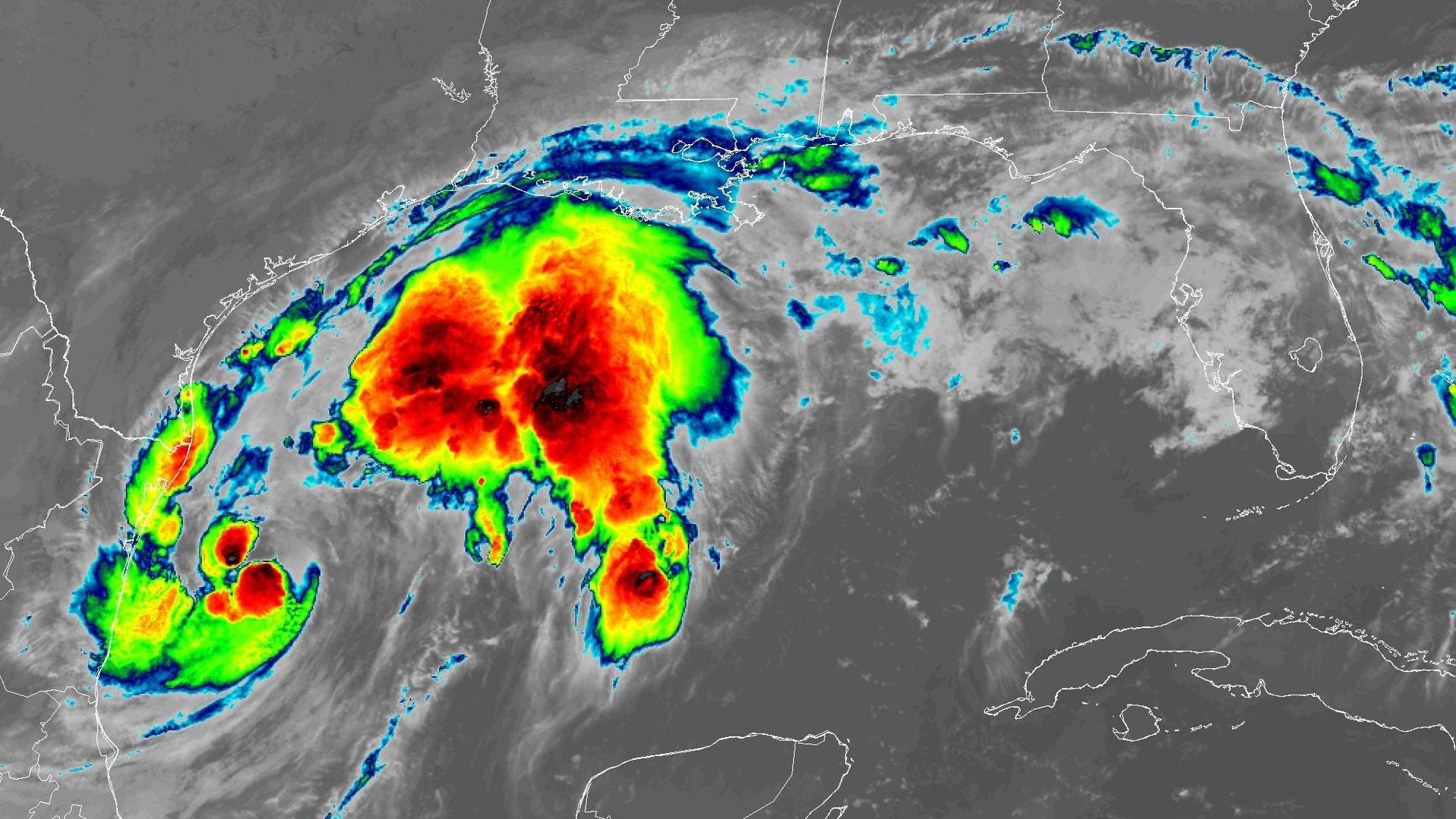
Satellite image of Tropical Storm Francine on Sept. 10. Image: NOAA
Tropical Storm Francine formed in the southwestern Gulf of Mexico on Monday morning, and is moving toward a likely landfall in central Louisiana as a Category 2 hurricane on Wednesday afternoon and evening.
Threat level: The storm is likely to bring damaging winds, coastal flooding and inland flooding to much of Louisiana and parts of Mississippi.
- The National Hurricane Center is predicting the storm to come ashore to the west of New Orleans with maximum sustained winds of 100 mph on Wednesday. A tropical storm warning is in effect for the city, while a hurricane warning is in effect between Sabine Pass to Morgan City, La.
- Heavy rains from the system could cause flooding especially near the Gulf Coast and inland, given that several inches of rain fell across this region last week. The NHC is forecasting storm total rainfall amounts to range from 4 to 8 inches, with local totals up to a foot.
- The Weather Prediction Center has placed much of Louisiana, including New Orleans, and southwestern Mississippi in a "moderate risk" for inland flooding during the next five days.
What we're watching: However, the storm hit a hiccup in intensity early Tuesday as some dry air was brought into the storm's core, disrupting some of its organization. There is still some uncertainty in its intensity as it approaches the Louisiana coast.
- Still, the storm is forecast to become a hurricane today and intensify until it nears the coast.
- Strong winds aloft and some dry air may cause the intensification to stop or weaken the storm slightly near or especially immediately after landfall, the Hurricane Center stated.
- For now, the cone showing the potential track of the storm's center (but not the entire scope of its impacts, which will be wider than that), includes much of the western and central Louisiana coastlines, with New Orleans on its eastern edge.
The big picture: Francine breaks the prolonged quiet period that the Atlantic Ocean Basin has been in since mid-August when Hurricane Ernesto dissipated on Aug. 20.
- The storm will have plenty of warm ocean waters to feed off of.
- The Gulf of Mexico currently has the highest level of ocean heat content on record for the region at this time of year.
- Ocean temperatures in the broader Atlantic Basin (as well as globally) have been running at record to near-record highs for months, in trends tied in part to human-caused climate change.
- September and October are the times of year when tropical storms and hurricanes are more likely to form in the Caribbean, portions of the Atlantic closer to the U.S., and the Gulf of Mexico, rather than spinning up soon after emerging off the west coast of Africa.
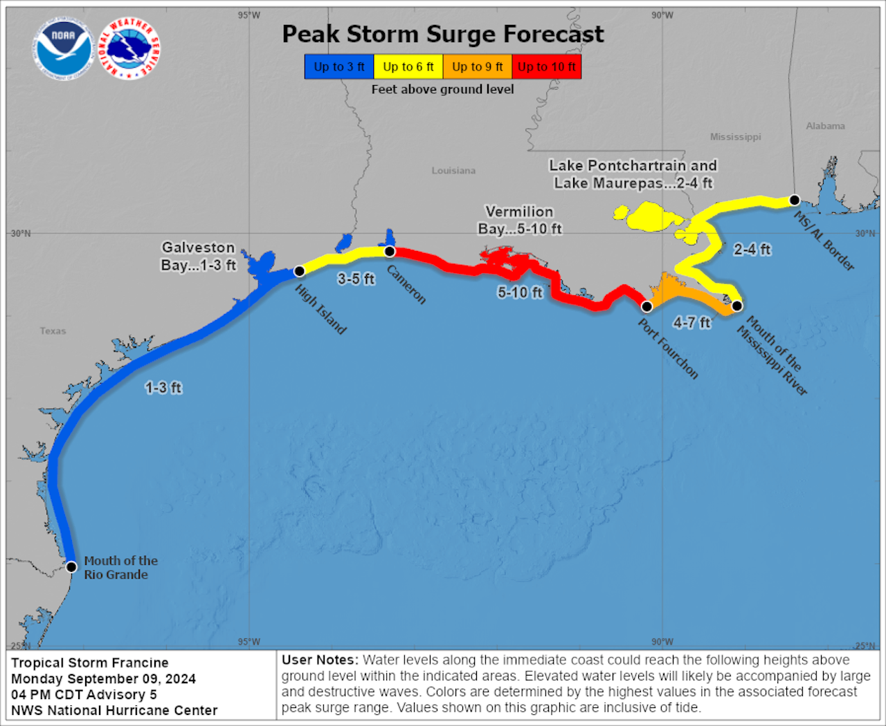
Zoom in: Tropical Storm Francine is forecast to hit a vulnerable part of the Gulf Coast, with surge amounts of 5 to 10 feet above normally dry ground along the central Louisiana coast, if the peak surge hits a high tide.
- The Louisiana coast faces challenges from rising sea levels due to climate change along with sinking land, which makes it especially prone to storm surge-flooding.
The bottom line: Gulf Coastal residents need to make preparations if they are in its predicted path, as high winds from then-Hurricane Francine may arrive in Louisiana as early as Wednesday morning.
Go deeper: New Orleans under tropical storm watch ahead of Francine: What to expect
Editor's note: This article has been updated to include the latest forecast information.
