Midwest under threat from hurricane-force winds in severe storm system

Add Axios as your preferred source to
see more of our stories on Google.
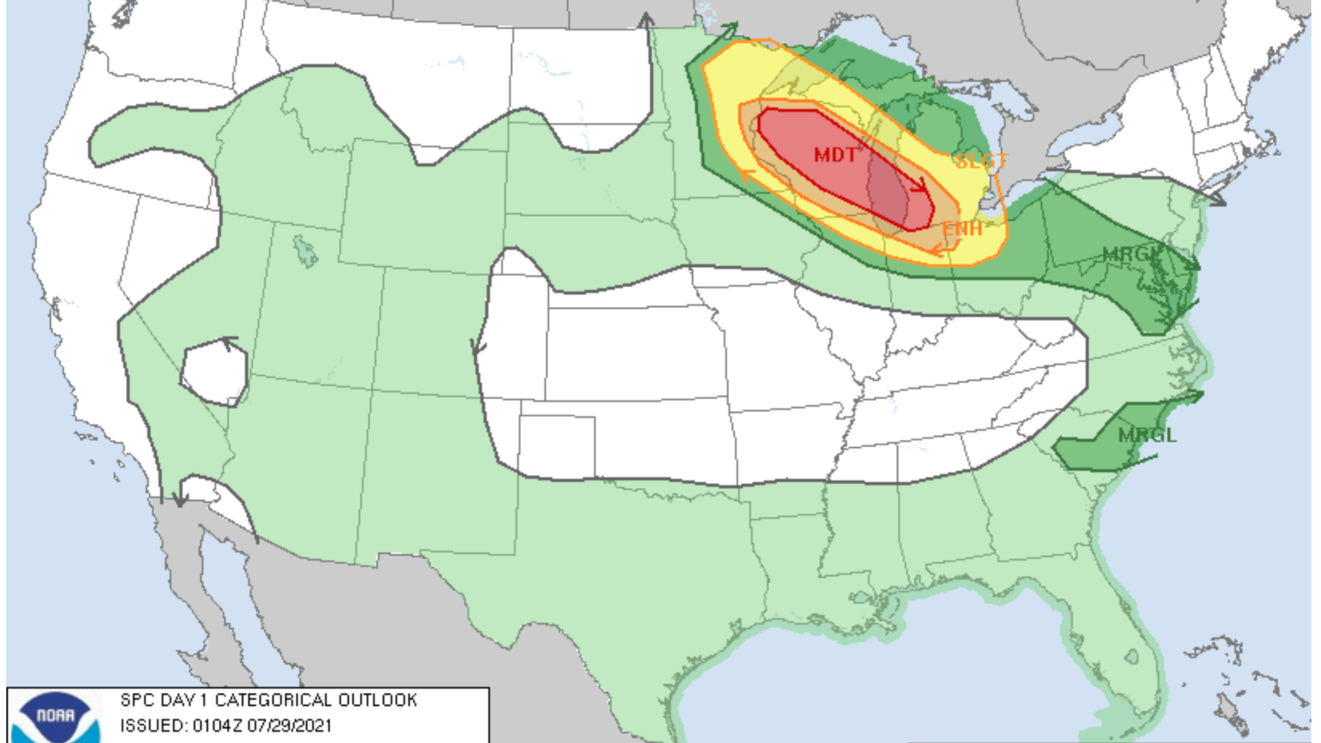
Photo: NOAA
Organizers in Wisconsin postponed the biggest air show in the U.S. as a severe storm system threatened the Midwest with potentially hurricane-force winds, tornados, hail and thunderstorms overnight.
Threat level: More than 5.9 million people could be affected by the storm system — which saw the EAA AirVenture in Oshkosh, Wisconsin, postpone events due to be held Wednesday until the following evening amid the threat of 90 mph winds.
- Storms moving through southern Wisconsin were bringing "damaging winds along the line" and the threat of tornadoes in the southeast of the state on Thursday morning, according to the NWS.
- "Thunderstorms associated with wind damage and a risk for a tornado, will be possible from the Ohio Valley, central Appalachians and Mid-Atlantic states on Thursday," the National Weather Service's Storm Prediction Center said early Thursday.
- The National Weather Service issued a level 3 out of 5 storm outlook, an an "enhanced" risk of severe weather, across the Mid-Atlantic states on Thursday, including Washington, Baltimore and Philadelphia.
The big picture: The latest in a series of heat waves that was bringing extremely hot temperatures to the Central U.S. Wednesday contributed to the severe storm system in the Midwest, per Axios' Andrew Freedman.
- Such weather patterns often lead to so-called derecho events, characterized by an organized group of severe thunderstorms that brings damaging straight-line winds across long distances, Freedman notes.
Flashback: A derecho that struck parts of Iowa and Indiana last year caused some $7.5 billion in damages.
Editor's note: This article has been updated with new details throughout.
