Barry weakens to tropical depression in Louisiana: Flood threat remains high

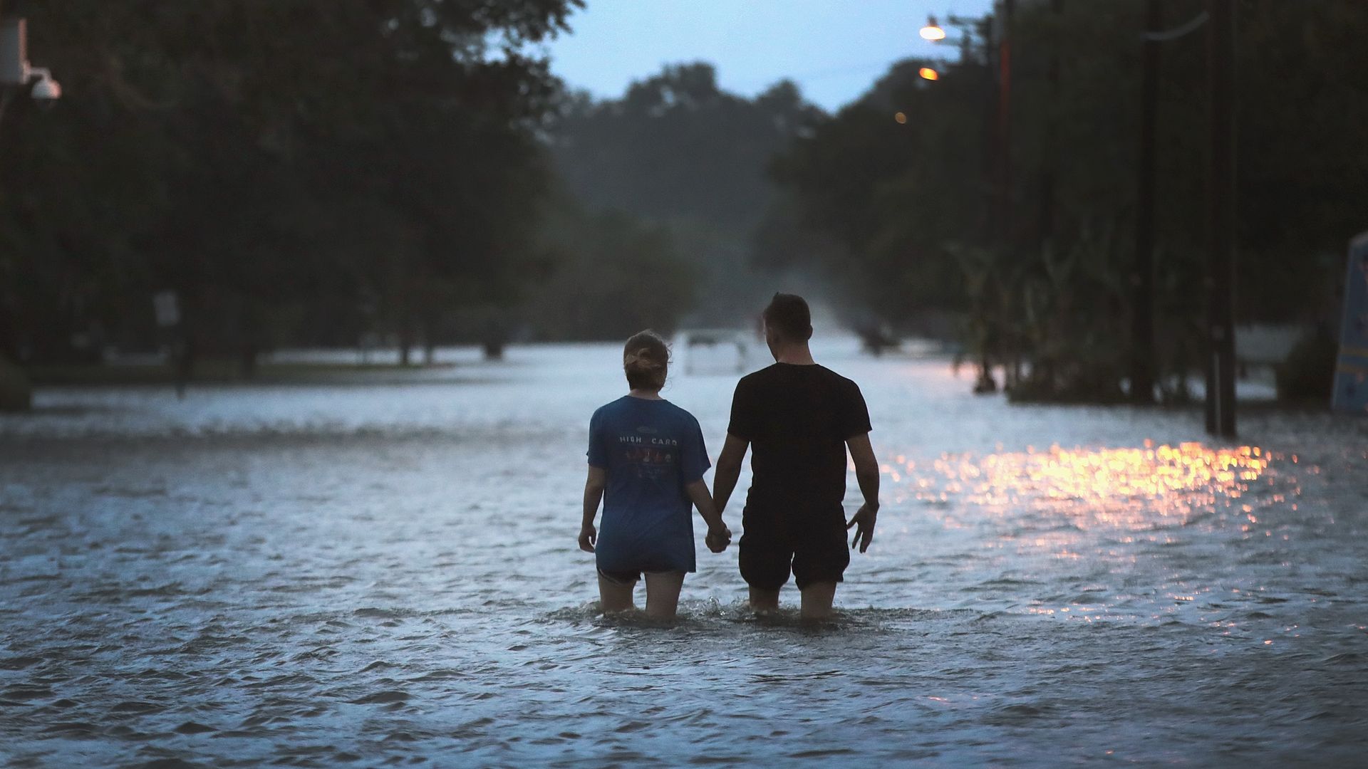
Lakeshore Drive near Lake Pontchartrain in Mandeville, Louisiana, is flooded. Photo: Scott Olson/Getty Images
Barry was downgraded to a tropical depression over northwestern Louisiana Sunday. But the National Hurricane Center said there's "still a high risk of flash flooding" from heavy rain as it churns toward Arkansas, and forecasters issued several tornado warnings.
Details: Louisiana Gov. John Bel Edwards (D) told a news conference Sunday that first responders rescued 93 people, and he said hundreds of thousands were without power following the storm.
The big picture: After a brief period as a Category 1 hurricane, Barry made landfall in Louisiana on Saturday, flooding highways, forcing people onto rooftops and dumping heavy rain across the state, per AP. The-then Tropical Storm Barry prompted preemptive evacuations, power outages, heavy rains and rescues along Louisiana's coast.
Threat level: Sustained rain through the weekend is projected to push some Louisiana rivers to near record-setting flood stages. NOAA forecast the Tchefuncte River — which feeds into Lake Pontchartrain, just outside New Orleans — would reach 30 feet by 2 pm Monday.
The impact: The rain, combined with a storm surge of 3–5 feet, could cause the Mississippi River to rise near or above 20 feet in New Orleans. NOAA forecasts the Tangipahoa River — which feeds into Lake Pontchartrain — to reach 21 feet by 2pm Tuesday.
- In Baton Rouge, the flood danger remained high: NOAA forecast the Amite River in Denham Springs would hit 41 feet by 3 pm Tuesday and the Comite River to break a record 34.5 feet by 3 pm Monday.
Editor's note: This article has been updated with more information from the NWS and the National Hurricane Center.
Go deeper: