Axios Science

November 16, 2018
1 big thing: Humans are a wildfire threat multiplier


The fires that wiped out the town of Paradise, California, and burned all the way to the Pacific Ocean in Malibu are the latest in a 13-month string of the deadliest and most destructive blazes the state has ever seen.
The big picture: These fires have parameters in common — unusually warm and dry preceding conditions, strong winds that caused the fires to spread rapidly, extreme fire behavior and populated areas that are difficult to evacuate on short notice.
No single factor — not climate change, forest management or building practices — is responsible for the deadly blazes the state is now seeing, experts tell Axios. Instead, it's their combination that's making an already dicey situation far worse. And the outlook in coming years, as climate change continues, is foreboding.
- The state's fire season now stretches later into the fall and starts earlier in the spring.
“Fire season in California doesn’t have a well-defined boundary anymore, that’s been true for some time."— Brenda Belongie, US Forest Service meteorologist
What's happening: Longer-term climate change and population growth are combining to increase wildfire risk in California and more broadly across the American West.
- One of the starkest changes firefighters are contending with is an uptick in instances of extreme fire behavior, such as the massive EF-3 fire tornado that accompanied the Carr Fire in July.
- The biggest climate change-related impact is manifested in the increased dryness of vegetation.
“The warming equals drying equals more explosive fire growth," said Neil Lareau, a researcher specializing in fire weather at the University of Nevada at Reno.
- According to a major climate assessment published in 2017, climate change-related factors helped to double the forest fire area burned in the West between 1984 and 2015.
- Other studies have pointed to the role played by conditions preceding major fires. For example, heavy rains followed by dry, unusually warm conditions can prime the environment for major burns.
- This summer, California had its hottest month in state history in July, along with the largest fire the state has ever recorded.
- Of the top 20 largest wildfires in state history, 15 have occurred since the year 2000.
The housing factor: Another major factor in the impact of these fires is the increasing number of people living in the so-called wildland-urban interface, or WUI, where communities sit next to lands that typically burn. But simply stopping building in such regions is not necessarily a practical solution.
"Almost everywhere we live in the West is wildland-urban interface," said Lareau. "It's overly simple to say we shouldn't be building here."
The bottom line: The recent, deadly fires are the new normal in California, and residents of other Western states should be paying close attention, because they could be next.
Go deeper: Special Report: A 30-year alarm on the reality of climate change
2. Wildfires aren't just a problem for California


A look at a map of all the fires detected by a NASA satellite on July 24 shows that wildfires are not a problem unique to California. Other Western states, British Columbia, Alberta and Alaska were seeing fires that day. So too were areas in Sweden, amidst an unusual wildfire outbreak in Scandinavia associated with a record heat wave.
The big event that day, though, doesn't jump out at you at first. Fast-moving wildfires there killed at least 80 people in tourist villages outside Athens, generating headlines around the world.
- This event was eerily similar to what California has just seen — flames fueled by dryness and drawn by strong winds toward populated areas with clogged escape routes and little advanced warnings.
- Other areas that experience Mediterranean climates are also prone to severe wildfires in hot, dry and windy periods, including Spain and Portugal.
The fire signatures seen on the map in South America and Africa are likely associated with agricultural fires and land clearing operations in the Amazon.
Go deeper: See a snapshot of global wildfires each day at NASA's WorldView website.
3: Why it's so hard to issue a fire warning
The nearly 30,000 residents of Paradise, California, got no official warning through the National Weather Service that an explosively growing wildfire was headed for their community on Nov. 8.
Why it matters: This was the deadliest wildfire in California history, and with more than 130 still missing, the toll is expected to rise. That so many people could perish in a single disaster due in part to the lack of warning means something is clearly wrong with how we're handling fire emergencies.
The big picture: Weather forecasters knew, and had clearly warned many days in advance, that conditions would be extremely conducive to wildfires in Northern California on Nov. 8. Butte County, which includes Paradise, was designated as being in a zone of "critical" fire weather risk, one of the most severe categories.
- But for wildfires, unlike severe thunderstorms and tornadoes, the journey from forecast to a warning being delivered is convoluted — and it's costing lives.
There is such a thing as a "fire warning," though they have seldom been issued, according to Robyn Heffernan, National Fire Weather Science and Dissemination Meteorologist at the National Interagency Fire Center in Boise, Idaho.
- The National Weather Service describes it as "an urgent message issued at the request of local officials to share detailed evacuation information with people threatened by wildfires."
But there's a catch: Such a warning must be requested by someone outside of the National Weather Service, such as an emergency manager.
“It’s really up to the emergency management community,” Heffernan said of the fire warning product.
Partly as a result of the spate of deadly fires in California, Heffernan said discussions are underway about changing the way such a warning works.
Go deeper: Read the entire story.
4. We're on the cusp of better wildfire forecasting
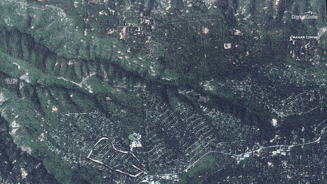
Satellite images of Paradise, California, showing the community before and during the Camp Fire. Images: DigitalGlobe, a MAXAR company.
5. Moving back to the fire zone
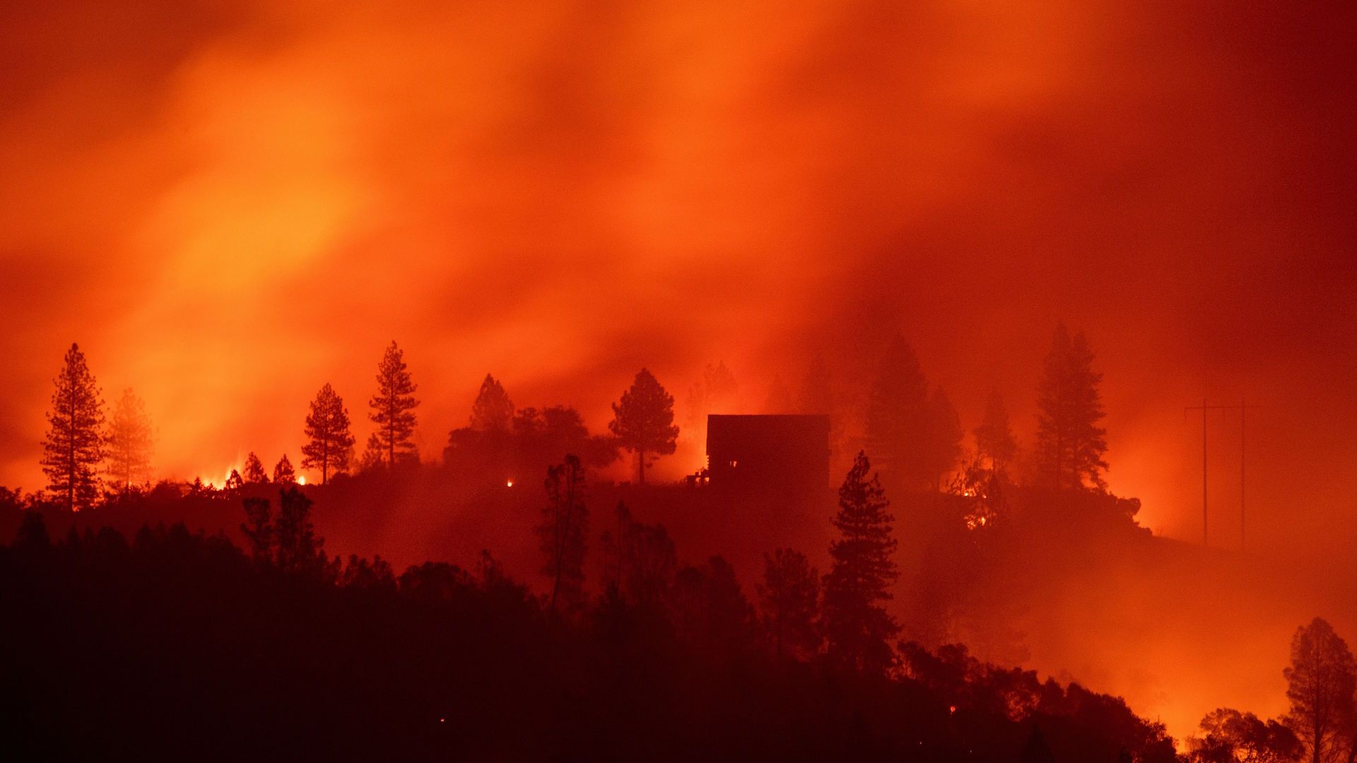
Flames from the Camp fire burn near a home atop a ridge near Big Bend, California, on Nov. 10. Photo: Josh Edelson/AFP/Getty Images
6. Axios stories worthy of your time
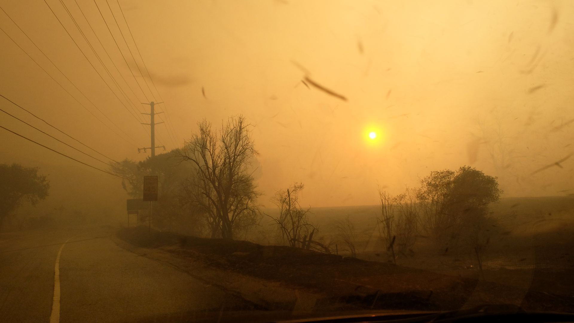
Smoke and ash partially block out the sun from the Woolsey fire on Nov. 9. Photo: Matthew Simmons/Getty Images.
7. What we're reading elsewhere
8. Something wondrous: A crater underneath the ice
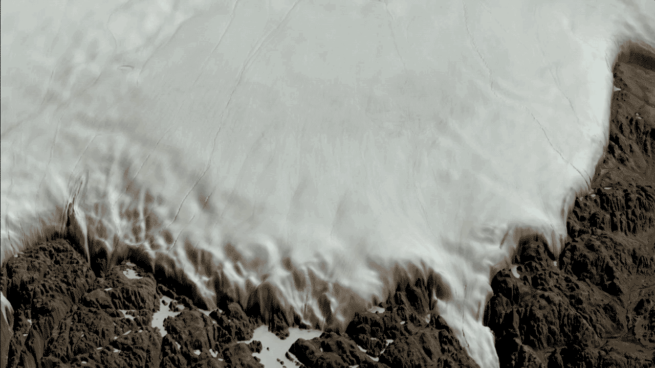
Two views of the Hiawatha crater region: one covered by the Greenland Ice Sheet, the other showing the topography of the rock beneath the ice sheet, including the crater. Image: NASA/Cindy Starr.
Axios Science

Gather the facts on the latest scientific advances