Twin Cities winter storm was substantial but not "epic"

Add Axios as your preferred source to
see more of our stories on Google.
This week's three-day snowstorm fell into the range that most meteorologists predicted, but it was not the "epic" blizzard some suggested it would be.
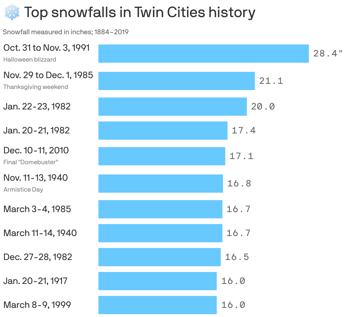
By the numbers: 13.4 inches of snow fell at MSP Airport Tuesday through Thursday. That didn't crack our top 10 snowfall totals dating back to 1884.
- In fact, it didn't even top the early January storm here, which dumped 14.9 inches.
Yes, but: Some areas saw more precipitation than others. Trained spotters in Apple Valley and Cambridge reported 19 and 17 inches, respectively.
Reality check: Meteorologists are taking some heat because we never reached the extreme end of the prediction spectrum, 29 inches, but the storm's totals fell within the range most of them forecasted.
- WCCO Radio's Paul Douglas tweeted on Monday, "I'm not sure how we escape with less than 12-15" and a few spots may see 20+." He was right.
- The National Weather Service on Monday forecasted widespread totals of 15 to 20 inches and 2 feet in some places. We came a tad short of that.
- MPR's Paul Huttner predicted 10 to 20 inches, but also said the storm would likely break records. It did not break any significant records.
Why it matters: Warning people of the worst case scenarios for storms can be life or death.
- A blizzard that hit the Buffalo, N.Y. region in December killed 47.
Zoom out: MSP Airport is now at 73.8 inches of snow for the winter, which puts us just 2 inches shy of cracking the top 10 snowiest winters in Twin Cities history, per the DNR.
- We still have the entire month of March to go.
The bottom line: We got a ton of snow. But we'll be in the 30s for most of next week, so it should be gone soon enough.
Editor's note: This story has been updated to include the latest snow totals.