Tropical Storm Bertha to make landfall Wednesday in Louisiana

Add Axios as your preferred source to
see more of our stories on Google.
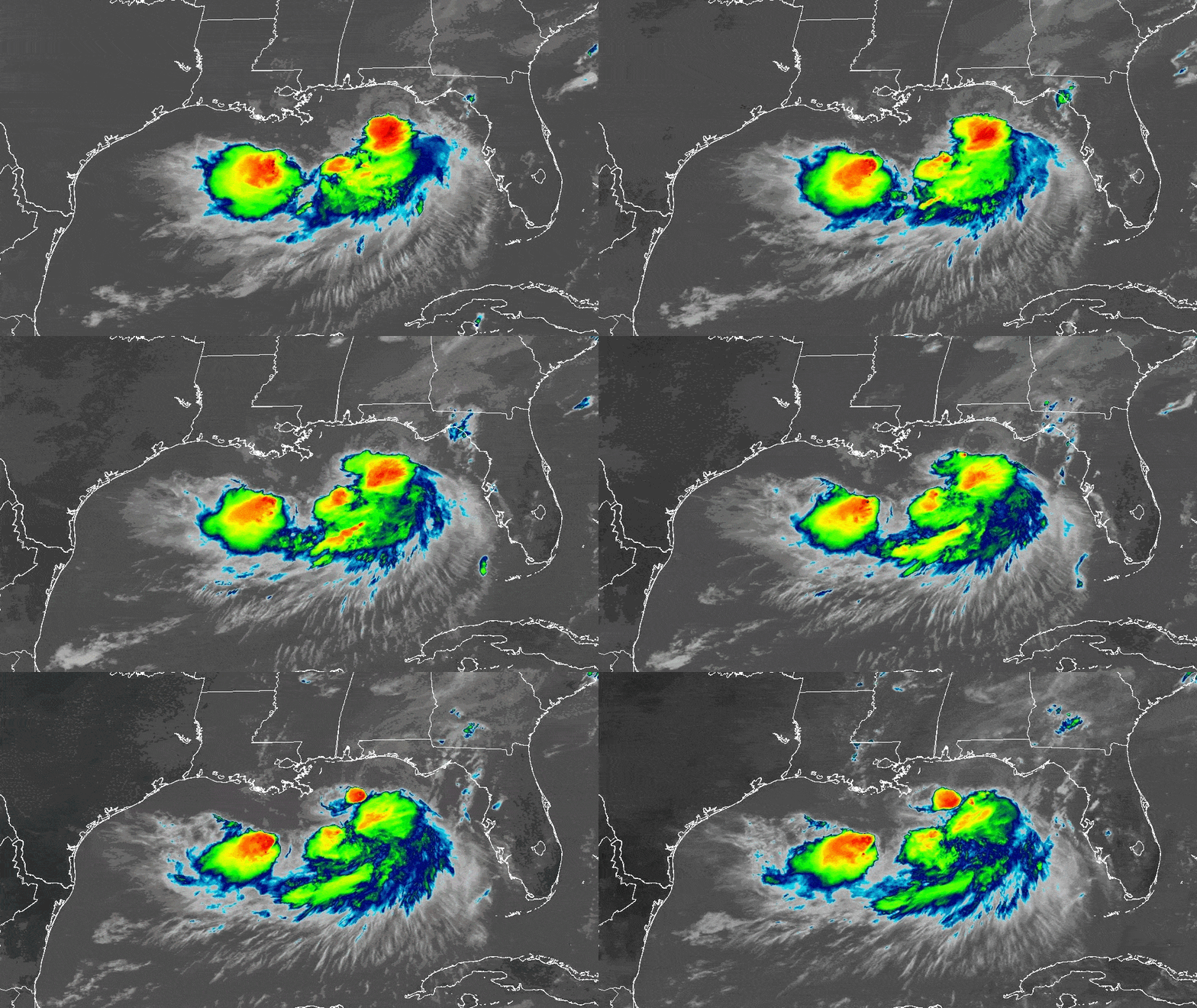
Tropical Storm Bertha is forecast to make landfall Wednesday in Southeast Louisiana, bringing rain, wind and coastal flooding to the region.
Why it matters: It's unclear how much of the bad weather will reach New Orleans, forecasters say.
The big picture: New Orleans and Metairie were under a tropical storm warning as of Tuesday afternoon.
- The warning extends west to Morgan City. See the map.
- The metro could get 2 to 4 inches of rain, the National Weather Service says, with higher amounts possible in isolated areas.
- The heaviest rain will be offshore, according to NOAA projections.
- Bertha is expected to make landfall in Plaquemines Parish before slowly moving west along the Gulf Coast for the next several days, according to the latest track from the National Hurricane Center.
- It could reach Texas this weekend.
Zoom in: The center of the storm was about 105 miles southwest of Panama City, Florida, as of 4pm Tuesday.
- Tropical storm conditions were spreading across portions of the Florida Panhandle and could reach the watch areas in Louisiana by late Wednesday, NHC says.
- Bertha has winds of 60 mph, and gradual weakening is expected Wednesday through Friday.
What they're doing: The city is opening a shelter Tuesday night for unhoused residents ahead of the storm.
- The Sewerage and Water Board says it is lowering canal levels and increasing staffing.
- Entergy also says it is preparing.
- Residents should use this time to secure outdoor items, clean catch basins and charge essential devices, the mayor's office says.
Zoom out: It's been a wild week of extreme weather in New Orleans.
- The city has had a tropical storm watch and warning, extreme heat warning and a heat advisory.
- Plus, Saharan dust and Canadian wildfire smoke have been causing air quality issues.
- "It's an interesting one for sure," NWS meteorologist Megan Williams said Tuesday.
Go deeper: Track Bertha via the National Hurricane Center.
Editor's note: This story was updated Tuesday afternoon with additional information.