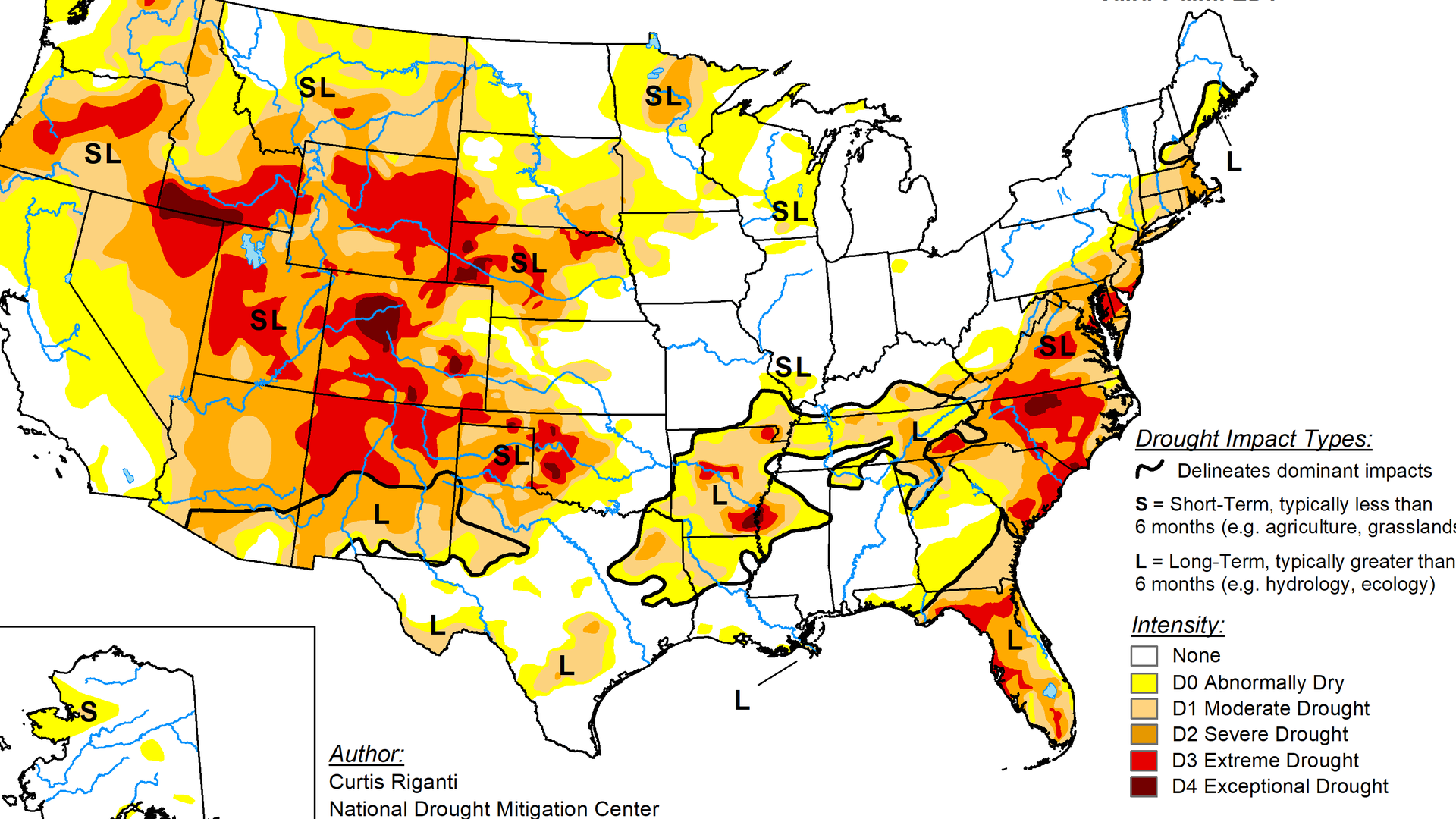
The U.S. Drought Monitor is jointly produced by the National Drought Mitigation Center at the University of Nebraska-Lincoln, the United States Department of Agriculture, the National Oceanic and Atmospheric Administration and the National Aeronautics and Space Administration. Map: Courtesy of NDMC.
Indiana is the only state in the nation not experiencing any level of drought, according to the most recent update from the U.S. Drought Monitor.
Why it matters: The widespread drought is impacting crops, fueling wildfires and forcing some tough conversations.
The big picture: Two-thirds of the country is experiencing at least abnormally dry conditions.
Nearly half of the country is experiencing some level of drought, with one-third experiencing severe, extreme or exceptional drought conditions.
Threat level: Amid the hot and dry conditions, wildfires have charred more than 3.4 million acres — far above normal for this time of year, according to the National Interagency Fire Center.
Florida has seen an unusually active wildfire season, while Utah and Colorado are dealing with massive, uncontained fires.
Yes, but: While fires threaten large swaths of the country and crops are withering in dry fields, Indiana's corn and soybeans have faced the opposite problem.
Early-season flooding, ponding and repeated heavy rains across much of the state did their own damage.
Hot, humid conditions over the last month have helped crops rebound.
The bottom line: Keep your fingers crossed for rain (but not too much).
As we're facing another hot stretch, agronomists say the next few weeks will be critical for the production of Indiana's crops.