Why Indianapolis wants to put a lid on the I-65/I-70 South Split

Add Axios as your preferred source to
see more of our stories on Google.
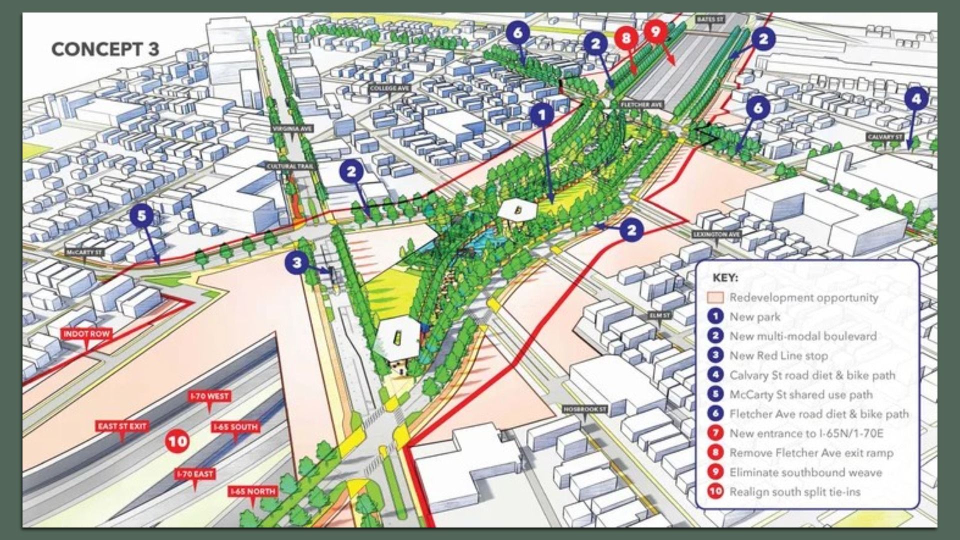
One of three concepts for recessing and capping portions of the interstate between Washington and Prospect streets to the north and south, and East and Shelby streets to the west and east. Photo: Courtesy of Rethink Coalition
Local leaders have released three proposals to reconnect neighborhoods and reclaim development space by capping part of the I-65/I-70 Inner Loop.
Why it matters: The coalition behind the plan says the project could correct planning decisions that have disconnected Indy communities since the 1970s.
Driving the news: The Rethink Coalition, in partnership with the City of Indianapolis and the Indy Chamber, published the final draft of its Southeast Gateway Planning Study on Monday.
- It's the culmination of research launched in fall 2024 and funded by a $2 million grant from the U.S. Department of Transportation through the inaugural Reconnecting Communities and Neighborhoods Grant Program.
Flashback: When the Inner Loop opened in 1975, it separated Fletcher Place from Fountain Square and Bates-Hendricks, and it cut off Fountain Square from the heart of downtown.
- The original construction displaced thousands of families and decreased the area's population by up to 30%, per Rethink.
The latest: All three proposals advocate building an interstate cap, or land bridge, over the Virginia Avenue "South Split," where the Inner Loop is partially recessed.
- The cap would feature parks, pedestrian walkways, IndyGo stops, housing and commercial development while reducing the interstate's footprint.
Zoom in: The simplest of the three concepts would cost nearly $225 million and would be built over the existing interstate. It would reclaim 8.2 acres of land for development valued at $13.3 million and would provide 2.4 acres of new parkland and up to 585 housing units.
- The medium-complexity concept would require modifications to the interstate outside the target area and cost more than $421 million. It would reclaim 7.3 acres valued at $12 million, add 6.4 acres of park space and up to 525 units.
- The most complex plan costs more than $500 million and would modify the current interstate configuration while requiring INDOT and the city to deal with traffic and lane changes well beyond the target area. It would reclaim 12.2 acres valued at $20 million and would add 5 acres of parkland and up to 891 housing units.
Plus: Each concept would add about 200 to 300 jobs.
Between the lines: A 30-year benefit-cost analysis found each dollar invested would generate $1.10 to $1.40 through property appreciation, land value creation and safety improvements.
Zoom out: A feasibility analysis conducted during the pandemic found that a recessed option would cost $2.8 billion for the full Inner Loop, while a more standard rebuild-as-is option would cost $2.3 billion.
- The plan's funding and implementation strategy focuses on establishing a downtown innovation corridor connecting entities like Eli Lilly, IU, Purdue, 16Tech, the Indiana Convention Center, and more.
- The study also points to tolling, federal transportation dollars, and earmarks with contributions from local governments as potential funding sources.
What's next: Rethink will spend the next several months conducting an innovation corridor analysis similar to the Southeast Gateway Planning Study.