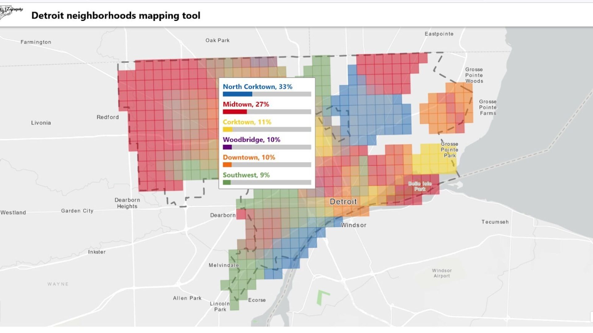
A map of initial responses to Detroitography's interactive neighborhood-defining tool. Solid colors mean agreement while blended colors show people disagree about neighborhood boundaries. Screenshot: Courtesy of Detroitography
Detroit's neighborhood boundaries and names often get shaped by outsiders, per a recent essay from Detroitography, a local map creator, in Model D.
The big picture: Detroitography is analyzing neighborhoods with an interactive tool that allows users to draw and define their own neighborhoods, then see how their drawings compare with others.
The tool was created to source more local perspectives on neighborhoods, as opposed to outside or political views.
State of play: The neighborhoods whose names and boundaries have stuck around the longest are generally historic districts, like Corktown, Detroitography wrote.
One way neighborhoods were drawn historically — in the 1960s-70s — was by United Community Services (now United Way), which drew them after census counts to analyze how the city changed.
The intrigue: Some more recent, suspect neighborhood names have appeared without residents even knowing about them. For example, "Corktown Shores," "The Eye" or "Buffalo-Charles."