Conifer is Colorado's new population center, census data shows

Add Axios as your preferred source to
see more of our stories on Google.
The new population center of Colorado is Conifer — or just east of it, to be precise.
What's new: The U.S. Census Bureau places the balance of the state's population just east of the Jefferson County community and part-way toward Littleton, along the western edge of Deer Creek Canyon Park.
- The coordinates are +39.534747, -105.185361.
Be smart: It's not the place with the most people, but the middle point of us all.
- "If you could see Colorado sprinkled with all the people, [it's] where that center would lie, where everywhere else around that dot is equal," explained Elizabeth Garner, the state's demographer.
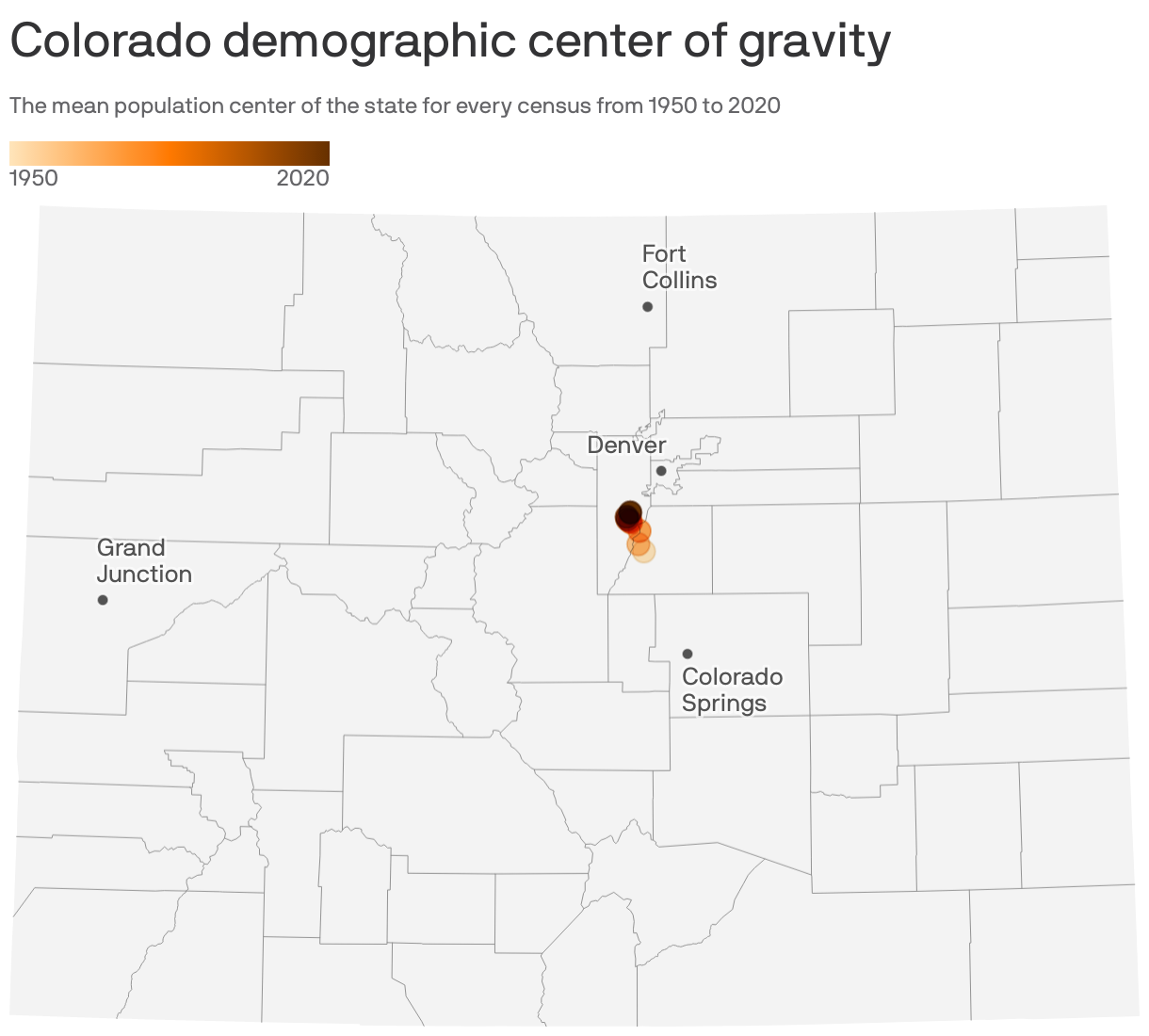
Why it matters: A map of the state's mean population centers since 1950 is a visual representation of our population trends, experts say. The population center moved north and slightly to the west.
- The northern shift reflects the increase in people moving to Weld, Adams and Larimer counties.
- The western drift indicates the Western Slope is gaining population and the decline of residents on the Eastern Plains.
Trivia: The population center for Denver is essentially 537 Steele St., between the Congress Park and Cherry Creek neighborhoods.
- The center of the United States is Hartville, Missouri.
Editor's note: This story has been updated to clarify the population center of Colorado is Conifer, per U.S. Census data.
This story first appeared in the Axios Denver newsletter, designed to help readers get smarter, faster on the most consequential news unfolding in their own backyard. Subscribe here.