Mapping out our "ghost neighborhoods"

Add Axios as your preferred source to
see more of our stories on Google.
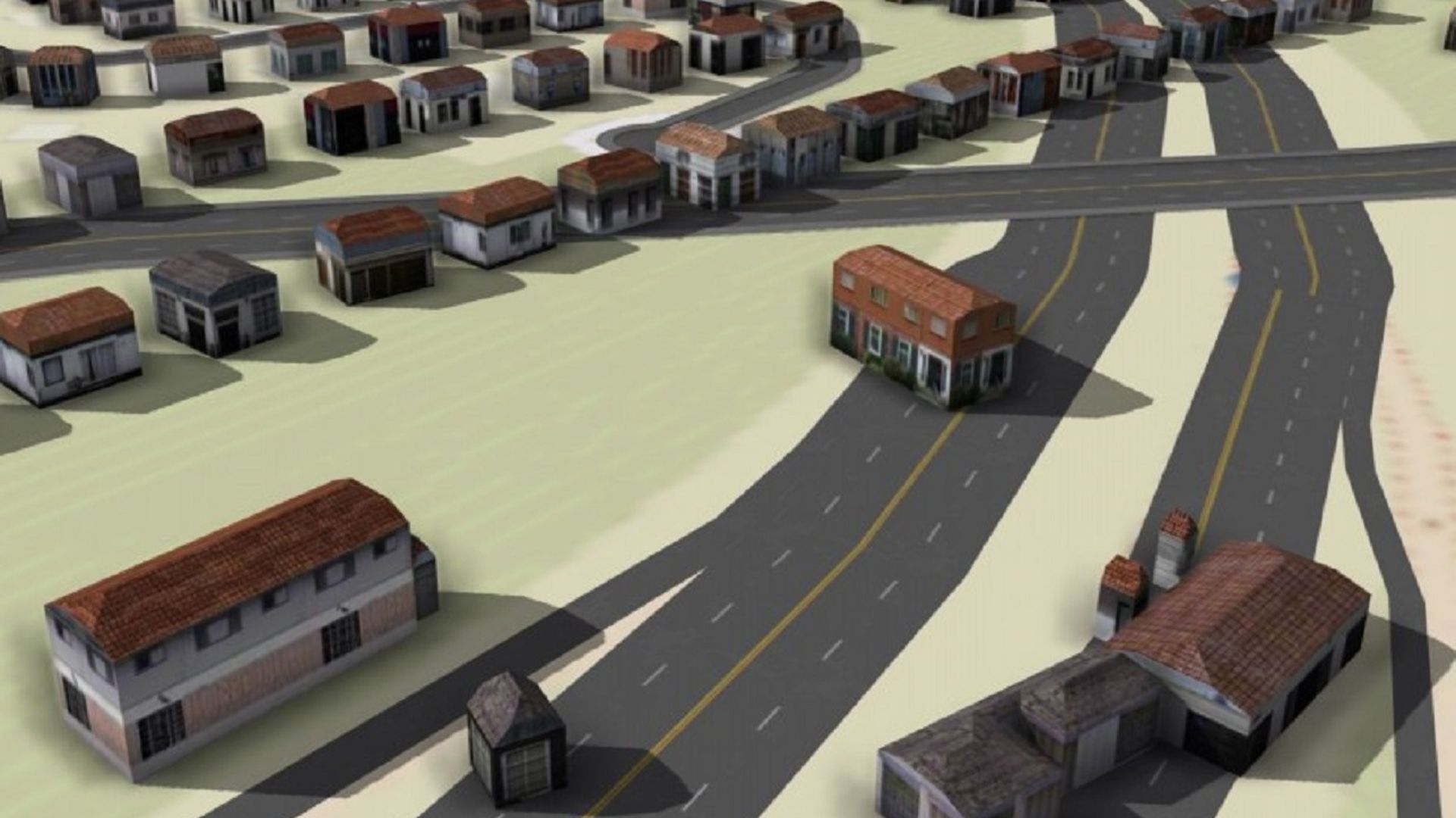
A 3D rendering of past Hanford Village buildings overlaid on present-day Route 70. Courtesy of OSU Center for Urban and Regional Analysis
What did Columbus look like before highway construction divided and destroyed neighborhoods across the city?
- An OSU research team is hard at work trying to piece them back together, business by business, home by home.
Why it matters: The Ghost Neighborhoods of Columbus project can offer both insight on the past and a lesson for more responsible development practices as the city continues growing.
What they're doing: The university's Center for Urban and Regional Analysis is fusing modern technology with old-fashioned research methods to digitally recreate once-vibrant communities.
- Students use hand-drawn fire insurance maps dating back to the 1800s to get an accurate sense of how each block was once laid out.
- Old photographs and land parcel data are helping to fill in any missing pieces.
What they're saying: “Our ultimate goal would be to come up with 3D visualizations that are realistic enough to give people a visceral feeling of what those neighborhoods were like,” Harvey Miller, a geography professor and the project's director, said in a news release.
State of play: The choices made by highway planners in the mid-20th century are still evident on today's map.
- Routes 70 and 71 were built directly over predominantly Black neighborhoods like Hanford Village and King-Lincoln Bronzeville.
- In the latter case, the highway displaced residents, split the neighborhood in two and cut it off from downtown — the resulting economic ramifications are still felt today.
- Flytown, a melting pot community near the modern-day Arena District, was decimated by Route 315 construction that forced its residents to relocate.
Meanwhile, highway construction avoided white-majority neighborhoods such as Bexley.
Separately, the research team hopes to map out Franklinton as it looked before a devastating 1913 flood.
Worthy of your time: The Columbus Dispatch's 2020 feature "How highways destroyed Black neighborhoods in the '60s, as told by elders who were there."