Hurricane Erin unleashes "life-threatening" rip currents on U.S. East Coast

Add Axios as your preferred source to
see more of our stories on Google.

A person surfs in Rockaway Beach amid Hurricane Erin on August 21 in Rockaway Peninsula in the Queens borough of New York City. Photo: Michael M. Santiago/Getty Images
Hurricane Erin began moving away from the Mid-Atlantic Coast after its outer bands pummeled the North Carolina Outer Banks, but forecasters warned threats to the U.S. East Coast would continue for days after peaking on Thursday evening.
The big picture: The biggest threat from the Category 2 storm was tidal flooding as the "very large" storm system turned northeast, said the National Hurricane Center as it urged beachgoers not to swim at most U.S. East Coast beaches due to "life-threatening" surf and rip conditions.
- "Swells generated by Erin will affect the Bahamas, Bermuda, the east coast of the United States, and Atlantic Canada during the next several days," the NHC said in a Thursday night forecast discussion.
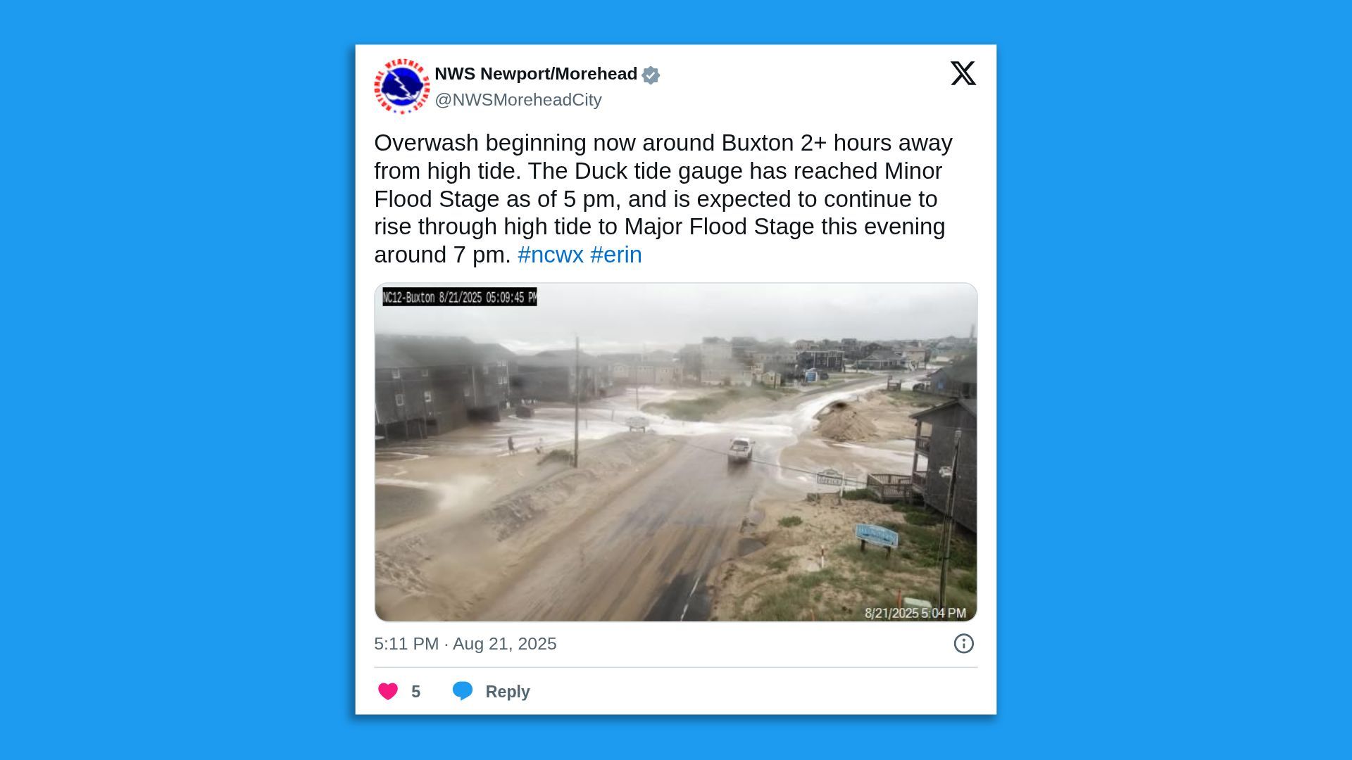
Threat level: A state of emergency went into effect at 2pm Thursday ET due to expected coastal and flash flooding, dangerous surf warnings and advisories and high winds for several counties across New Jersey, per a statement from the N.J. governor's office.
- There were reports of coastal flooding in several states during high tide on Thursday evening, including in West Wildwood, southern N.J., and Ocean City, Maryland.
- The National Weather Service's Mount Holly office said in a forecast discussion that a "widespread impactful coastal flood event" was expected as Erin passed by offshore Thursday into Friday.
- NWS Mount Holly noted on X that "strong wave action/energy" was continuing across Dare County, N.C., especially the eastern-facing beaches where waves are at least 8-12 ft, and as high as 10-15 ft in some spots.
Zoom in: The NHC noted that wind gusts to tropical storm-force were reported on Bermuda and on Nantucket Island, Massachusetts, on Thursday evening.
- A tropical storm warning remained in effect for Bermuda at 11pm Thursday ET, but all other such alerts were canceled.
Yes, but: NWS Mount Holly said coastal flood warnings remained in effect for all counties along the Atlantic Ocean and within Delaware Bay, "where widespread moderate flooding is expected along the coast."
- There's potential for locally major coastal flooding impacts, especially in Sussex County, Delaware, and Cape May County, N.J., according to the forecast discussion.
- "Widespread minor flooding is forecast with the Friday morning high tide, then additional moderate coastal flooding is possible with the Friday evening high tide," the discussion added.
State of play: Erin's 24-hour intensification from a Category 1 to a Category 5 storm on Saturday was one of the strongest on record.
- Climate change is increasing hurricane wind speeds, research shows.
- Erin has fluctuated for days in intensity but has remained a Category 2 hurricane for the past two days.
- The storm was some 365 miles north-northwest of Bermuda, as it moved east-northeast at 22 mph with maximum sustained winds of 100 mph at 11pm Thursday ET.
- The sprawling system's hurricane-force winds extended outward
up to 105 miles from the center, and tropical storm-force winds extended outward up to 320 miles.
Go deeper: How climate change supercharged Hurricanes Helene, Milton
Editor's note: This is a breaking news story. Please check back for updates.
