N.C., Virginia under Hurricane Erin storm alerts, some East Coast beaches shut

Add Axios as your preferred source to
see more of our stories on Google.
Editor's note: Read the latest on Hurricane Erin here.
Hurricane Erin's threats prompted North Carolina's governor to declare a state of emergency as the massive storm began bringing huge swells that were impacting the N.C. Outer Banks on Tuesday.
The big picture: The storm is not forecast to make landfall in the United States, but forecasters warned of "life-threatening" storm surges, coastal overwash and flooding along the U.S. East Coast this week.
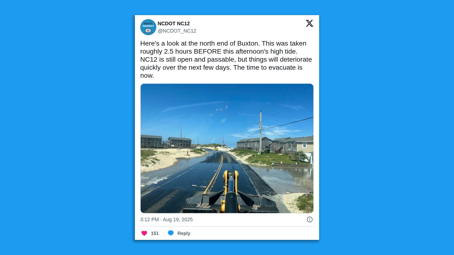
- Mandatory evacuation orders are in effect in North Carolina's Dare and Hyde counties, including for Ocracoke and Hatteras islands.
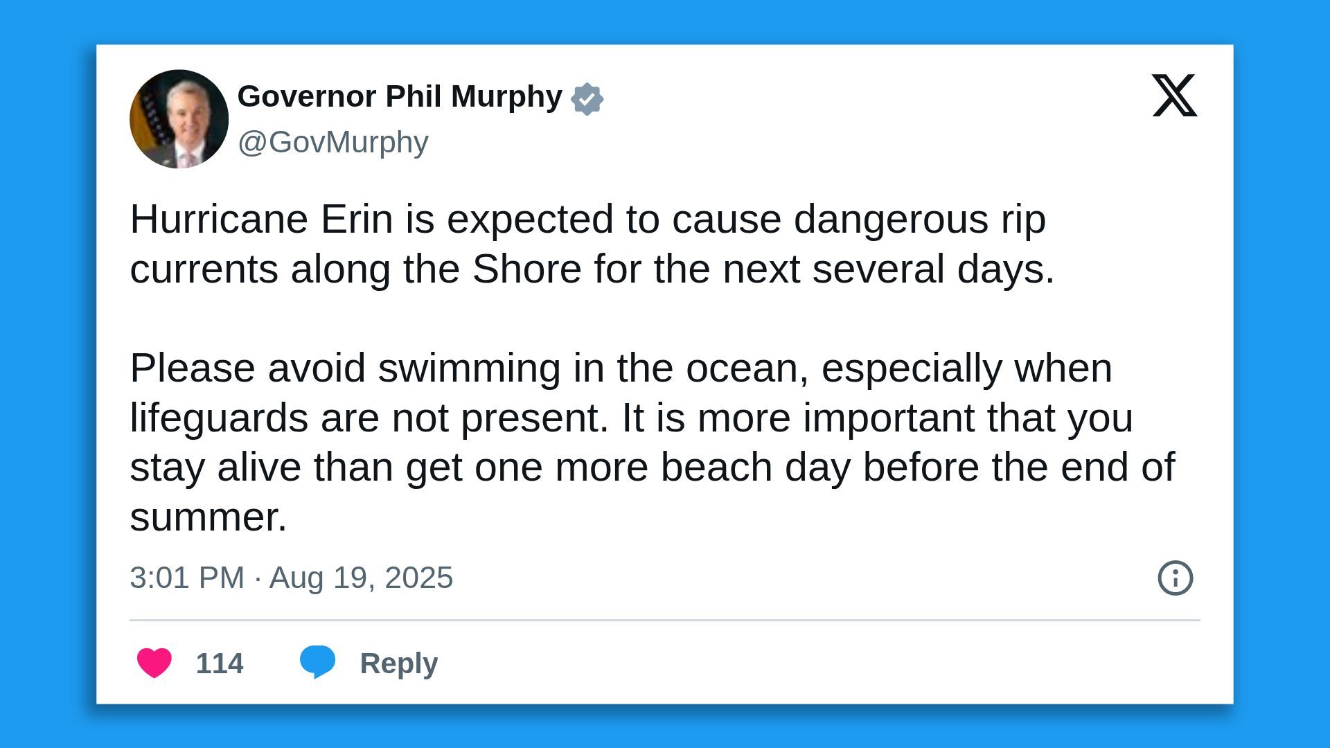
- Swimming bans and beach closures were in effect in N.C. and other states, including New York City's Long Island ocean beaches, and parts of New Jersey and Delaware due to threats of flooding, rough surf conditions and potential rip tides from the hurricane.
Threat level: A storm surge warning is in effect from Cape Lookout to Duck, N.C., while a tropical storm warning is in place from Beaufort Inlet to Duck, including Pamlico and Albemarle sounds.
- A tropical storm watch is in effect for north of Duck to Chincoteague, Virginia, and also Bermuda.
- Highway 12 "will likely be washed out for several days," per a Hyde County Facebook post.
- The National Hurricane Center expects storm surges of up to 4 feet along parts of the N.C. coast. Portions of coastal South Carolina and Virginia, up to Chincoteague Island, Va., could see storm surges of 1-3 ft.
State of play: The now-Category 2 storm has fluctuated for days in intensity from a Category 5 hurricane and was expected to continue to do so this week.
- The hurricane had maximum sustained winds of 100 mph some 540 miles south-southeast of Cape Hatteras, N.C., as it churned in a north-northwesterly direction at 12 mph, per an 11pm Tuesday ET NHC forecast discussion.
- The NHC noted "Erin is a large hurricane," with hurricane-force winds extending outward up to 80 miles from the center and tropical storm-force winds extending outward up to 230 miles.
- "Satellite imagery and reports from an Air Force Reserve Hurricane Hunter aircraft indicate that Erin is getting better organized, and slow strengthening is expected through Thursday night," the NHC said.
- The center of the storm was expected to pass to the east of the Bahamas on Tuesday night and then move over the western Atlantic between the U.S. East Coast and Bermuda on Wednesday and Thursday.
What's next: The storm was expected to pass between North Carolina and Bermuda within the next 24 to 36 hours, National Hurricane Center director Michael Brennan said in a Tuesday evening video update posted to the NHC's social media channels.
- Although it's not forecast to make landfall in the United States, Brennan noted the hurricane's "expansive wind field" will "cause dangerous ocean conditions and life-threatening storm surges along the U.S. East Coast, particularly on the North Carolina Outer Banks."
- "Significant inundation is also predicted for northeastern South Carolina and the Hampton Roads area. Rip current risks are high from Florida to New England," Brennan said.
Background: Erin formed as a tropical storm on Aug. 11 and became on Friday the first hurricane of the 2025 Atlantic season.
- The storm flooded Puerto Rico and other Caribbean islands over the weekend.
Between the lines: Research shows climate change is increasing hurricane wind speeds.
- Erin experienced "rapid strengthening" as the hurricane passed over "unusually warm ocean waters" that Climate Central data shows were made "up to 100 times more likely" due to human-caused climate change.
Go deeper: How climate change supercharged Hurricanes Helene, Milton
Editor's note: This is article has been updated with new details throughout.
