Hurricane Erin prompts evacuation orders along N.C. Outer Banks

Add Axios as your preferred source to
see more of our stories on Google.

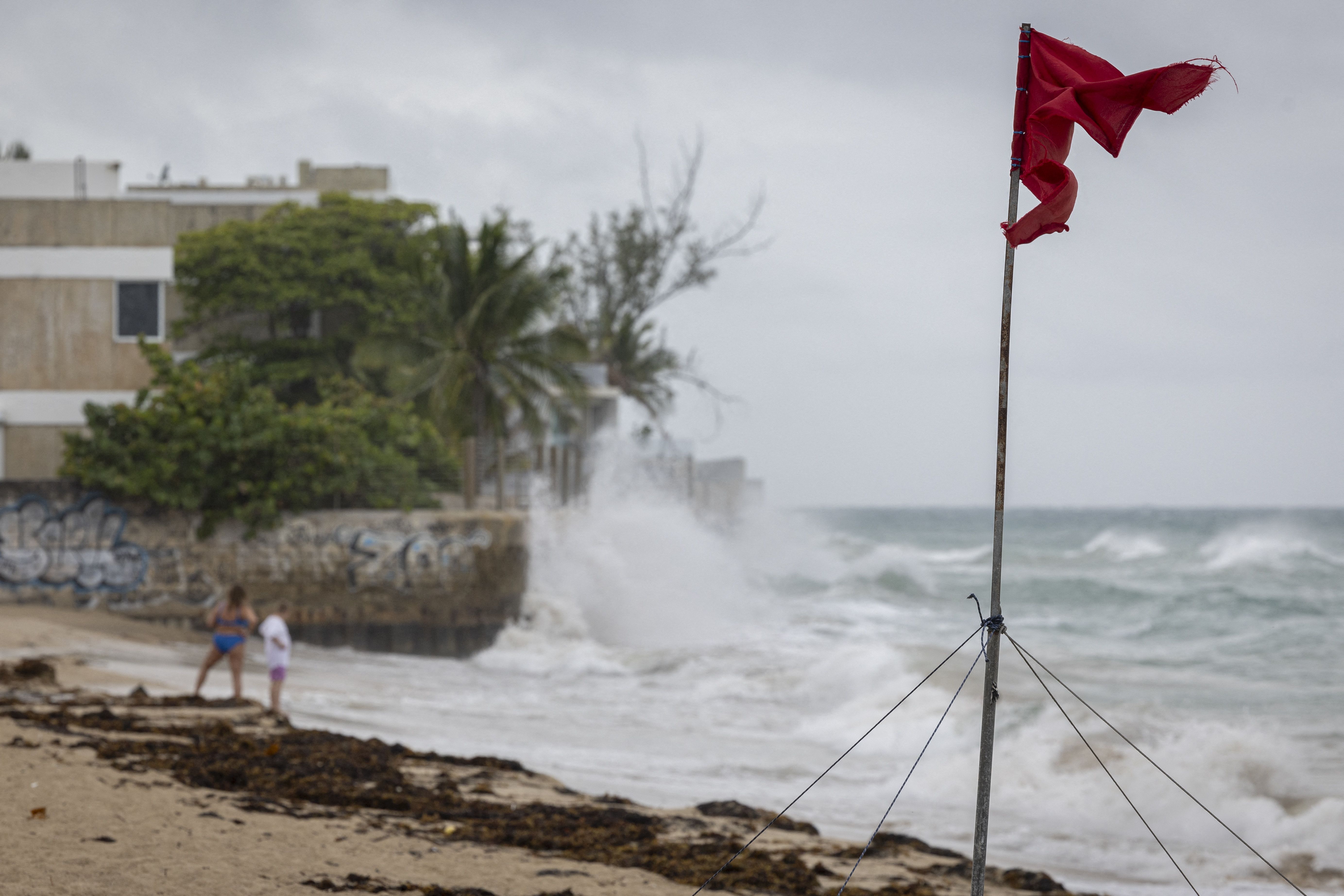
A truck drives through a flooded road as Category 3 Hurricane Erin leaves the region in Naguabo, Puerto Rico, on Aug. 16. Photo: Ricardo Arduengo/AFP via Getty Images
Editor's note: Read the latest on Hurricane Erin here.
Major Hurricane Erin's outer bands were lashing Puerto Rico and other Caribbean islands with heavy rains, as officials in the North Carolina Outer Banks declared a state of emergency Sunday.
The big picture: The U.S. was expected to avoid a direct hit, but Dare County made the emergency declaration and issued a mandatory evacuation order for Hatteras Island for Monday onwards due to the storm's expected "life-threatening impacts."
Threat level: Erin's intensity was fluctuating over the weekend — weakening from a Category 5 to a Category 3 storm before strengthening back into a Category 4 hurricane late Sunday.
- "Some additional strengthening is expected today," the National Hurricane Center said in an advisory early Monday, as the storm churned northwest 110 miles northeast of Grand Turk Island, packing maximum sustained winds of 130 mph.
- "Even though some weakening is forecast beginning tonight, Erin will remain a large and dangerous major hurricane through the middle of this week."
Zoom in: A Tropical Storm Warning was in effect for the Turks and Caicos Islands and the southeast Bahamas, while a coastal flood watch was issued for Dare County.
- "Coastal flooding and ocean overwash are expected to begin as early as Tuesday ... and continue through Thursday," per a Dare County statement. "Portions of N.C. Highway 12 on Hatteras Island will likely be impassable for several days."
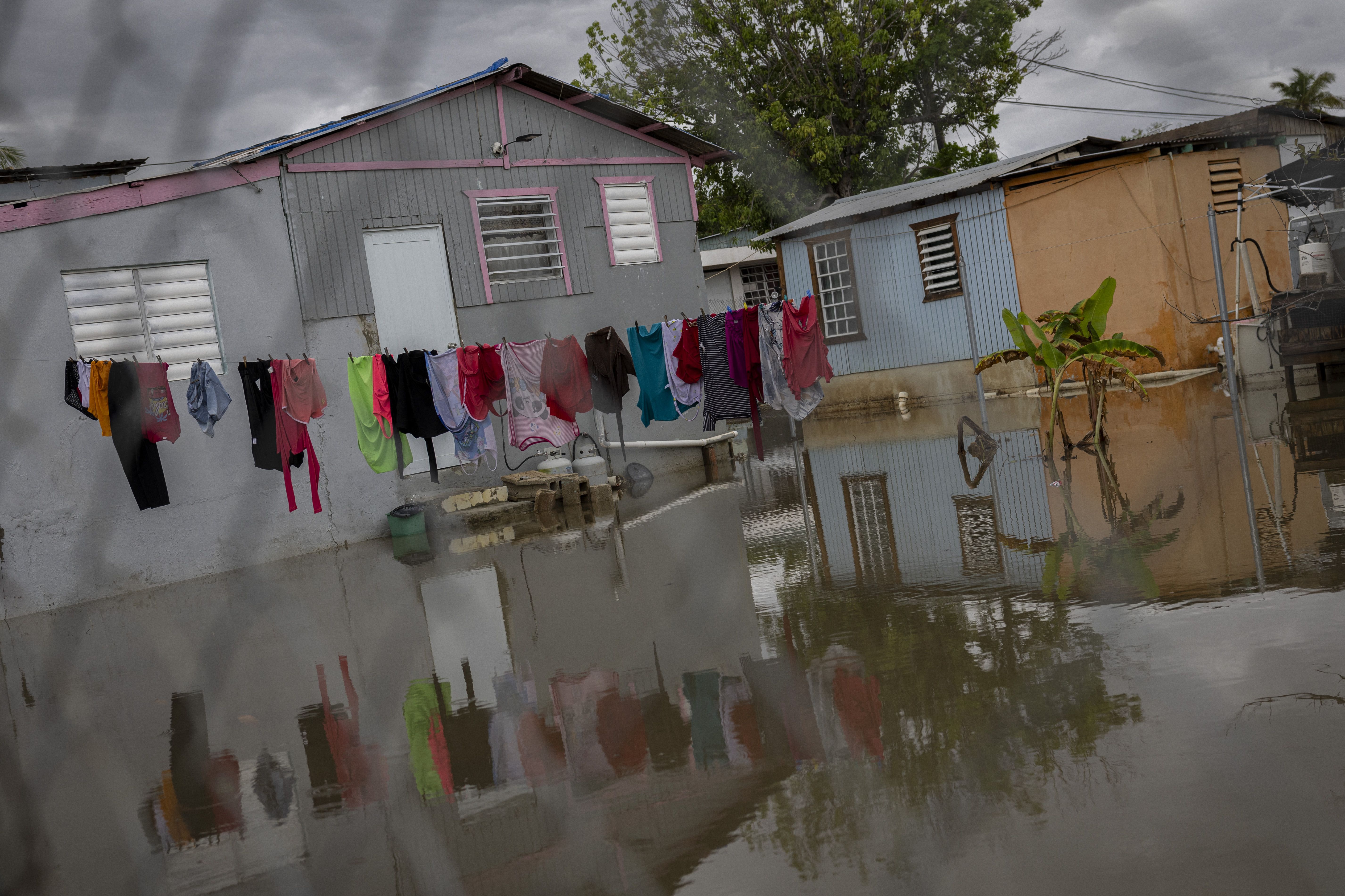
Meanwhile, Erin was continuing to dump heavy rains across Puerto Rico on Sunday, after its outer bands first reached the United States territory and U.S. Virgin Islands on Friday night.
- "Locally considerable flash and urban flooding, along with landslides or mudslides, are possible" for Puerto Rico and other Caribbean islands, according to the NHC.
By the numbers: Cayey, Puerto Rico, has seen 6.28 inches of rain fall since Friday night and the U.S. Virgin Islands' St. John 7.32," per a post to X by the National Weather Service's San Juan office.
- "Additional rainfall of 1 to 2 inches are expected across Puerto Rico
through Monday," per the NHC. - "Additional rainfall of 2 to 4 inches, with locally higher amounts to 6 inches, are forecast over the Turks and Caicos and the eastern Bahamas including San Salvador Island through Tuesday," the NHC added.
In photos: Hurricane Erin's outer bands lash Puerto Rico


Go deeper: Erin becomes 2025's first major hurricane
Editor's note: This article has been updated with the National Hurricane Center's early Monday forecast.
