Malibu blaze swells as Santa Ana winds bring "extremely critical" fire risk


Add Axios as your preferred source to
see more of our stories on Google.
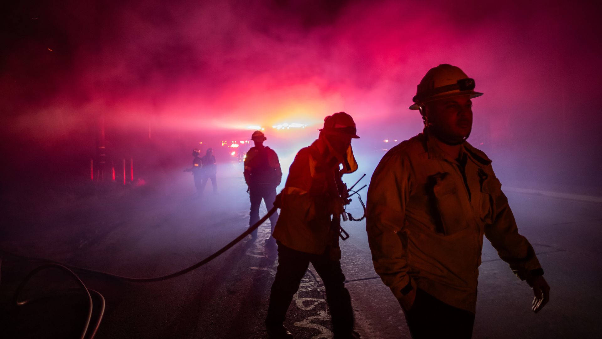
A firefighter fights the Franklin Fire while it burns in the Pacific Coast Highway on Dec. 11 near Malibu, California. Photo: Apu Gomes/Getty Images
Parts of Southern California are still facing "elevated to brief "critical conditions" into Thursday night as a fast-moving wildfire that forced thousands in Malibu to evacuate continues to grow.
Threat level: Red Flag warnings ended as powerful Santa Ana winds eased on Wednesday afternoon, but the National Weather Service's Los Angeles office said on X that breezy areas of southwest Santa Barbara County and the San Gabriel Mountains were still under threat amid "very dry" conditions.
- Meanwhile, Malibu's Franklin fire had swollen to more than 4,000 acres as of Wednesday afternoon after rapidly expanding overnight. It was 7% contained. The cause of the blaze remains under investigation.
State of play: Flames had reached the Pacific Coast Highway on Tuesday, shutting down parts of the road, according to the City of Malibu.
- Due to the anticipated long duration of dry and windy conditions, there is a heightened risk that new ignitions could have "very rapid fire spread and extreme fire behavior," according to the NWS LA.
- Malibu Schools will remain closed on Wednesday and Thursday.
- At least seven structures have been destroyed, and eight have been damaged, according to a Tuesday evening update from Malibu.
- California Gov. Gavin Newsom announced Tuesday that the state had secured federal assistance from FEMA to help bolster its response to the fire.
Zoom in: This past Santa Ana wind event has been unusually intense, exceeding 90 mph in spots, particularly in and around hilly terrain.
- The NWS forecast office in Los Angeles warned of "extreme & life-threatening wildfire behavior."
- "This event has the potential to be as strong as the November 5th-6th Santa Ana event that led to the Mountain Fire," the NWS stated, referencing the fire that burned nearly 20,000 acres and damaged or destroyed more than 400 structures near Camarillo, Calif.
What they're saying: The Franklin Fire is manufacturing its own weather, drawing air in from nearby areas, the NWS stated in an online forecast discussion.
- "The combination of winds, very low humidities and dry fuels make for an explosive fire environment."
- The fire at one point went from 1 acre to 100 acres in under an hour.
Zoom in: Southern California typically sees Santa Ana events during the fall, and they are characterized by strong winds, extremely dry air flowing from land to sea, and cooler-than-average temperatures.
- Some of the region's worst wildfires have occurred during these periods, since the winds can quickly spread flames into heavily populated areas.
- While red flag warnings are often issued for fire weather threats, the "PDS" designation indicates heightened risk. Such designations are issued only for "the most extreme events," the NWS stated.
- The most dire conditions are expected to occur across western portions of LA County along with eastern Ventura County, including the communities of Malibu, Santa Clarita, Thousand Oaks and Oxnard.
- A larger area of "critical" wildfire danger is also forecast to cover much of Southern California as the winds increase overnight Monday and extend potentially into Wednesday.
Context: Similar weather patterns have historically been associated with fast-spreading and deadly fires in the "wildland urban interface," where homes border areas with dry vegetation and hilly terrain.
- Climate change is a key factor leading to an increase in days with extreme fire weather conditions in the Southwest.
- This fall, heat waves following wet conditions helped lead to a buildup of fire-prone, dry vegetation in the Southwest.
Go deeper: How wildfire smoke impacts your health
Editor's note: This story was updated with the latest containment data.
