Tropical Storm Sara bringing "catastrophic" Central America floods

Add Axios as your preferred source to
see more of our stories on Google.
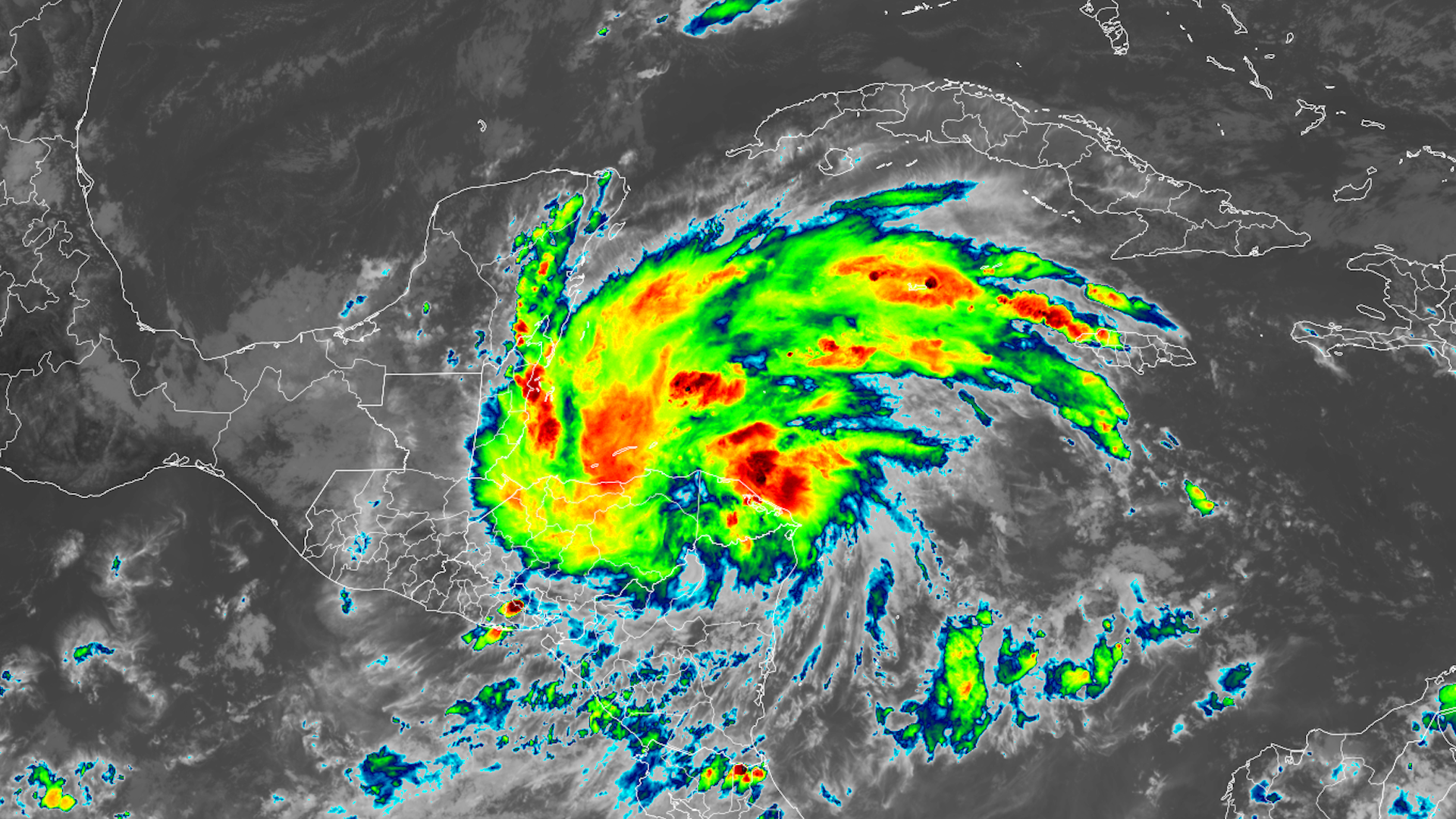
Infrared satellite image showing Tropical Storm Sara over the Caribbean on Nov. 14. Image: NOAA
Tropical Storm Sara formed Thursday in the Caribbean and is delivering "potentially catastrophic" rainfall in Honduras.
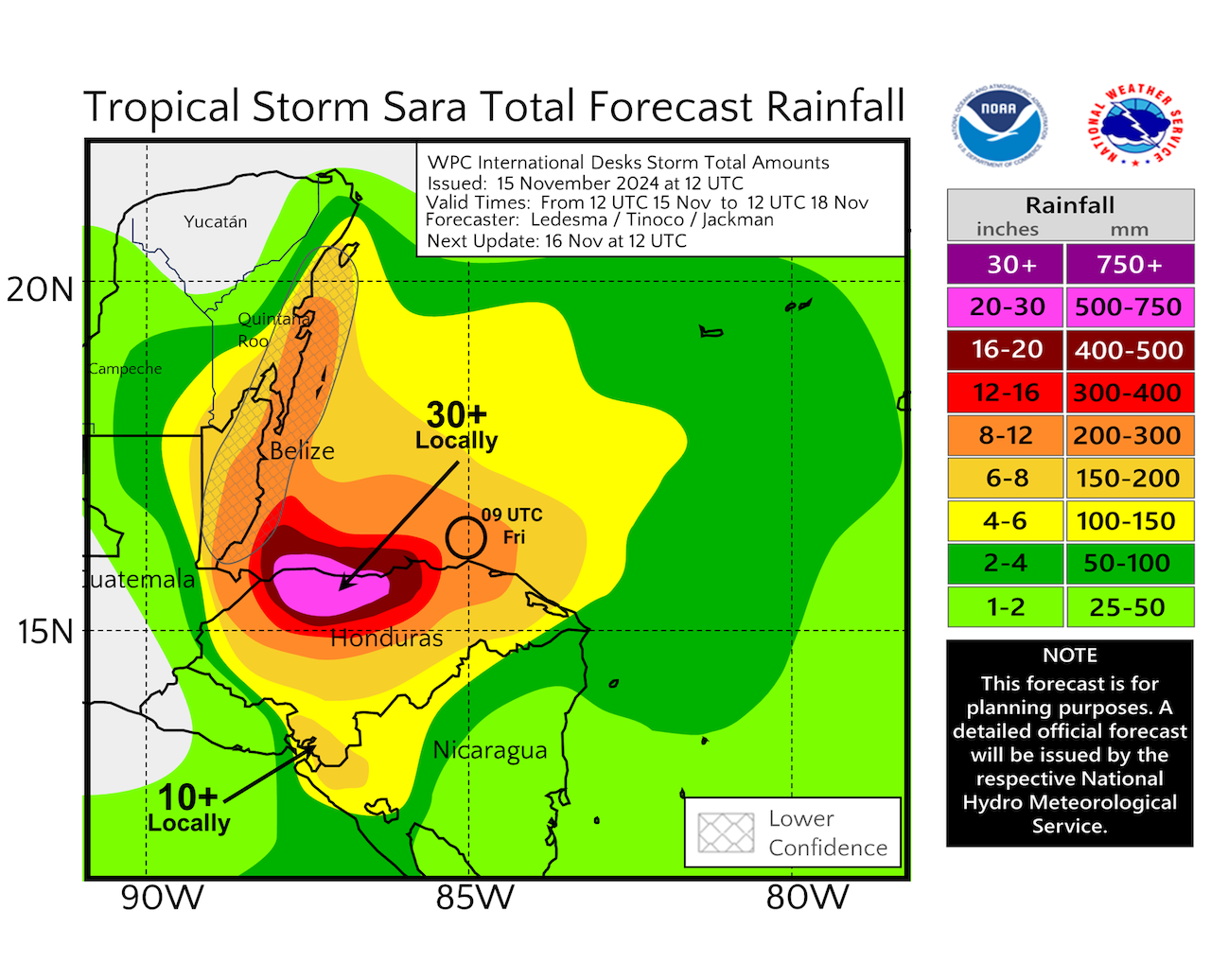
Threat level: The storm, which also poses a threat to Belize, is not likely to make it into the Gulf of Mexico. It's instead expected to weaken over the Yucatán Peninsula.
- It's forecast to slowly meander west-southwestward toward the northern coast of Central America, bringing 30 or more inches of rain into the weekend to parts of Honduras and possibly coastal Guatemala.
- Honduras and neighboring Guatemala saw devastating flooding during Hurricane Mitch in late October 1998, with more than 10,000 deaths.
- The high terrain in this area makes it especially vulnerable to landslides and flash flooding.
- According to meteorologist Michael Lowry of WPLG Local 10 in Miami, Golosón International Airport on the west side of a port city in northern Honduras had picked up about 22 inches of rain in just 24 hours from this storm, as of Friday morning.
- This would be nearly unheard of in most U.S. states, Lowry noted in his Substack newsletter.
What we're watching: The intensity and movement of the storm after Sunday are each unclear right now, because of uncertainty regarding whether the center of the storm moves inland for a time near Honduras, or stays over water.
- An inland track would involve greater weakening over time, and prevent the storm from becoming a hurricane, and the National Hurricane Center is emphasizing a greater-than-average uncertainty in the intensity forecast.
Between the lines: Due to warming ocean waters and air temperatures from human emissions of greenhouse gases, tropical storms and hurricanes are now delivering heavier precipitation than just a few decades ago.
- This makes the meandering tropical storm, even if its winds remain relatively weak, an even bigger threat.
Zoom in: The storm continues the backloaded Atlantic hurricane season, and is the 11th named storm to form since Sept. 24th, according to Colorado State University meteorologist Phil Klotzbach.
- The season overall is now well above average by most measures, though not quite as active as feared during the spring and summer.
What's next: The National Hurricane Center shows the storm curving slowly northwest as it traverses the Yucatán Peninsula and dissipates early next week.
Go deeper... Report: Extreme weather cost world $2 trillion in 10 years, U.S. worst hit
