NOAA issues rare alert on Hurricane Helene's widespread flooding rains


Add Axios as your preferred source to
see more of our stories on Google.
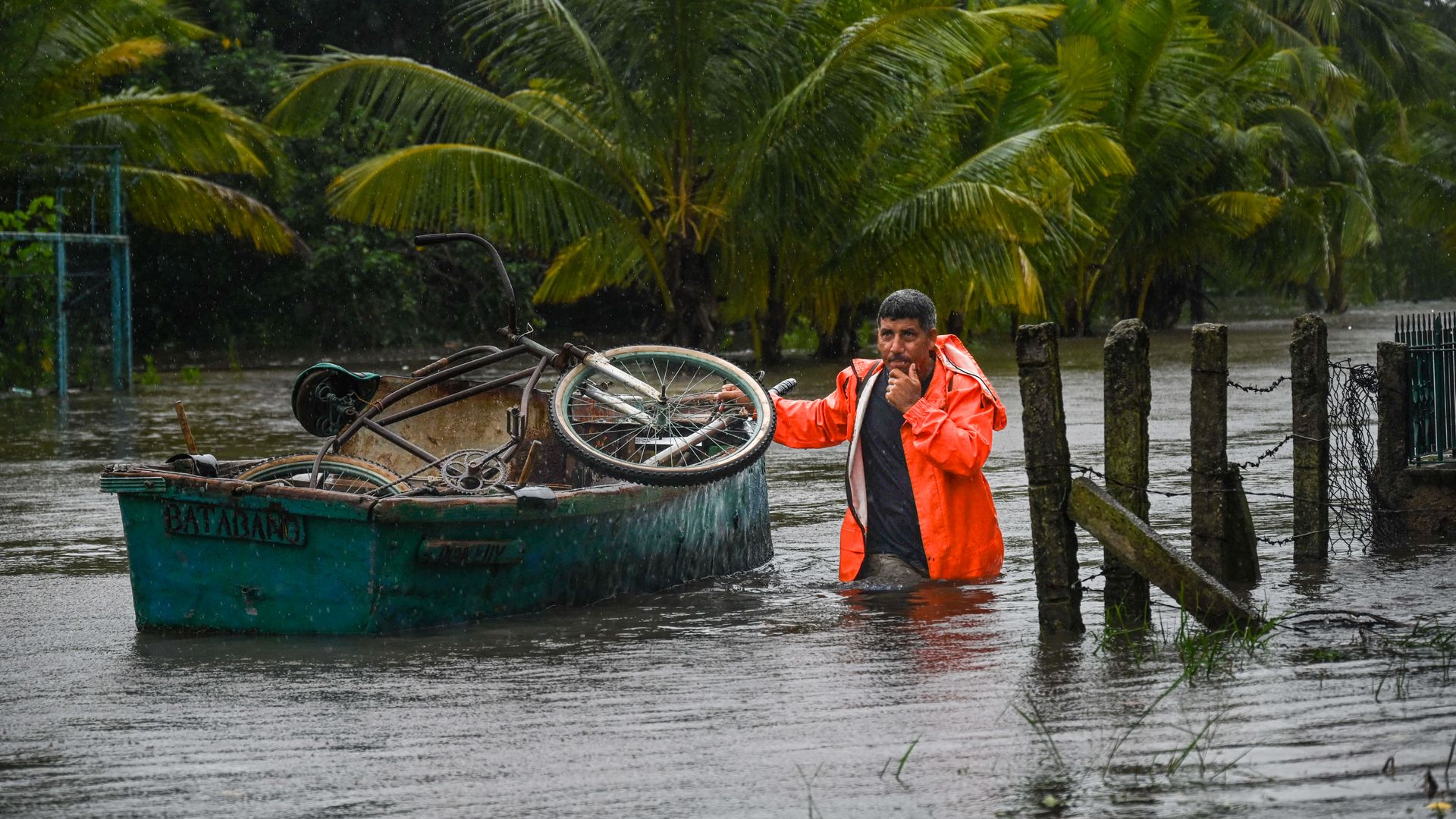
A resident of the coastal town of Guanimar, southwest of Havana in Cuba, transports his personal belongings in a boat on a flooded street after the passage of Hurricane Helene on Wednesday. Photo: Yamil Lage/AFP via Getty Images
Hurricane Helene's threat of widespread flooding rains and high winds prompted NOAA to issue a rare alert Wednesday, warning the storm's effects "won't be limited to the Gulf Coast," with it "expected to travel hundreds of miles inland."
The big picture: NOAA warned in its special weather statement that "heavy rainfall will begin" in parts of the southeastern U.S. "well before" the "unusually large" storm's expected landfall along Florida's northwest coast as a major hurricane Thursday evening,
/2024/09/25/1727308439014.gif)
- "Communities need to prepare for catastrophic and life-threatening flooding from Helene, even well after landfall," the National Oceanic and Atmospheric Administration said.
- Heavy rains tied to the tropical moisture surging north ahead of the storm have already prompted flash flood warnings in parts of Georgia, North Carolina and Tennessee.
Threat level: The hurricane that's also threatening parts of Cuba, the Cayman Islands and the northeast Yucatan Peninsula with flooding rains has a windfield that extends as far as 275 miles from its center, per NOAA.
- The storm is expected to dump 6-12 inches of rain across parts of the Southeastern U.S. into the southern Appalachians, with isolated totals around 18 inches, according to the National Hurricane Center.
- "This rainfall will likely result in catastrophic and potentially life-threatening flash and urban flooding, along with significant river flooding. Landslides are possible in steep terrain across the southern Appalachians."
Zoom in: The National Weather Service's Tallahassee office said in a Wednesday evening forecast discussion that there's "increasing confidence of Catastrophic and/or potentially Unsurvivable storm surge for Apalachee Bay."
- It added that storm surge may begin to arrive "as early as late Wednesday night ahead of the strongest winds, building through landfall."
- NWS Tallahassee said to expect catastrophic wind damage near the eventual landfall point and inland along the track, with widespread and prolonged power outages, damage to critical infrastructure possible and outages that will "likely last days, if not weeks, near where it makes landfall."
- It added: "Due to the quick forward speed of Helene, significant wind damage may extend well into Georgia."
State of play: The storm "will continue to move northward into the southern Appalachian region through Friday, where storm total rainfall amounts are forecast to be up to 18 inches," NOAA said.
- "The major flood risk includes the urban areas around Tallahassee, metro Atlanta and western North Carolina, including Asheville," it said.
- "Recent rainfall in these areas, especially the southern Appalachians, have left the grounds saturated and the river tributaries running high," NOAA added. "Additional rainfall from Helene will exacerbate the existing flood risk.
- "Extreme rainfall rates (i.e., torrential downpour) across the mountainous terrain of the southern Appalachians will likely inundate communities in its path with flash floods, landslides, and cause extensive river and stream flooding."
Meanwhile, NOAA warned that "gusty winds, combined with saturated ground, will raise the risk of falling trees that can cause loss of life, property damage, blocked roads, and lead to power outages."
Context: Studies show that hurricanes are increasingly likely to become more intense due in large part to human-caused climate change, and they are also likelier to rapidly intensify.
- The extreme intensification rate in this storm is largely driven by record-hot ocean surface temperatures in the Gulf of Mexico along with ocean heat content values that are also in rare territory.
Go deeper: Why Hurricane Helene's large size, rapid intensification make it a threat
