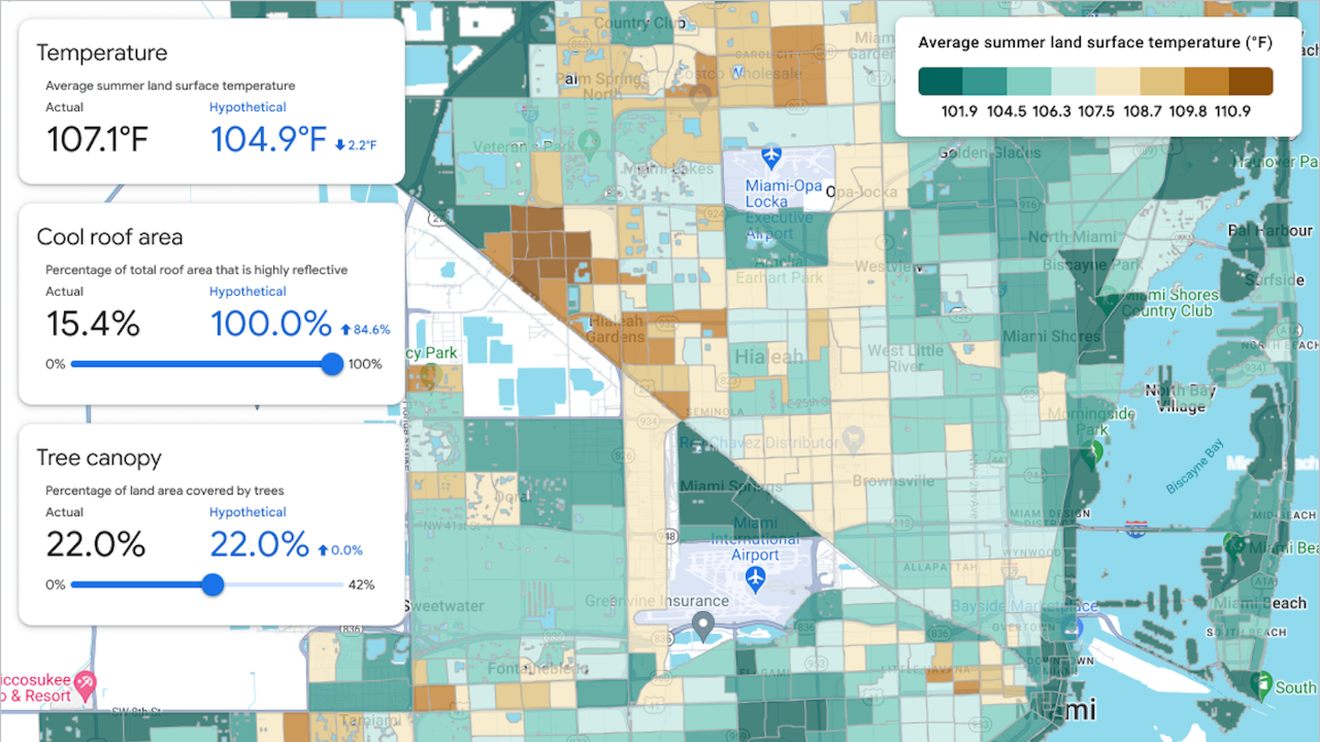
Zoom in: The Google tool uses satellite-based, high-resolution land surface temperature data.
It employs machine-learning algorithms to identify buildings, trees and other factors critical to determining how much heat a portion of land absorbs.
It also incorporates indicators of social vulnerability, including income statistics, to identify the areas most in need of heat relief.
Using the model-based tool, officials can see how average summer land surface temperatures would change if certain actions were taken, such as increasing the tree cover of a particular neighborhood or installing cool roofs.
Between the lines: While heat officers can advocate for policies, they often lack decision-making power within a city or regional government.
The new tool could give these officials data to bring to mayors or use to apply for grants.
What they're saying: "Eventually our hope is that thousands of cities can use this tool to implement solutions," Mansi Kansal, Google's product manager for heat resilience, tells Axios in an interview.