Tropical Storm Debby's flooding threat escalates in the Southeast

Add Axios as your preferred source to
see more of our stories on Google.
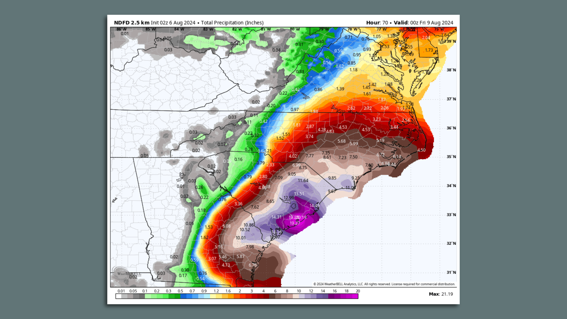
Forecast rainfall amounts from the NWS through Friday. Image: Weatherbell.com
Tropical Storm Debby will likely be the heaviest rainstorm on record for many communities in the Southeast — particularly southeastern Georgia and South Carolina, but heavy rains are likely to fall farther north, too.
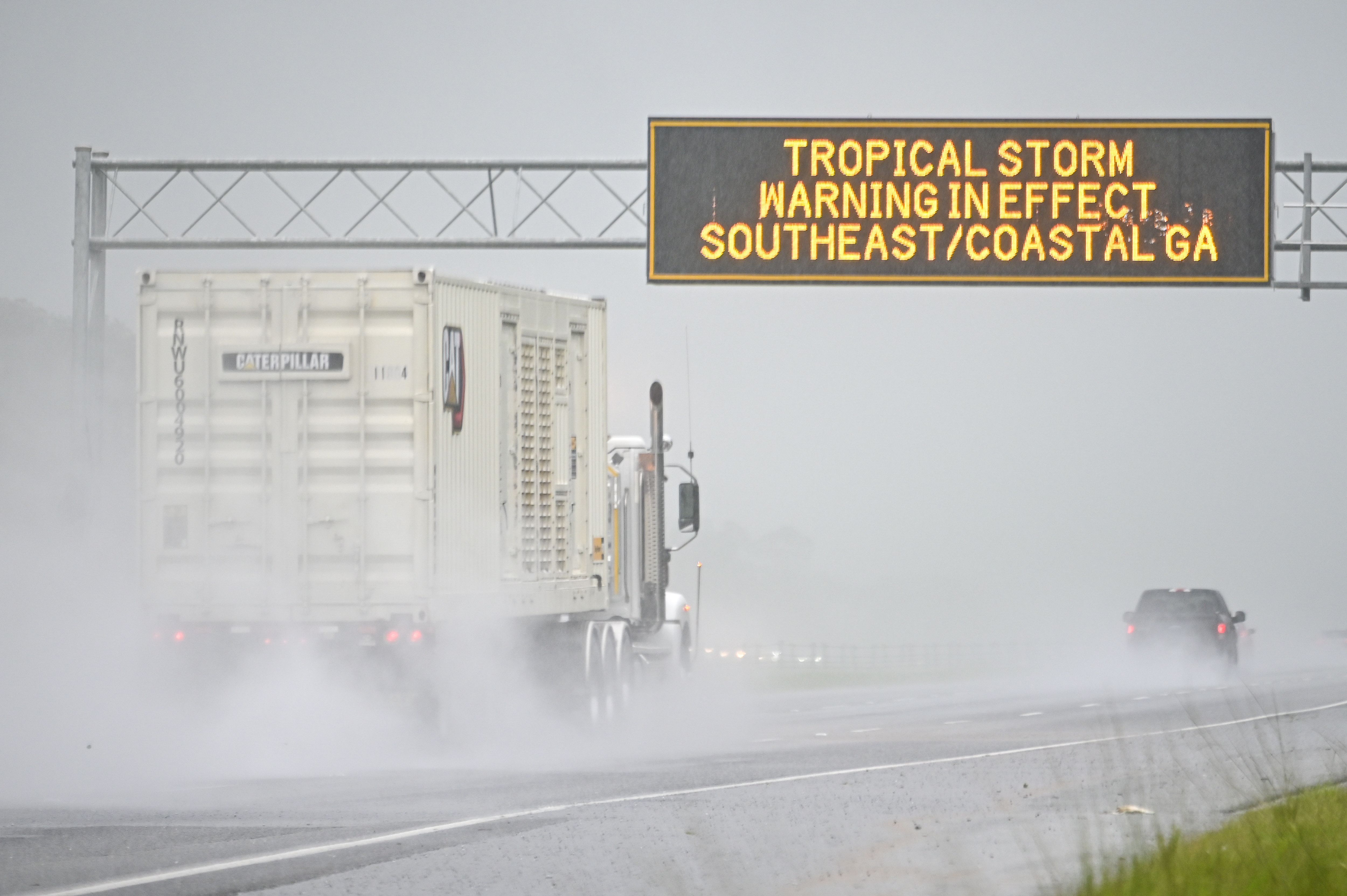
Threat level: The National Weather Service forecast office in Charleston, S.C., summarized the threat in a discussion Monday night: "Historic and catastrophic flooding through mid-week."
- "This is a life-threatening situation," the NWS said on Tuesday.
- Forecasters are calling for this storm to meet or beat past four-day rainfall totals from the biggest events, which would mean upward of 17 inches in the Charleston area.
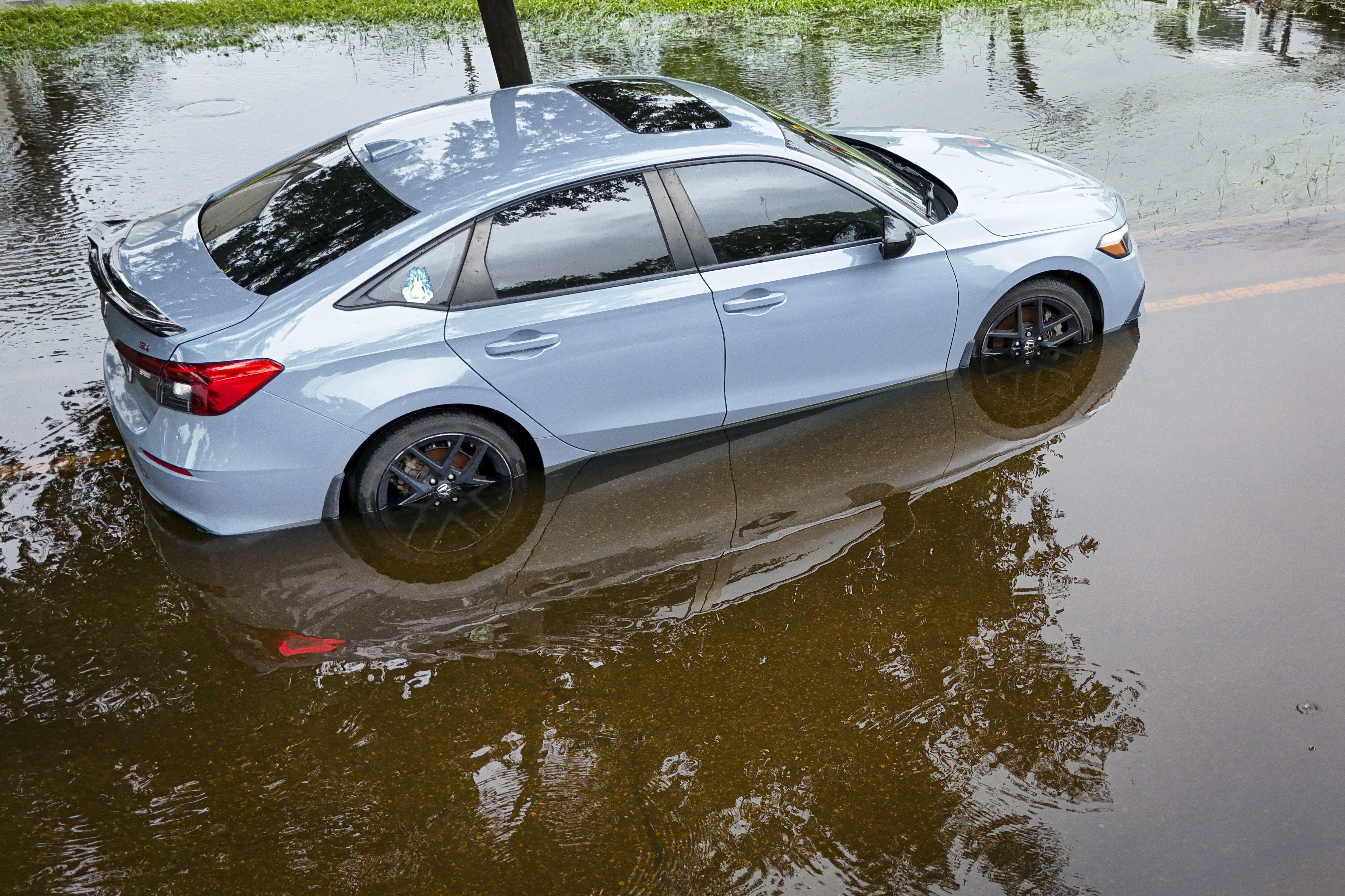
- Water rescues and flooding has been reported across wide regions in southeastern South Carolina, with widespread flooding in Charleston. In the region between Savannah and Charleston, there have been reports of floodwaters entering buildings, stalled-out cars and water rescues.
It's difficult to pinpoint exactly where the heaviest rain bands will set up, especially with the center of Tropical Storm Debby moving at five miles per hour or less at times during the next two days just off the Georgia and South Carolina coasts.
- The storm's center is forecast to move back over the ocean, allowing the system to re-intensify to some extent over the warm waters of the Gulf Stream Tuesday and Tuesday night.
- The center is forecast to then slingshot back over land in northeastern South Carolina on Thursday morning, which could result in "catastrophic flooding," per the NWS on Tuesday.
- Flooding is expected from North Carolina through portions of mid-Atlantic states and southern New England through Sunday morning, the NWS said.
How it works: The storm is moving slowly in an area without much upper-level wind, so it's not being pushed by anything. It's spinning around like a top, waiting for something to move it again.
- Tropical feeder bands coiled around the storm center have already dumped 5 to 10 inches of rain in some locations, and flash flooding will continue to escalate Tuesday as another 3 to 6 inches or more falls in parts of South Carolina, per the NWS.
- State records for the most rainfall in a single storm will be threatened, particularly in southeast Georgia and South Carolina.
Between the lines: This storm has already prompted flash flood emergencies — the most dire flood warning — in northern Florida.
- Expect more of these warnings — indicating imminent and dire threats to life and property — to be issued in the hardest hit areas on Tuesday and Wednesday.
Context: The urban areas from Savannah to Charleston are extremely vulnerable to flooding, especially this combination of storm surge-related flooding at the coast and heavy rainfall-induced floods. This is referred to as compound flooding, a term coastal residents should get used to hearing more often in a warming world.
- Such events are becoming more common and more damaging with human-caused global warming.
- Human-caused climate change makes tropical storms and hurricanes wetter than they used to be, and some studies show that these storms are now moving more slowly after landfall than in previous decades.
- Some of the biggest flood events in the Southeast have come in the past two decades, owing to slow-moving tropical storms and hurricanes, such as Matthew in 2016 and Florence in 2018.
- Coastal population growth has also put more people in harm's way, including in Georgia and South Carolina.
What they're saying: "[Storm] Impacts will be widespread and severe, likely including numerous flooded homes and structures, damage to roadways including washouts, and unprecedented flooding along creeks and streams," forecasters at NWS Charleston stated Monday evening, continuing the drumbeat of similar wording from earlier in the day.
- Forecasters are warning of lengthy, potentially historic flooding of larger rivers that would continue long after Debby has passed the region.
What's next: The storm's track will be critical to determining how much rain falls further north, with the increasing likelihood of flooding rains extending into North Carolina and the Mid-Atlantic region through the weekend.
- There is the distinct possibility of a region of a narrow region of potentially significant flooding in the Mid-Atlantic, somewhere between Richmond and New York City.
Go deeper: Tropical Storm Debby slams Florida with heavy rains, flooding
Editor's note: This story has been updated with forecast details. Axios' April Rubin contributed reporting.
