Tropical Storm Debby slams Florida with heavy rains, flooding


Add Axios as your preferred source to
see more of our stories on Google.
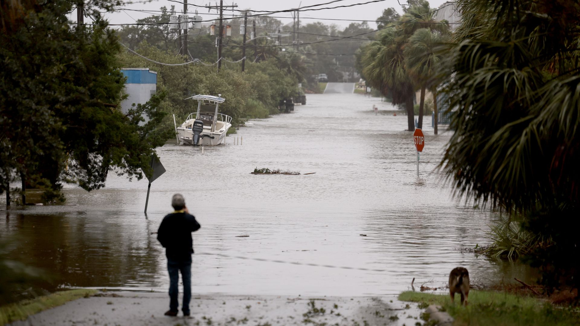
A person surveys a flooded street caused by the rain and storm surge from Hurricane Debby on Aug. 5, in Cedar Key, Florida. Photo: Joe Raedle/Getty Images
Tropical Storm Debby — a potentially devastating storm — is posing a nightmare scenario for flooding across the Southeast this week.
The big picture: The storm could tie or break state records for rainfall from a single storm in Georgia and South Carolina.
- Debby made landfall as a Category 1 hurricane early Monday in Florida's Big Bend before being downgraded to a tropical storm around 11 am ET, though it remains exceedingly dangerous due to flooding from historic rainfall.
- Tornado watches until Monday afternoon were also declared for parts of central Florida and southeast Georgia in response to Debby.
The latest: A flash flood emergency, the National Weather Service's (NWS) most dire flood warning, was declared for Florida's Suwannee County Monday afternoon.
- The area had already received between 10 and 15 inches of rain and an additional 3 to 6 inches are possible, according to the NWS.
- About 300,000 customers were without power across Florida and Georgia as of Monday afternoon, according to PowerOutage.us.
Zoom in: As of Monday morning, the storm had killed at least two people.
- A 13-year-old boy was crushed by a tree that had fallen onto a mobile home, according to the Levy County Sheriff's Office.
- Officials with the Hillsborough County Sheriff's Office said a driver of an 18-wheeler truck died after the vehicle partially fell into the Tampa Bypass Canal.
- A woman and a boy died in a single-car crash in Dixie County as Debby approached Sunday night, though the deaths were not immediately attributed to the storm, according to the Tallahassee Democrat.
Threat level: The NWS is describing this rainfall as "historic and potentially catastrophic," according to the National Weather Service.
- The rainfall amounts forecast for Savannah, Georgia, and Charleston, South Carolina, are between 10 to 20 inches, with up to 30 or more inches possible.
- "With these expected rainfall totals, impacts will be widespread and
severe, likely including numerous flooded homes and structures,
damage to roadways including washouts," according to the NWS. - Record-setting flooding may continue along rivers well after Debby moves away from the region, it added.


Zoom out: The center of Debby may meander over or remain just offshore the coasts of Georgia and South Carolina from Tuesday through late Thursday, directing a firehose of moisture off the unusually warm waters of the Atlantic into these low-lying cities.
- At the same time, onshore gales will pile a storm surge along the coast, creating coastal flooding as the deluge occurs, rendering drainage — which relies on gravity, ineffective.
- This happens as floodwaters on land make water levels there about equal to ocean levels, preventing waters from receding even between high tides.
Between the lines: Charleston in particular is known to flood at times of astronomical high tides even on sunny days, making this scenario almost unimaginable.
- Human-caused climate change makes tropical storms and hurricanes deliver more rainfall than they used to, and some studies show that these storms are now moving more slowly after landfall than in previous decades as well.
- Climate change is also increasing sea levels, which yields more destructive storm surges. Coastal population growth has put more people in harm's way, including in Georgia and South Carolina.
The bottom line: Water, not wind, typically kills the most people in these storms. That may especially be the case with Debby.
Go deeper: "Unusual warmth" hits nearly all of world's oceans
Editor's note: This story was updated with the latest developments.
