Tropical Storm Bret forms in rare spot, forecast to intensify

Add Axios as your preferred source to
see more of our stories on Google.
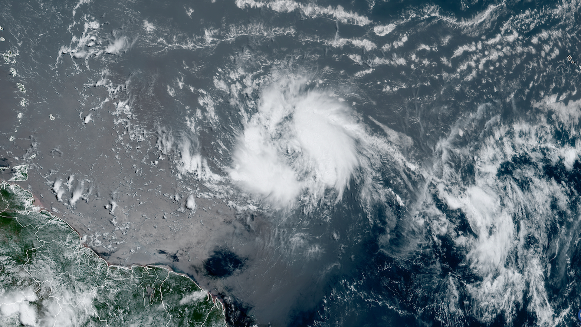
Satellite image of Tropical Storm Bret seen in the Central Atlantic on Tuesday. Image: CIRA/RAMMB
Tropical Storm Bret formed Monday afternoon in the Central Atlantic, after emerging off the west coast of Africa and tracking over record warm ocean waters for this time of year.
Why it matters: This storm shows what can happen when the tropical North Atlantic Ocean features temperatures more typical of September than June, defying seasonal norms.
- The storm formed in a location more typical for August or September, and is among only a handful of tropical storms to be named there during June.
- It is "the farthest east that a tropical storm has formed in the tropical Atlantic (south of 23.5°N) this early in the calendar year on record," according to Phil Klotzbach, a researcher at Colorado State University and seasonal hurricane forecaster.
Threat level: Tropical Storm Bret was moving west at 18 mph, packing maximum sustained winds of 45 mph as of 8pm Tuesday ET.
- Tropical storm watches were issued for the Caribbean islands of Barbados, Dominica and St. Lucia on Tuesday.
What we're watching: The storm may threaten the Lesser Antilles as a strong tropical storm towards the end of the week, and move into the Caribbean after that, though computer models show a pronounced weakening trend is likely to occur at that time.
- "Bret is forecast to approach the Lesser Antilles through early Thursday and then move across the islands Thursday and Thursday night as a tropical storm, bringing a risk of flooding from heavy rainfall, strong winds, and dangerous waves along the coast," National Hurricane Center forecasters wrote in an online forecast discussion.
- The NHC advised those in the Lesser Antilles, Puerto Rico and the Virgin Islands to closely monitor the storm.
- Computer model projections diverge depending on the storm's intensity, with a weaker storm more likely to move west-southwest into the Caribbean, guided by lower-level winds.
Context: Tropical Storm Bret is what is known as a Cape Verde storm, having formed from a tropical wave emerging off the west coast of Africa.
- Such storms are known for spinning up in late summer and early fall, when the waters of the central and eastern Atlantic Ocean are typically warm enough to support tropical storm formation.
- This is no ordinary tropical season. Much of the North Atlantic Basin, from the Gulf of Mexico to Africa north toward the U.K. and Republic of Ireland, is record warm for this time of year.
- The warmth is thought to be caused by human-caused climate change, as well as prevailing weather patterns that have slackened winds across much of this region.
- It is this record warm water that is likely to battle with a developing El Niño event in the tropical Pacific Ocean to be the dominant factor tilting the scales for or against an above average hurricane season.
Yes, but: Typically, the influence of an El Niño event on hurricane season has a lag time of a couple of months.
- This means that the traditional peak of the season in mid-to-late-August could be quieter than usual, if winds in the upper atmosphere strengthen, posing a hurdle for tropical storms and hurricanes to overcome in order to intensify and, in some cases, even survive.
What's next: A cluster of thunderstorms swirling behind T.S. Bret is also forecast to develop this week. If it is named, it would become Tropical Storm Cindy.
Editor's note: This article has been updated to include the details of Tropical Storm Bret's latest movements.
