New Zealand's flood-hit largest city braces for second atmospheric river


Add Axios as your preferred source to
see more of our stories on Google.
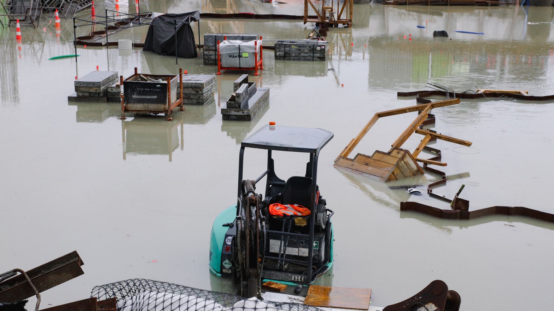
A digger is submerged in a flooded construction site on Jan. 28 in Auckland, New Zealand. Photo: Lynn Grieveson/Getty Images
Auckland authorities are urging residents to stay home if possible ahead of a second atmospheric river event forecast to hit Tuesday after record rainfall flooded much of New Zealand's largest city Friday.
The impact: At least four people have died after Auckland officials declared a state of emergency late Friday, after floodwaters inundated much of the city and many areas recorded their wettest-ever day. Further flooding was reported after more heavy rain over Sunday night.
- The severe storm has also caused landslides, while flooding has closed roads across New Zealand's upper North Island.
- New Zealand's education secretary directed all Auckland region schools to close for on-site classes until Friday as the state of emergency remains in place amid the threat of further weather disruptions and to minimize traffic "while vital infrastructure is urgently repaired," per a Ministry of Education statement Monday.
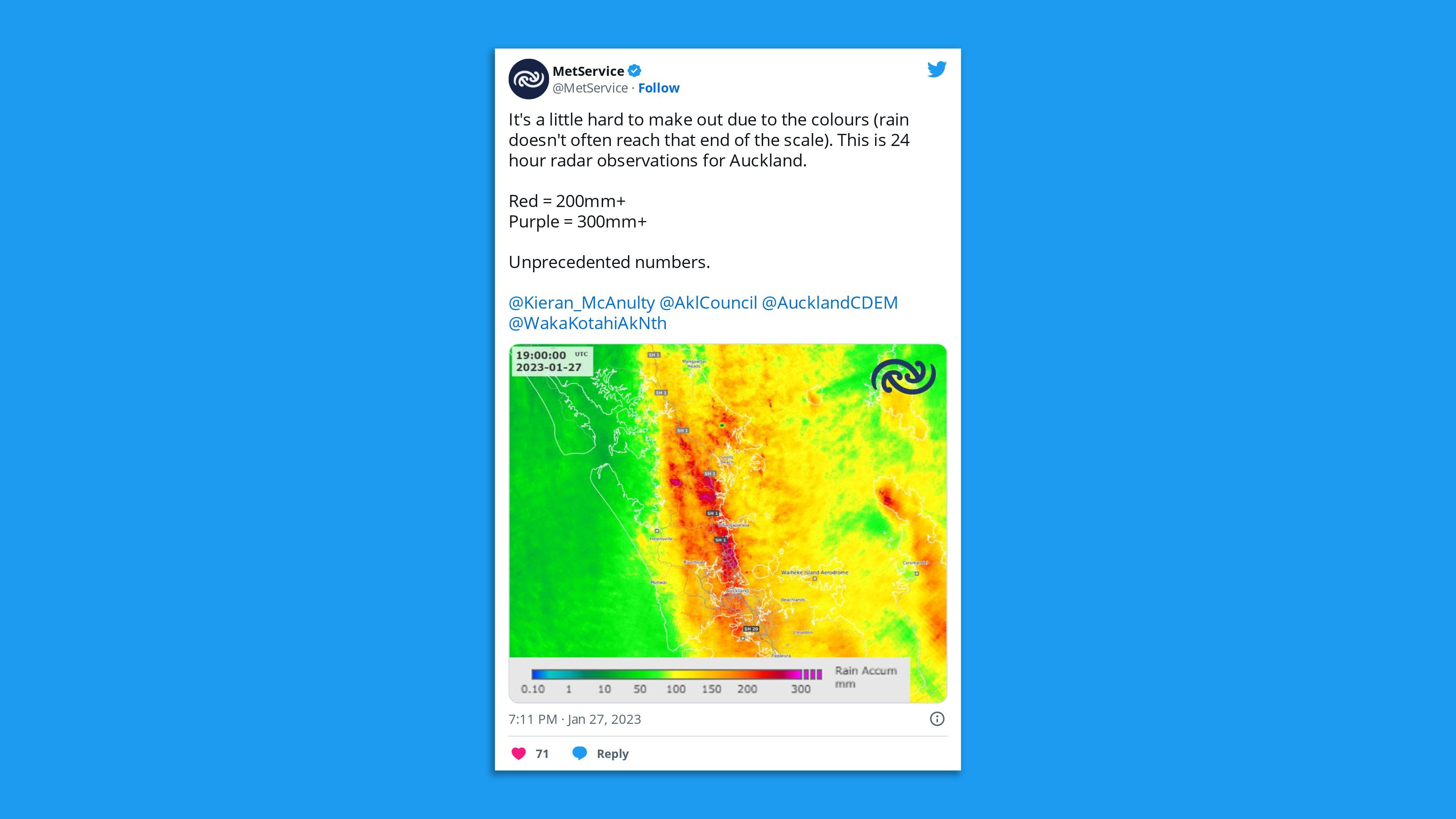
The big picture: This marks an unprecedented rainfall event for Auckland and its surrounding areas, with some places getting a season's worth of rain in one day.
- Auckland has recorded more than 769% of its normal January monthly rainfall and over 38% of its "entire ANNUAL rainfall" as of Monday morning local time, according to New Zealand's National Institute of Water and Atmospheric Research (NIWA).
- Auckland Airport halted flights until Saturday after almost 11 inches of rain fell, flooding parts of the terminal and stranding hundreds of people over Friday night.
By the numbers: Kumeu, a suburb north of Auckland, observed 79% of its normal summer rainfall in just 15 hours, with more than 6.5 inches of rain, per NIWA.
- Albany, meanwhile, recorded 75% of its normal summer rain.
- Castle Rock has the highest rainfall levels, with more than 12 inches of rain from Friday to noon Saturday.
Context: Atmospheric rivers are narrow currents of moisture-laden air that can transport vast amounts of water vapor thousands of miles.
- Climate change is adding even more moisture to atmospheric rivers, enabling them to dump higher rain and snow totals, per Axios' Andrew Freedman.
Thought bubble via Freedman: This extreme precipitation event is consistent with how climate change is altering weather worldwide.
- Heavy rainfall events are already becoming more common and intense across the U.S. and in other countries since the atmosphere holds about 7% more water vapor per 1 degree Celsius of warming.
What's next: More heavy rain and possible thunderstorms forecast for northern New Zealand in the next few days could potentially aggravate the flooding.
- National weather agency MetService has issued multiple severe weather warnings and watches for the Northland region for 24 hours from early Tuesday and Auckland for 12 hours from 6pm that night.
Axios' Andrew Freedman contributed to this report.
Editor's note: This article has been updated with additional details throughout.
