The polar vortex splits, sending frigid air howling into the U.S., Europe

Add Axios as your preferred source to
see more of our stories on Google.
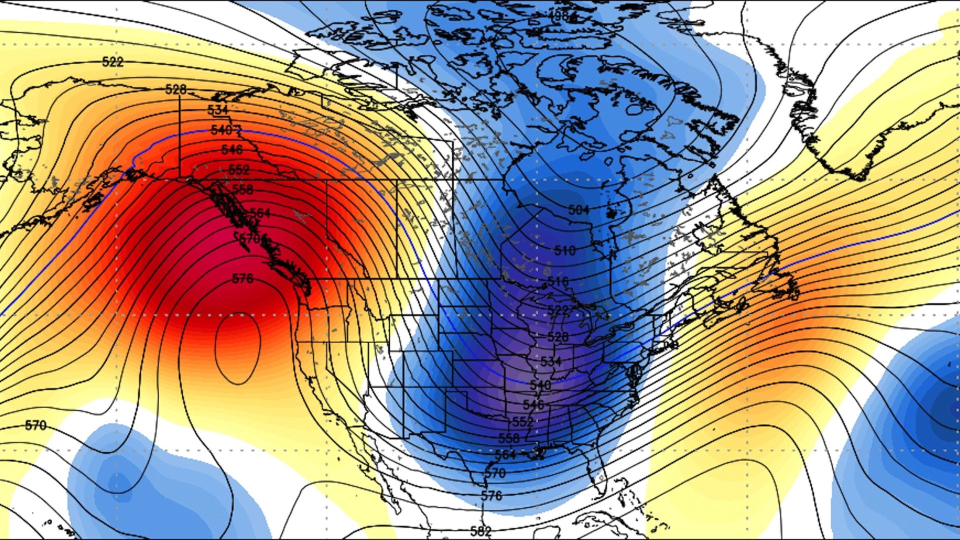
Computer model projection of 500 mb height anomalies showing a deep trough over the Midwest and East Coast with much colder-than-average conditions in late January. Image: Weatherbell.com
The polar vortex, the often hyped weather feature that typically keeps frigid, Arctic air nestled close to the North Pole during winter, has broken down into 3 pieces. It's spilling cold air out of the Arctic like a leaky faucet and spawning intense winter storms in parts of the U.S. and Europe in particular.
Why it matters: After a relatively mild start to the winter, parts of the Lower 48 states are about to experience a brutal second half to the season, with air temperatures dipping below 0°F as soon as this weekend in the Midwest. If the cold and snow is significant enough, it could put a dent in the economy, which is already feeling the effects of the partial government shutdown.
The big picture: The switch to a cold, snowy pattern from the Midwest to the East Coast has its roots in an event that took place in December and early January at about 100,000 feet above the Earth's surface.
Temperatures in the stratosphere suddenly spiked, in what's known as a "sudden stratospheric warming" event. This gradually disrupted the polar vortex, much like a person bumping a spinning top and causing it to spin off balance, slow down and meander drunkenly across a table.
- Experts told Axios that what's happening now — with a major winter storm about to cross the country from west to east, dumping 1–2 feet of snow in the Northeast and opening the gates to Arctic air behind it — is indicative of a weather pattern triggered by the stratospheric warming event and polar vortex split.
Details: According to Amy Butler, a research scientist at the Cooperative Institute for Research in Environmental Sciences, the weather pattern is transitioning to one resembling past years that were influenced by stratospheric warming events that also disrupted the polar vortex.
The evolving weather pattern for January into February, Butler says, looks to feature:
- Colder-than-average conditions in Eurasia and the eastern U.S.
- Warmer-than-average conditions over Greenland and subtropical Asia.
- The development of a blocking area of high pressure aloft across the North Pacific, as well as over Greenland.
These will act as so-called "blocking highs," slowing the progression of weather systems and effectively keeping the weather pattern in place for an extended period.
- Some of the biggest East Coast snowstorms on record, ones that paralyzed the big cities from Washington to Boston, occurred when such blocking weather patterns were in place.
What's next: Michael Ventrice, a meteorologist with The Weather Company, told Axios that the period from Jan. 28 through Feb. 5 is likely to be the coldest of the winter from the Midwest to the Ohio Valley and East Coast, but that plenty of cold weather will follow.
- “[For the] Eastern U.S. and I-95 corridor, it's going to be a long second half of winter," Ventrice told Axios, adding, "This is going to be a long cold wave for Europe as well.”
- This weather pattern will bring the first below-zero readings of the season to Minneapolis, lead to a frigid AFC championship game in Kansas City on Saturday, and cause low temperatures to plunge to the single digits in Manhattan by early next week.
Judah Cohen, director of seasonal forecasting at AER, a Verisk company, told Axios that he sees the impacts of the sudden stratospheric warming event and polar vortex split as lasting potentially into early March.
The bottom line: Get your cold weather gear ready. Tens of millions from the Midwest to the East Coast and over into Europe may be in for a wild ride during the second half of the winter.
