Sign up for our daily briefing
Make your busy days simpler with Axios AM/PM. Catch up on what's new and why it matters in just 5 minutes.
Stay on top of the latest market trends
Subscribe to Axios Markets for the latest market trends and economic insights. Sign up for free.
Sports news worthy of your time
Binge on the stats and stories that drive the sports world with Axios Sports. Sign up for free.
Tech news worthy of your time
Get our smart take on technology from the Valley and D.C. with Axios Login. Sign up for free.
Get the inside stories
Get an insider's guide to the new White House with Axios Sneak Peek. Sign up for free.
Catch up on coronavirus stories and special reports, curated by Mike Allen everyday
Want a daily digest of the top Denver news?
Get a daily digest of the most important stories affecting your hometown with Axios Denver
Want a daily digest of the top Des Moines news?
Get a daily digest of the most important stories affecting your hometown with Axios Des Moines
Want a daily digest of the top Twin Cities news?
Get a daily digest of the most important stories affecting your hometown with Axios Twin Cities
Want a daily digest of the top Tampa Bay news?
Get a daily digest of the most important stories affecting your hometown with Axios Tampa Bay
Want a daily digest of the top Charlotte news?
Get a daily digest of the most important stories affecting your hometown with Axios Charlotte
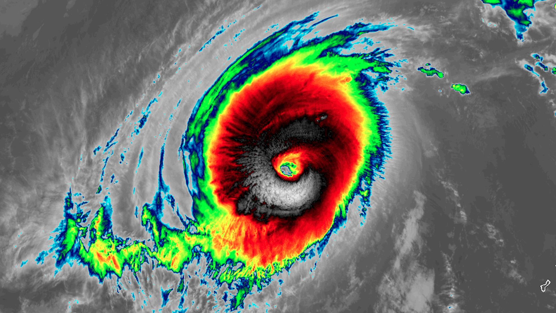
Super Typhoon Yutu, known as Rosita in the Philippines, may strike the northern Philippines around Oct. 31, 2018. Image: RAMMB/CIRA
Super Typhoon Yutu, which struck the Northern Mariana Islands as the strongest tropical cyclone to hit U.S. soil since 1935, appears headed for a second significant landfall — this time in the northern Philippines.
The big picture: Super Typhoon Yutu continues to push westward, and has turned into a larger, more sprawling system with estimated maximum sustained winds of 160 miles per hour. This puts it back to Category 5 intensity on the Saffir-Simpson scale. It's forecast to intensify further, to a 165-mph monster, during the next 24 hours, before slowly weakening.
What's next: The storm appeared to intensity on Friday, and is forecast to only slowly weaken as it spins westward, moving ever closer to the Philippine island of Luzon. Computer models that had previously suggested the storm would recurve harmlessly out to sea are now converging on a far more damaging scenario, with a potential landfall in northern Luzon early next week as a Category 2 or 3 storm.
The Philippines' weather agency, known as PAGASA, has announced that the storm will be locally known as "Rosita."
Go deeper: One of strongest storms ever slams Northern Mariana Islands