Aug 28, 2026 - Development
RFK site looms larger as D.C. construction slows

Add Axios as your preferred source to
see more of our stories on Google.
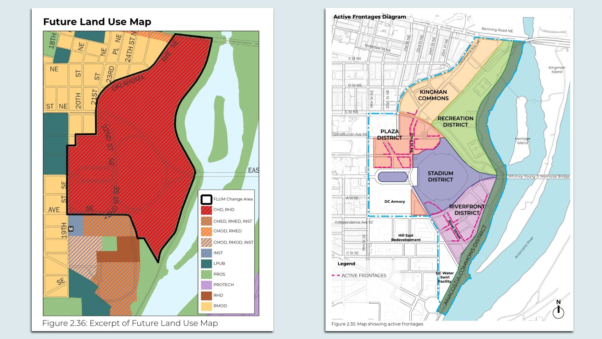
In the left image, the red portion encompasses the RFK development. Images: Courtesy of D.C. Office of Planning