D.C.'s winter weather outlook: Warmer but snow still likely

Add Axios as your preferred source to
see more of our stories on Google.
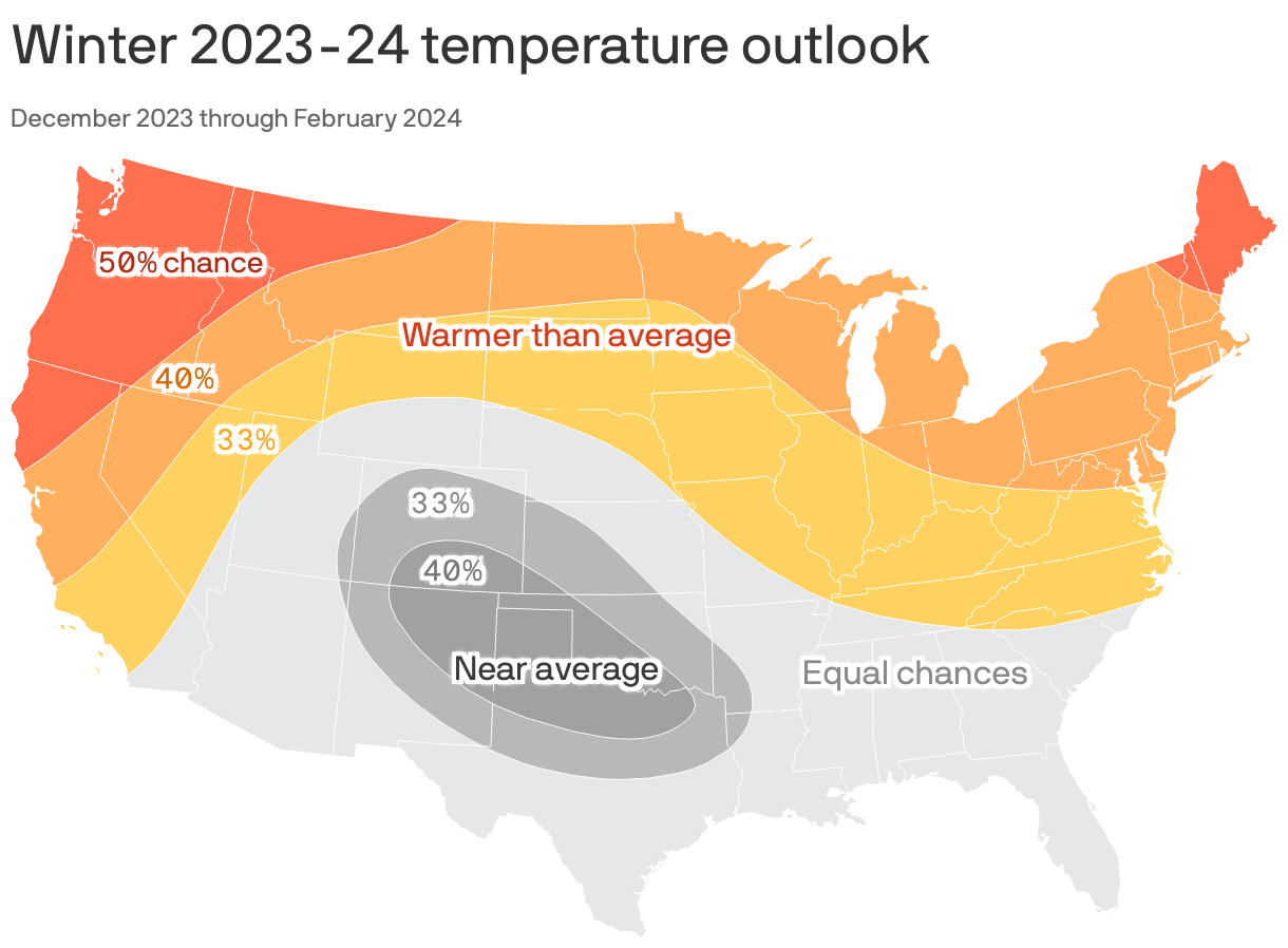
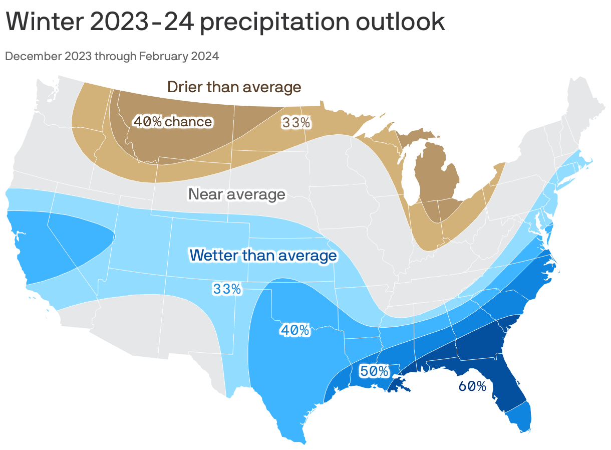
There's a heightened chance of warmer-than-average temperatures and wetter-than-usual weather this winter around Washington, per a new NOAA seasonal outlook.
- Yes, but: Snow lovers may still be rewarded after an unusually mild season last year that saw few flakes.
The big picture: The combination of a strong El Niño in the tropical Pacific Ocean and record high global ocean temperatures are likely to shape winter in potentially unexpected ways, Axios' Andrew Freedman writes.
Catch up quick: El Niño winters in the U.S. tend to feature a split jet stream flow across the country. A southern branch brings above-average precipitation from central California to Florida, while a northern branch of the jet stream brings cold Arctic air.
- When the branches interact, major, moisture-rich storms can form. If land temperatures are cold enough, heavy precipitation could fall as snow.
What they're saying: Jon Gottschalck of NOAA's Climate Prediction Center recently told reporters that the main storm track along the East Coast tends to be suppressed south and east during El Niño years, raising the likelihood of heavy snowstorms for the Mid-Atlantic states.
- He noted that the winter of 2009-10 — when D.C. saw the major "Snowmageddon" blizzard, among other storms — was a winter with a strong El Niño.
Meanwhile, less official predictors at the Old Farmer's Almanac say an abundance of acorns and other tree nuts means we're in for a snowy season — and apparently, it's a very nutty year.
Between the lines: The D.C. area just experienced record-high temperatures with six days of 80-degree weather — a first for late October — before our current cold snap.