Dec 15, 2021 - News
Minnesota braces for unprecedented December storm

Add Axios as your preferred source to
see more of our stories on Google.
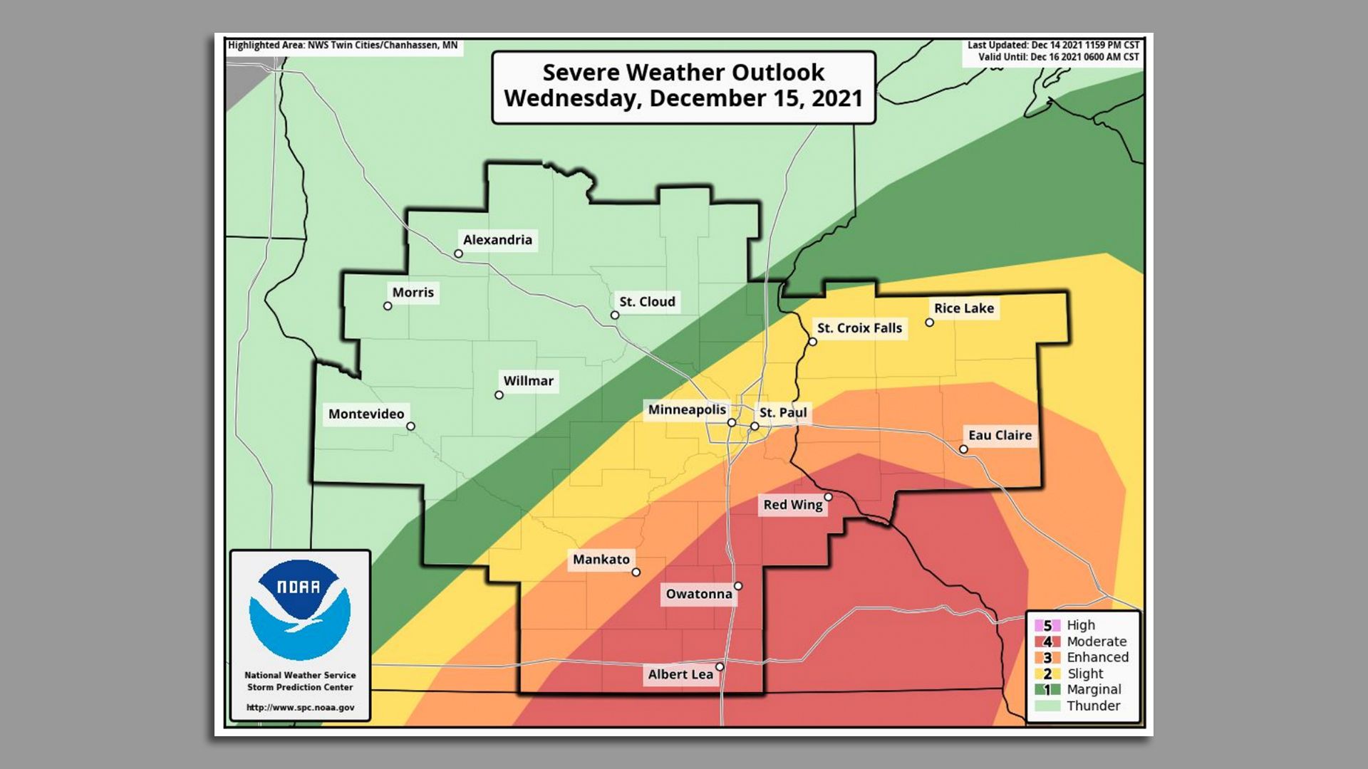
Map courtesy of the National Weather Service Storm Prediction Center
Add Axios as your preferred source to
see more of our stories on Google.
Map courtesy of the National Weather Service Storm Prediction Center