Colorado winter outlook: Powerful El Niño boosts snow hopes

Add Axios as your preferred source to
see more of our stories on Google.
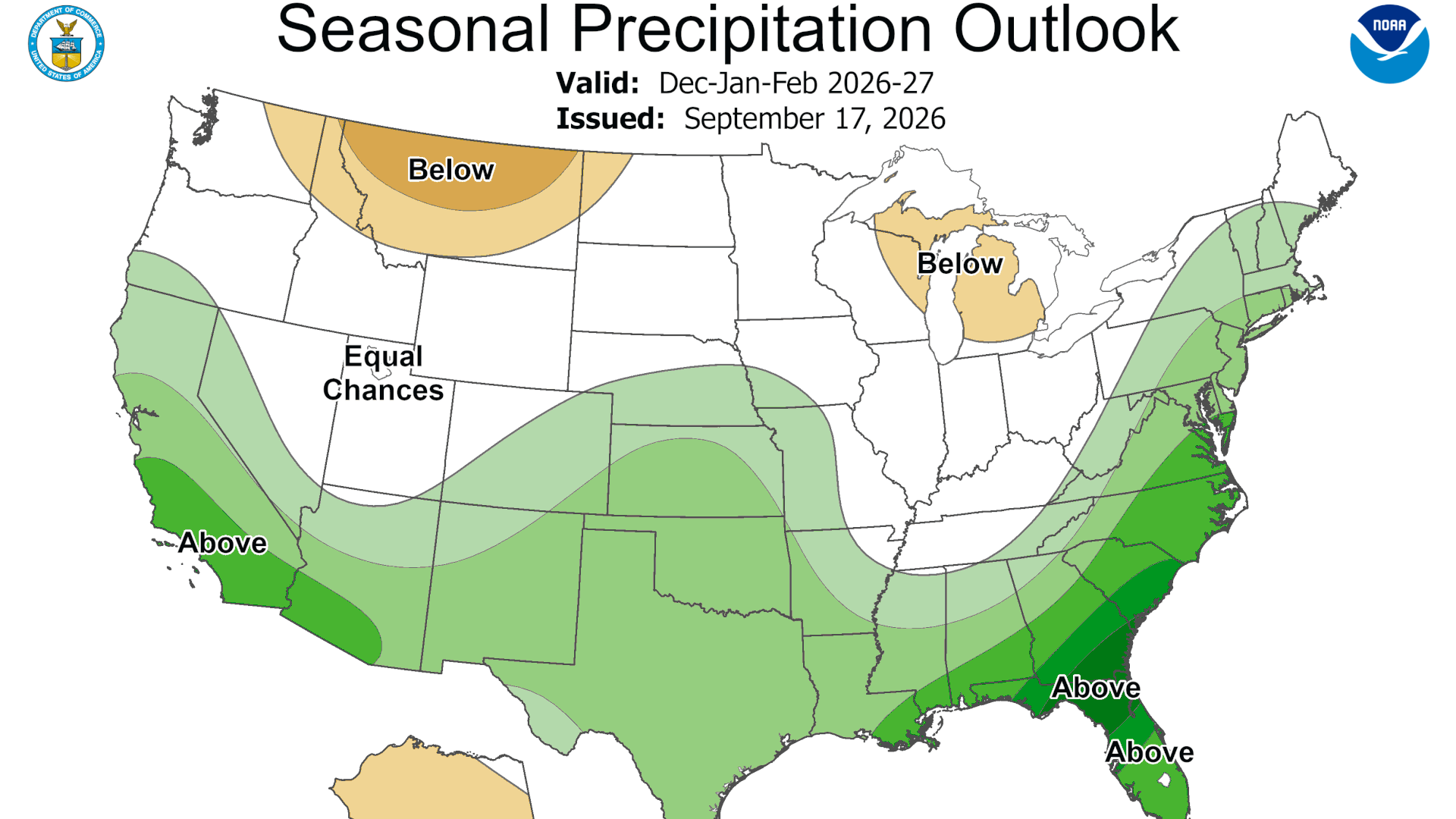
Map: NOAA
Colorado's best hope for breaking its historic drought is gaining strength in the Pacific.
Why it matters: We're thirsty. Nearly 86% of the state is in drought, and this winter's snowpack could help determine water supplies, wildfire risk — and the fortunes of the state's ski economy.
Driving the news: El Niño is strengthening rapidly, with a greater than 90% chance of becoming a very strong event this fall and winter, meteorologists report.
- NOAA gives it a 75% chance of reaching historic strength from October through December — potentially rivaling the strongest El Niño events dating to 1950.
Zoom in: The pattern typically shifts the country's winter storm track south, raising the chances for wetter conditions in Colorado's San Juan Mountains and the Rio Grande and Arkansas river basins.
- The Front Range and Eastern Plains also tend to see more fall and spring moisture, including an elevated chance of major upslope snowstorms.
- The signal is much weaker for the northern and central mountains. Steamboat, Vail, Summit County and Aspen could finish above or below normal because El Niño has historically offered little consistency there.
Reality check: A massive El Niño doesn't guarantee blockbuster Colorado snow.
- Only three similarly powerful events exist in modern records. The 1982–83 El Niño delivered enormous snowfall, while the 1997-98 and 2015-16 winters finished closer to average.
Another reality check: Even a banner winter may not erase Colorado's water deficit.
- Experts say it could take multiple normal or snowy winters to rebuild storage and fully ease the drought.
The bottom line: Colorado has better odds of a wetter and snowier winter than last season, particularly the southern mountains and east of the Continental Divide.
- But El Niño is loading the dice — not guaranteeing the result.