25 walking trails in Charlotte for nature lovers and city views

Add Axios as your preferred source to
see more of our stories on Google.
Little Sugar Creek Greenway near Park Road Shopping Center. Photo: Ashley Mahoney/Axios
Ah…the great outdoors. We’ve compiled a list of 20+ trails in the Charlotte area for nature lovers, city vibes, and everything in between.
Editor's note: This is not a definitive list of every trail in the Charlotte area — there are a ton. If you’ve already made your way through the ones below, use Mecklenburg County Park Explorer for more trails.
- You can also check out Carolina Thread Trail’s website and sort by county, level of difficulty and trail use.
- The AllTrails app also helps you track trails and mark your completed walks.
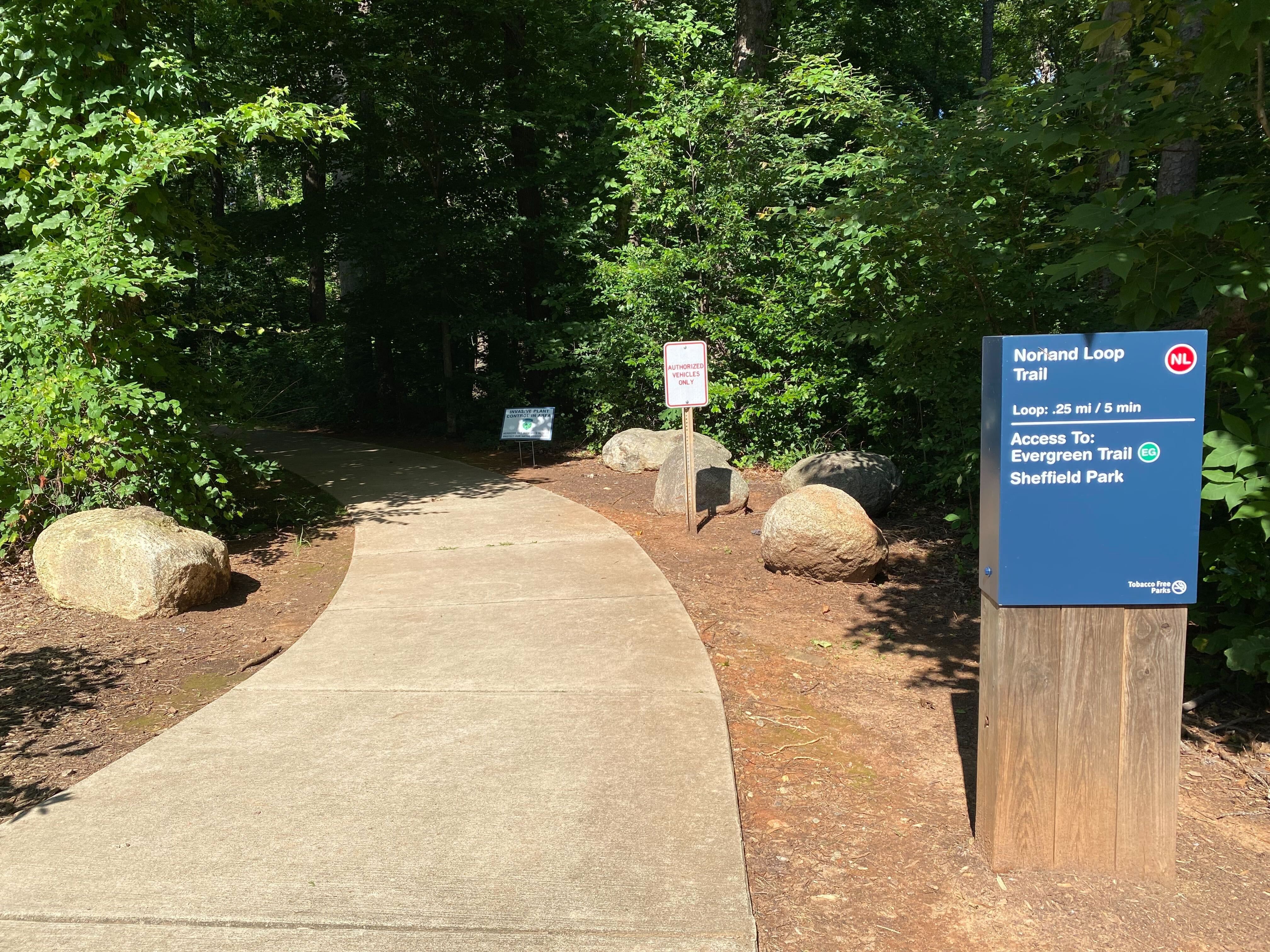
Evergreen Nature Preserve
The east Charlotte gem is great for hiking, walking, running and bird watching. It’s open year-round and dogs are allowed on the trail with a leash. There's an easy 1.8-mile loop of paved and dirt paths.
Stop by: 1336 Norland Road
Reedy Creek Nature Preserve
Walk through 920 acres of natural habitats along seven natural and gravel-surface hiking trails. In all, there are more than 10 miles of trails.
Stop by: 2900 Rocky River Road
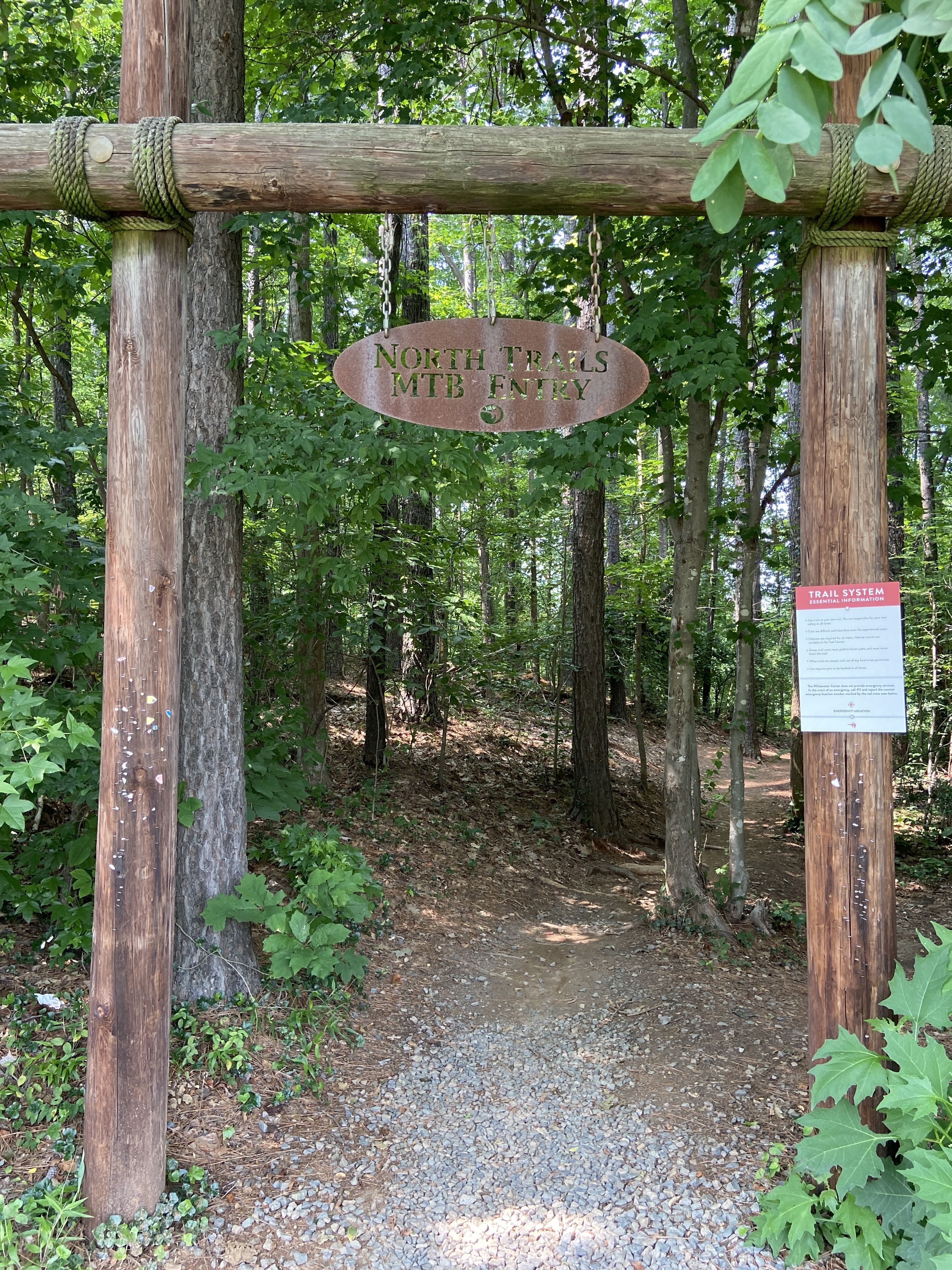
Whitewater Center
The U.S. National Whitewater Center isn’t just for rafting, kayaking and listening to live music — it also has more than 50 miles of trails to hike, run, or bike along.
- Check to see if trails are open before heading out. Find trail status here.
- Trails are free to use, but it’ll cost you $12 per day to park or $40 for the calendar year.
Stop by: 5000 Whitewater Center Parkway
Go deeper: 15 ways to spend a day at the Whitewater Center
Ribbonwalk Nature Preserve
The nature preserve a few miles north of Uptown is a peaceful escape from the city. There's a 1.1-mile and a 2-mile trail, both are categorized as "easy," on the AllTrails app.
Stop by: 4601 Nevin Road
Clarks Creek Nature Preserve
There are several intertwining trails. Use Mecklenburg County Park Explorer to see the distance and surface type of each.
Stop by: 5434 Hucks Road
/2024/01/06/1704503202116.webp)
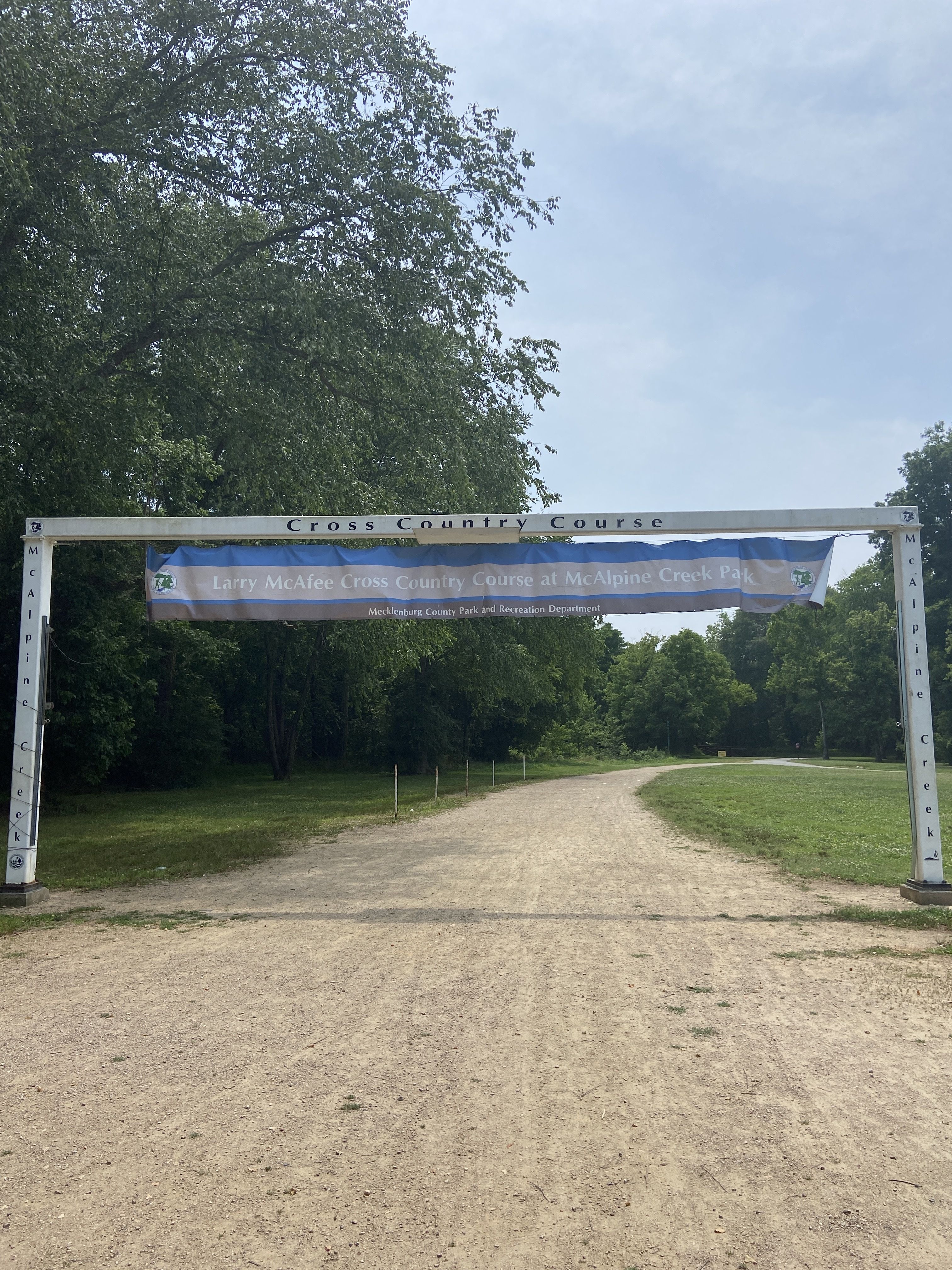
Campbell Creek Greenway and Upper McAlpine Creek Greenway
These east Charlotte greenways connect in McApline Creek Park off Monroe Road. Explore 5.8 miles of trail from Lockmont Drive to Providence Road and check out the Larry McAfee Cross Country Course in the park.
- Trails are a mix of surfaces.
Stop by: 8711 Monroe Road. McAlpine Creek Park is a great starting point and there's plenty of parking.
Four Mile Creek, Lower McAlpine Creek and McMullen Greenways
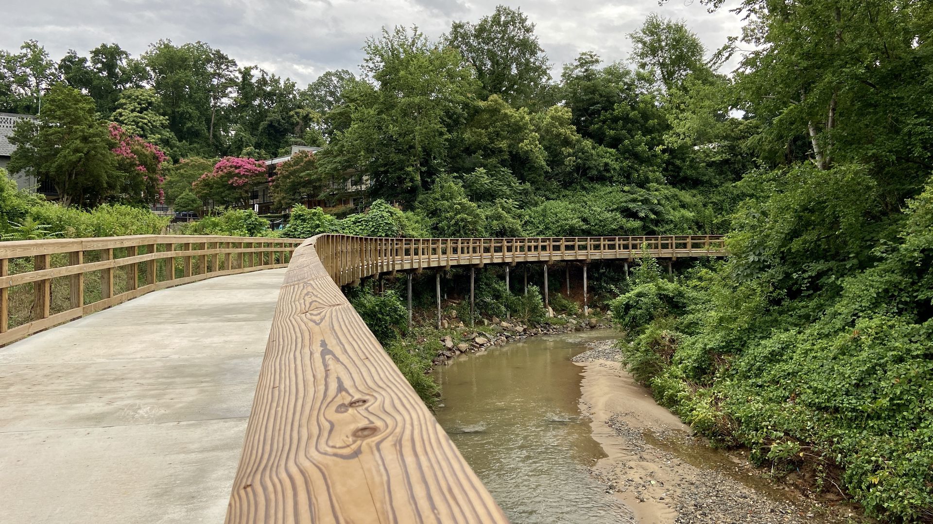
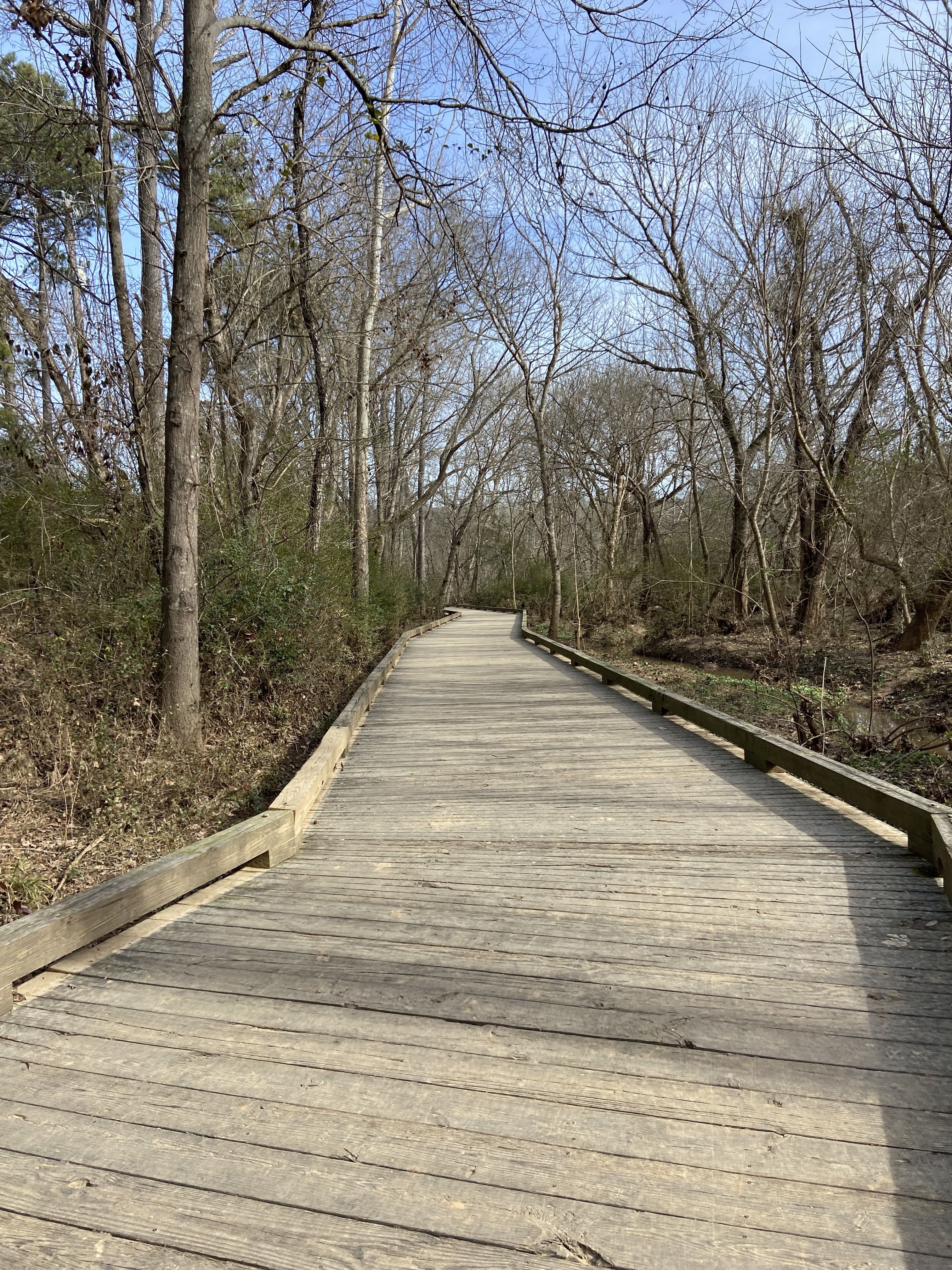
The 7.3 miles of trails connect much of south Charlotte from Hwy 51 to Johnston Road and Rea Road. It includes paved surfaces and wooden boardwalks.
Irwin Creek, Stewart Creek and Wesley Heights Greenways
These greenways are just west of Uptown spanning 2.7 miles from State Street to Cedar Street, with a connection to Freedom Drive. Plus, 1.7 miles from West Boulevard to Clanton Road, and the 1-mile stretch of Stewart Tributary Greenway, from Lakewood Avenue to Yellowstone Drive.
- Stewart Creek Tributary 2 opened earlier this year.
- By the end of 2024, a new 0.5-mile section of Stewart Creek Greenway will open near where Blue Blaze used to be.
/2024/01/06/1704503202729.webp)
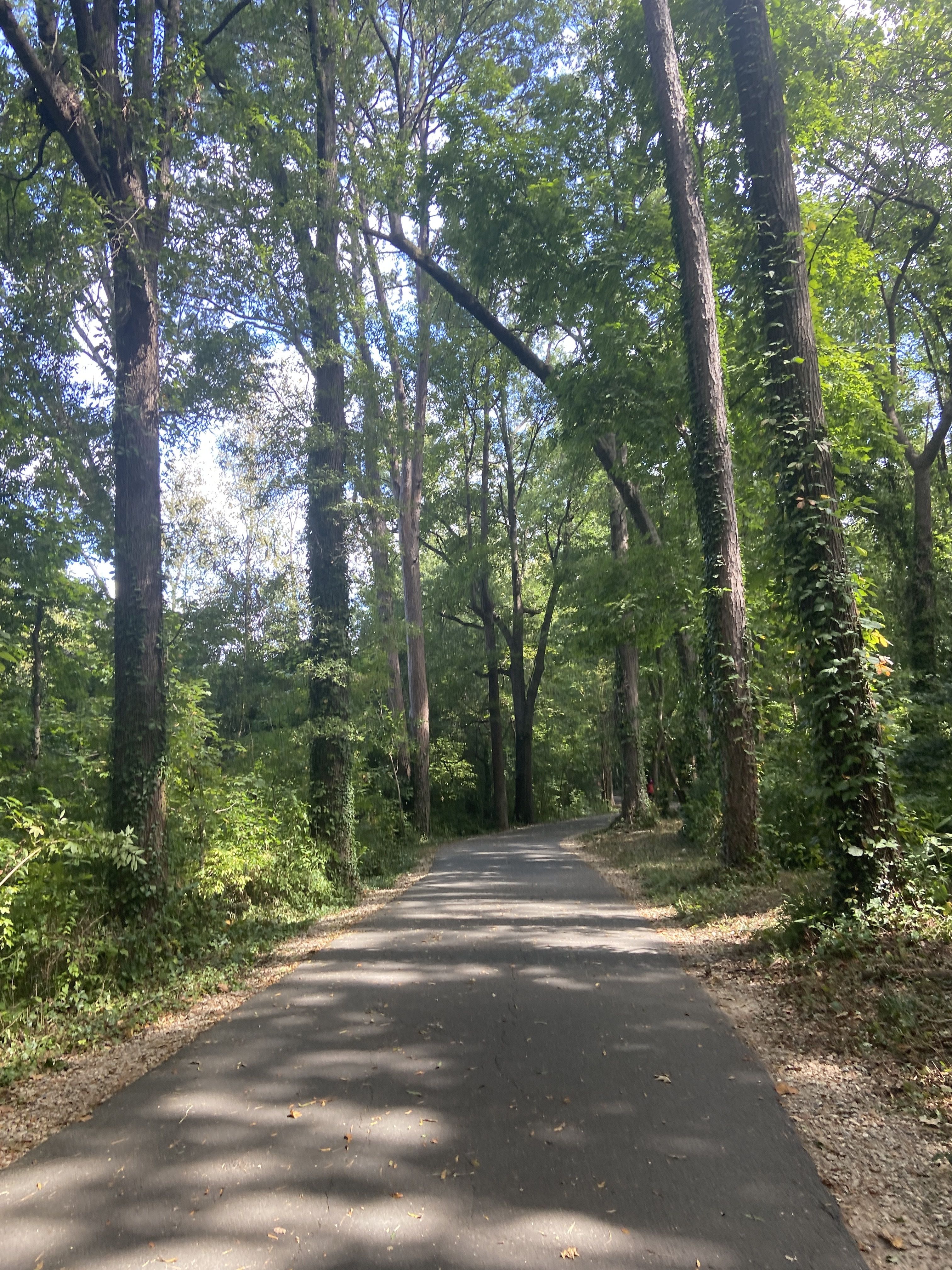
Little Sugar Creek Greenway
The popular greenway spans more than 17 miles starting near NoDa to the South Carolina state line. It's also part of the Cross Charlotte Trail, which will eventually span from the southern end of the county to the northern.
- It includes everything from serene trails to skyline views.
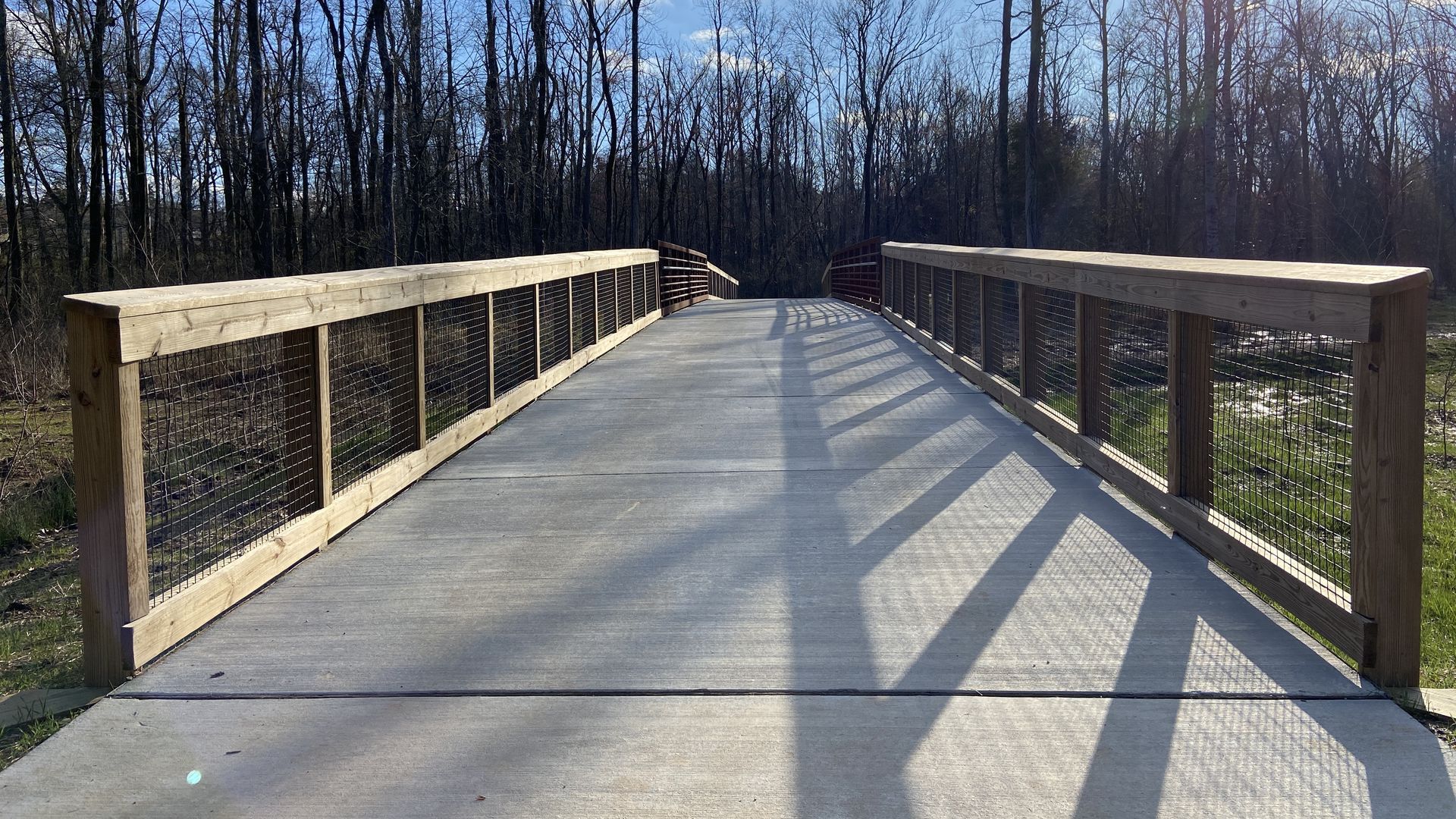
Long Creek Greenway
The 2-mile second phase of Long Creek Greenway opened in the spring. The greenway now extends 3.5 miles from the Target in Northlake to I-485 off Beatties Ford Road.
- A third phase will add 2.1 more miles to the trail in 2025.
Go deeper: New stretch of greenway opens in north Charlotte
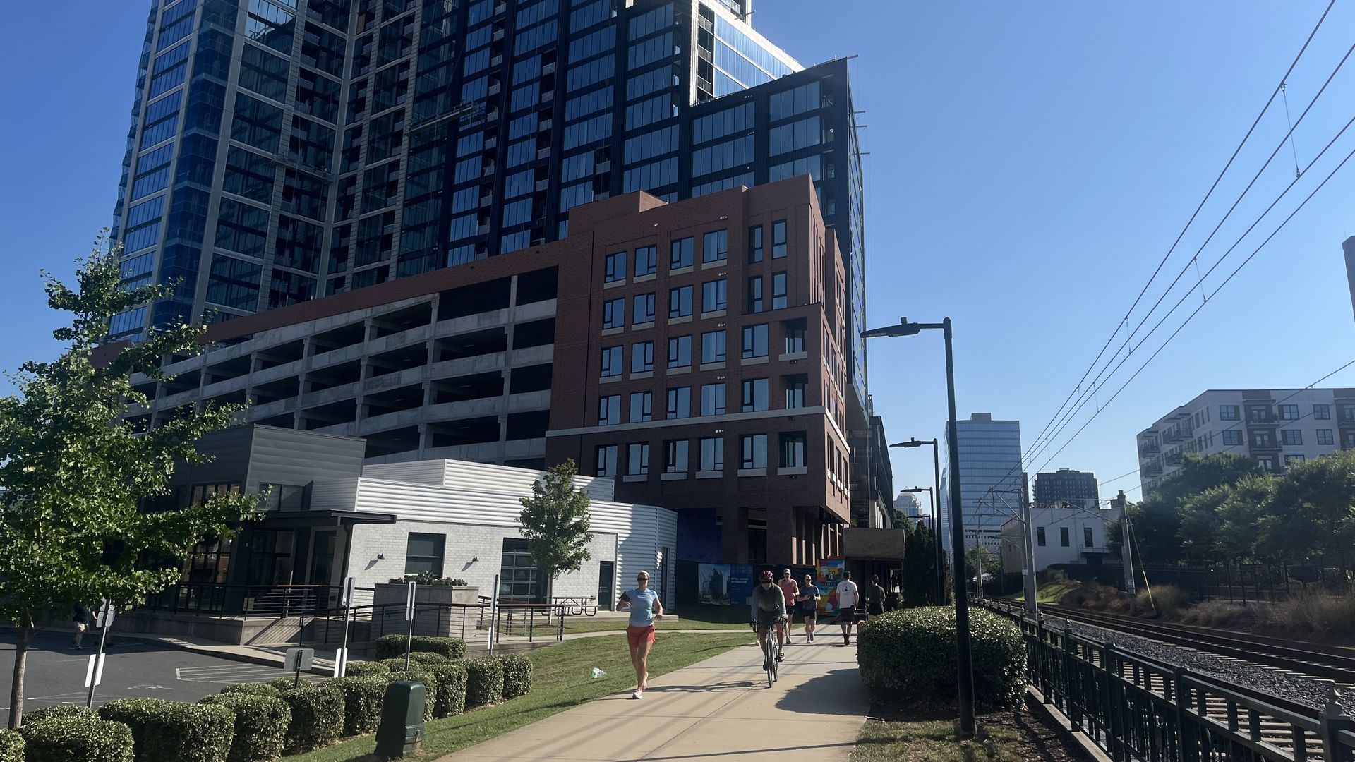
Charlotte Rail Trail
This 3.5-mile stretch spans from South End to Uptown next to the LYNX Blue Line.
Jetton Park
The 105-acre lakefront park on the edge of Lake Norman has picnic areas, 1.5 miles of walking/rollerblade trails, 1.3 miles of bike trails, a playground, a tanning beach and eight tennis courts.
Stop by: 19000 Jetton Road in Cornelius, about a 30-minute drive from Charlotte.
Duke Kimbrell Trail
Duke Kimbrell Trail (formerly the Seven Oaks Preserve Trail) is a 2.9-mile natural surface and paved trail running along Lake Wylie and Daniel Stowe Botanical Garden.
Stop by: 6900 S. New Hope Road in Belmont, roughly a 30-minute drive from Charlotte.
Anne Springs Close Greenway
2,100 acres of protected land, right in the urban apron of Fort Mill (about 20 miles from Uptown Charlotte).
- Named for Fort Mill native Anne Springs Close, a noted philanthropist who climbed Mt. Kilimanjaro multiple times, expect a series of trails, including a few historical ones.
Stop by: 2573 Lake Haigler Dr.
/2024/01/06/1704503204811.webp)
Pharr Family Preserve Trail
Pharr Family Preserve Trail located near Midland is a 3.4-mile loop trail that runs parallel to the Rocky River.
Stop by: 9111 Mt Pleasant Road. S. in Concord, about a 35-minute drive form Charlotte.
Girl Scouts Hornets’ Nest Council Trail
The Girl Scouts Hornets’ Nest Council Trail offers a unique place to hike or mountain bike. The 2-mile trail is housed on the Oak Springs Campus — a regional destination for the Girl Scouts. Nature enthusiasts will appreciate this trail because of its wealth of biodiversity.
Stop by: 1763 Turnersburg Highway in Statesville, about 50 minutes north of Charlotte.
Buffalo Creek Preserve Trail
The 2.1-mile paths are great for walking, hiking, running and mountain biking.
Stop by: 7911 Malibu Road in Mount Pleasant, about 40 minutes northeast of Charlotte.
Riverwalk: Piedmont Medical Center Trail
The Piedmont Medical Center Trail, located in the Riverwalk community, is a 2.5-mile paved trail along the Catawba River.
Stop by: 575 Herrons Ferry Road in Rock Hill, S.C.
Pharr Yarns Family Trail
This historic 2.4-mile Pharr Yarns Family Trail (formerly the South Fork Trail) is a mixed-surface trail.
Stop by: 119 Willow Drive in McAdenville, located on the South Fork branch of the Catawba River.
South Fork Rail Trail
South Fork Rail Trail runs 1.8 miles along the south fork of the Catawba River in the 324-acre Rhyne Preserve.
Stop by: 2677 Laboratory Road, a 45-minute drive from Charlotte to the trailhead just outside Lincolnton.
Editor's note: This story was originally published on March 6, 2021 and last updated on Nov. 6, 2024.