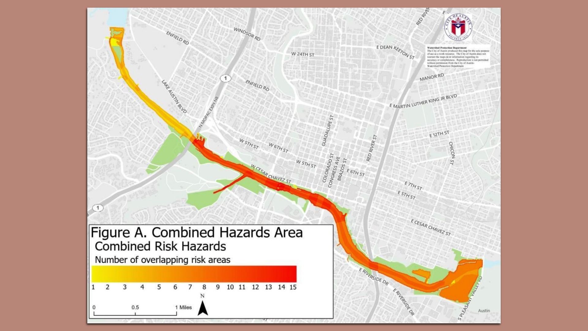
A map of swimming hazards on Lady Bird Lake. Image courtesy city of Austin
Swimming in Lady Bird Lake is dangerous business, according to a new city memo.
Why it matters: The lake is the main waterway in downtown Austin.
State of play: Swimming has actually been prohibited in the lake since 1964, capping a decade in which 30 people drowned in the reservoir, per the Sept. 18 memo, sent by Austin's public safety, parks and public health chiefs to the mayor and City Council.
Since 2019, six dogs have died in the lake, their deaths attributed to toxins from blue-green algae.
The risks: Swift currents after floods, pointy construction debris, potentially poisonous algal blooms and lacerating zebra mussels all make the list of hazards.
Plus: "Anecdotal evidence ... indicates that floating sharps, including syringes, are not uncommon," per the memo.
Yes, but: There's no mention of snakes.
Zoom in: Allowing swimming "would necessitate full-time lifeguards," per the memo.
And monitoring for water quality often has significant lag times, "making real-time safety advisories impractical," per the memo.
The bottom line: Making the shore by Deep Eddy Pool safely swimmable would "require an upfront investment of approximately $11 million and an estimated annual recurring cost of approximately $4.5 million," per the memo.