Jul 7, 2025 - News
Lake Travis rose dramatically after July 4 weekend

Add Axios as your preferred source to
see more of our stories on Google.
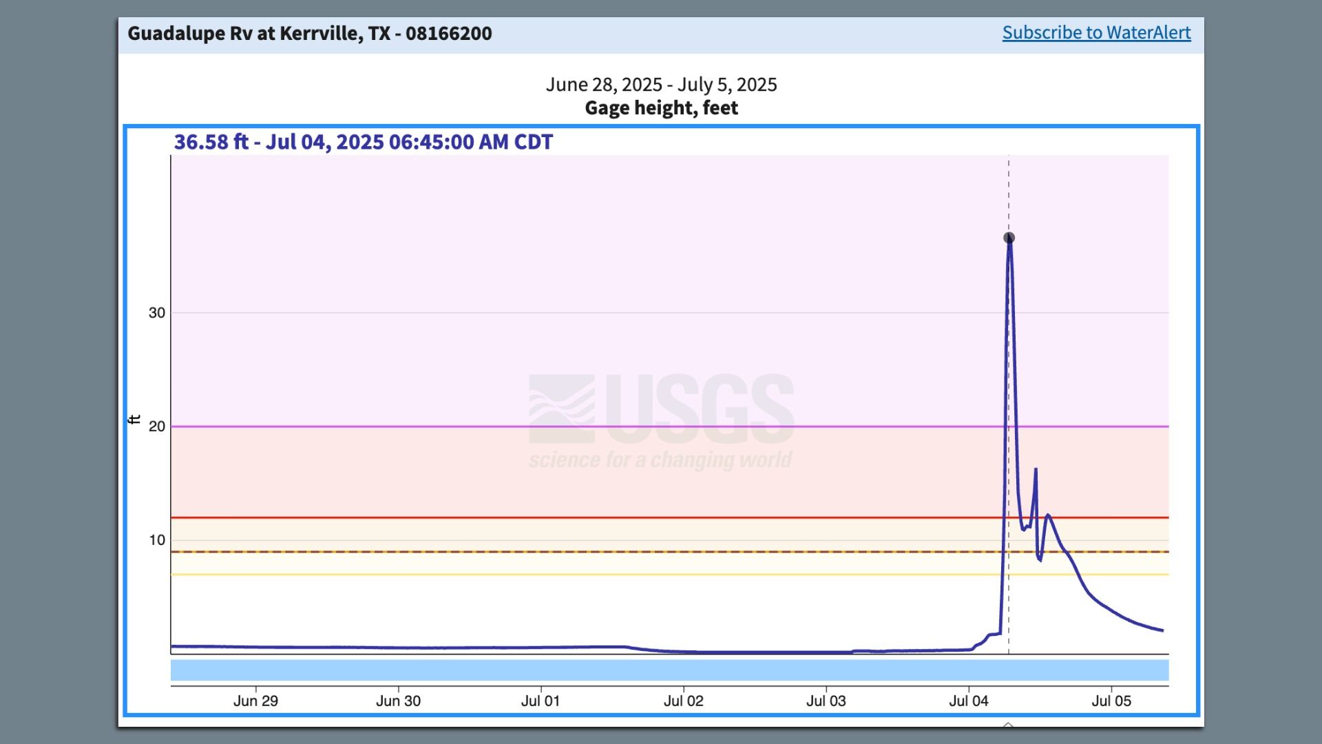
At 2am Friday, the Guadalupe River was running at 2 feet, per federal flood gauges — and within five hours it was cresting at 36 feet as a crush of water surged downstream.
Zoom out: Rainfall totals in some areas of Central Texas topped 20 inches between Wednesday and Saturday night, as a "rain bomb" — as CBS Austin's Avery Tomasco put it, detonated over Texas.
- A rain bomb is not, strictly speaking, a meteorological term, but it can describe a column of wet, sinking air sometimes associated with a stalled thunderstorm.
All that rain recharged the region's drought-stricken lakes, Travis and Buchanan.
- In the 48 hours between late morning Friday and late yesterday morning, Lake Travis jumped by more than 200,000 acre-feet of water. (An acre-foot is about 326,000 gallons.)
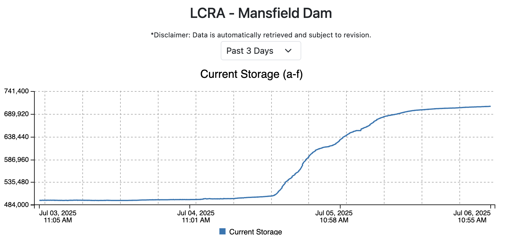
Stunning stat: That's far more water than the residents and businesses of Austin consume in an entire year — about 140,000 acre-feet.