Hurricane Florence on track for direct, dangerous strike

Add Axios as your preferred source to
see more of our stories on Google.
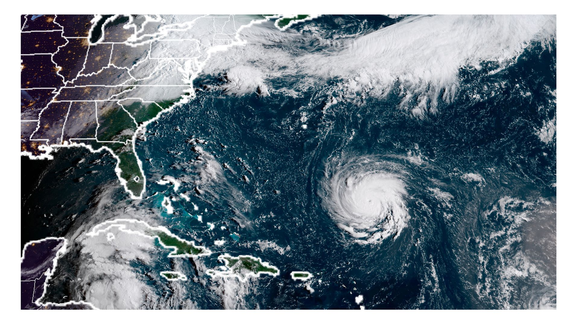
Photo: NOAA via CIRA/RAMMB
Hurricane Florence, currently a Category 4 storm, is going through an astonishingly rapid intensification process, and could hit anywhere from the Carolinas to the Mid-Atlantic by Thursday or Friday.
Driving the news: As of 5 pm ET, Hurricane Florence had maximum sustained winds of 140 mph. The official intensity forecast has been raised — now calling for it to peak as a Category 5 storm before weakening slightly as it makes its approach to the coast. All eight of South Carolina's coastal counties will face a mandatory evacuation beginning at noon Tuesday, per The State.
What's happening: Computer models are still projecting a range of landfall locations, so anywhere from South Carolina to Virginia are still in play. This will be a very large storm, with damaging impacts far from the center.
If Florence follows current model projects and official forecasts, it would...
- Be capable of producing 20-30+ inches of rain in the Carolinas and Mid-Atlantic, possibly including the D.C. area. This is a nightmare inland flood scenario.
- Bring hurricane-force winds for more than a day to a swath of land about 350 miles in diameter or greater, extending well inland from the landfall point.
- Drive one of the largest potential storm surges on record onto the Carolina coast.
- Be one of the strongest hurricanes on record to make landfall in the Carolinas or Mid-Atlantic.
- Make landfall or come closest to land on Thursday-Friday before stalling for up to three days.
Be smart: This could be a major test of how President Trump handles another multifaceted crisis, this time one that is possibly at his literal doorstep.
