Tropical Storm Florence wallops Carolinas with surge and catastrophic flooding

Add Axios as your preferred source to
see more of our stories on Google.
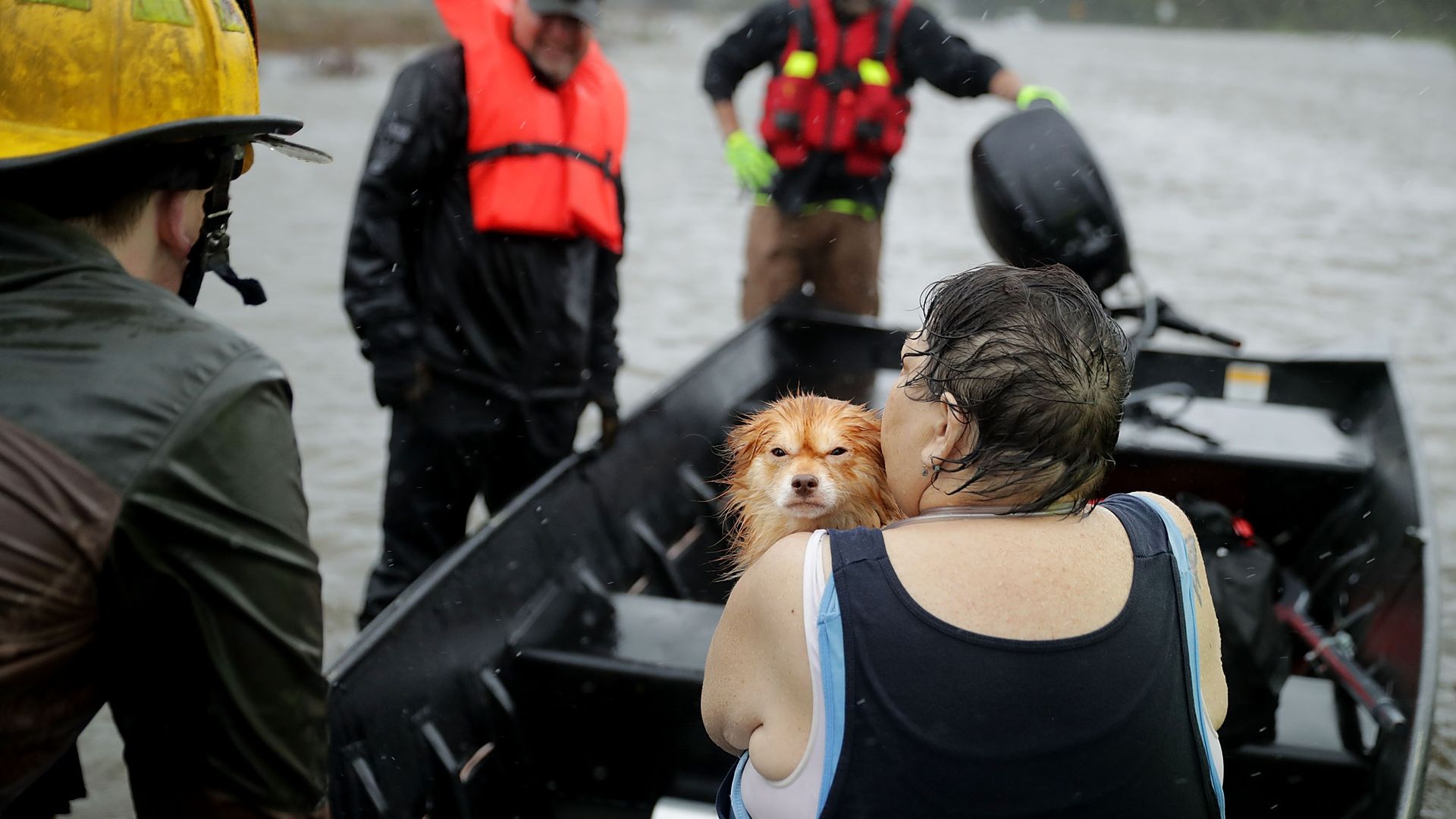
Rescue workers rescue a woman and her dog from their flooded home in North Carolina. Photo: Chip Somodevilla/Getty Images
Hurricane Florence roared onto the North Carolina coast at a snail's pace Friday, subjecting the coastline to more than 12 hours of punishing hurricane-force winds and pushing a massive storm surge inland. Based on a weakening of sustained wind, Florence has since been downgraded to a tropical storm.
The big picture: The surge put a large portion of the community of New Bern underwater Thursday night and Friday. While winds are still gusting to greater than 100 miles per hour in some locations, the danger from here on out remains the surge and inland flooding from what is likely to be the worst tropical cyclone-related rainstorm in North Carolina history. In some areas, rain was falling at rates between 3 and 7 inches per hour.
The impacts to date: So far the storm has brought Wilmington, North Carolina its highest winds since 1958, with a gust to 105 mph recorded. Several locations are also setting records for the all-time highest storm water level, which is a combination of tide plus storm surge. Rainfall in central parts of the state is already eclipsing 2 foot, on the way to 3 feet or more. The all-time rainfall record for a tropical storm or hurricane in North Carolina, 24 inches, set during Hurricane Floyd in 1999, is certain to be broken on Friday.
- The problem is that while the eye of the storm is just over the coast, a large portion of the hurricane remains over the open water, vaulting spiral bands of extremely heavy rainfall at the coast.
- Computer models are starting to project even higher rainfall totals than called for at this time yesterday, possibly approaching 45 inches or greater.
- Storm surge flooding will continue on Friday and Saturday in the Carolinas.
What's next: Hurricane Florence is sliding southwest toward Myrtle Beach, South Carolina, which is the opposite of how such storms normally move in this region.
Florence is forecast to turn to the northwest and eventually the north over the weekend. This track will keep much of North Carolina on the wet side of the storm, setting up what could be a "catastrophic" inland flood scenario, the National Weather Service has warned.
- It will take days for rivers to crest, meaning a significant portion of this damaging storm is yet to come.
Like with Hurricane Harvey in Texas in 2017, the consistent flow of moisture off warm ocean waters will be capable of producing prodigious amounts of rain, raising rivers beyond their banks and extending storm impacts well inland.
Go deeper:
