Oct 29, 2019 - Technology
Google taps satellites to offer clearer picture of wildfires

Add Axios as your preferred source to
see more of our stories on Google.
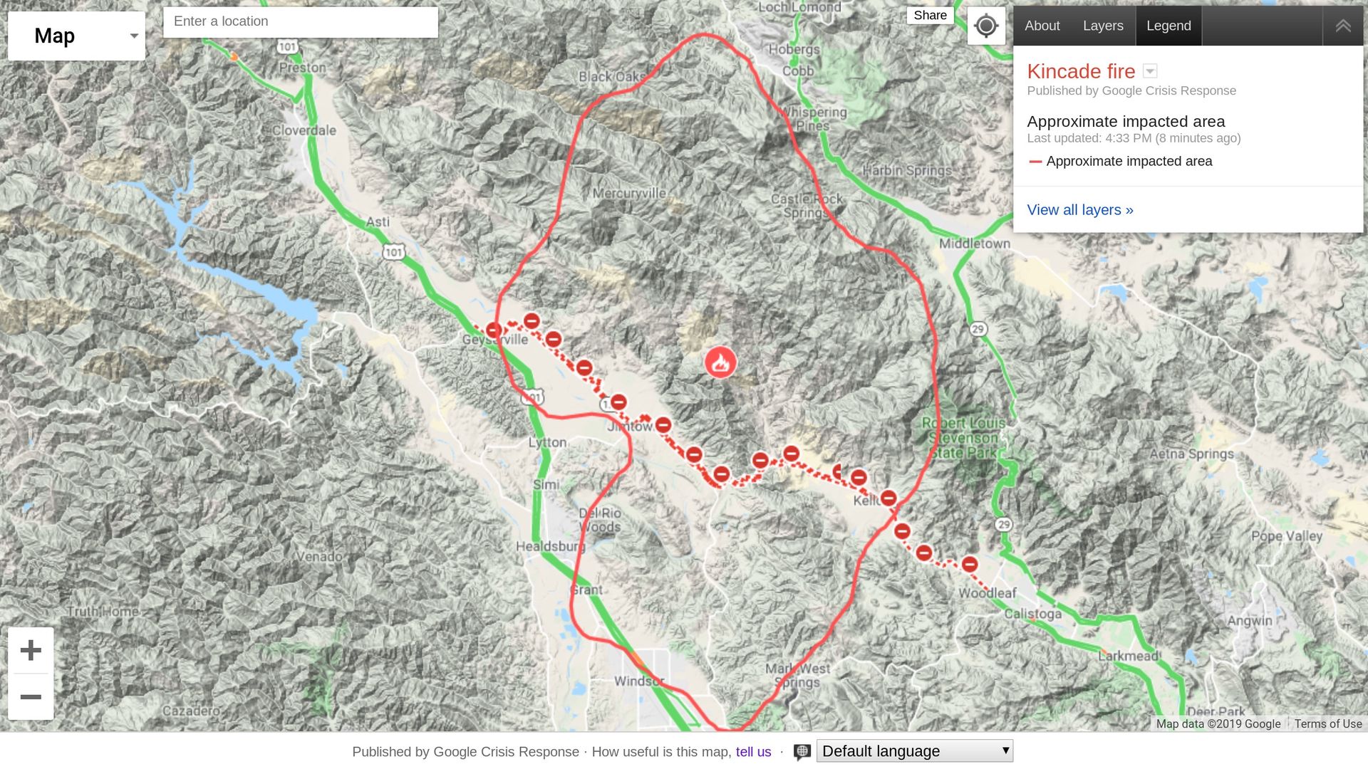
Photo: Google
Add Axios as your preferred source to
see more of our stories on Google.
Photo: Google
