Atmospheric river takes aim at Southern California's burn scars

Add Axios as your preferred source to
see more of our stories on Google.
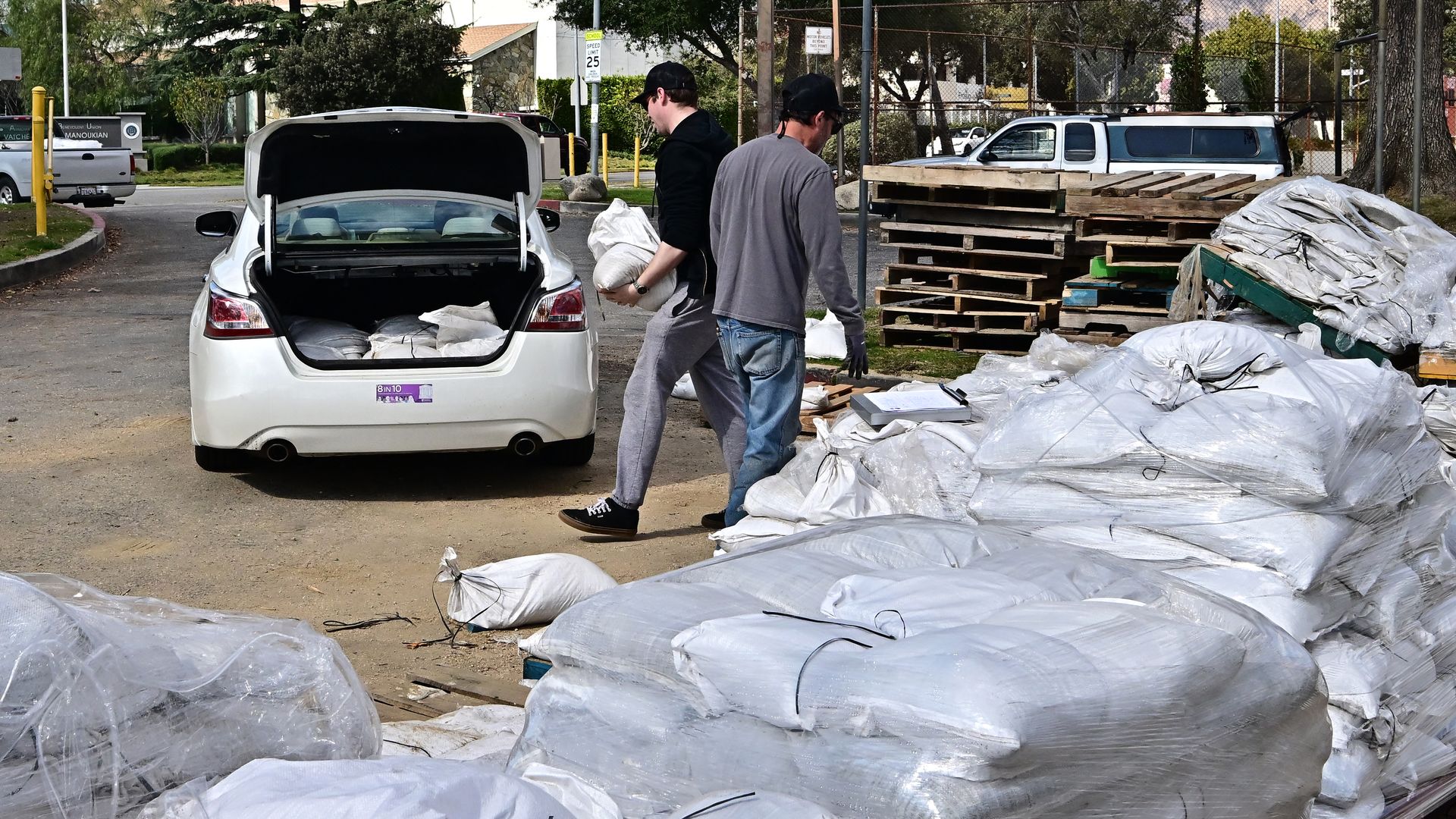
Sandbags are loaded into the trunk of a car on Feb. 12 in Pasadena, Calif. Photo: Frederic J. Brown/AFP via Getty Images
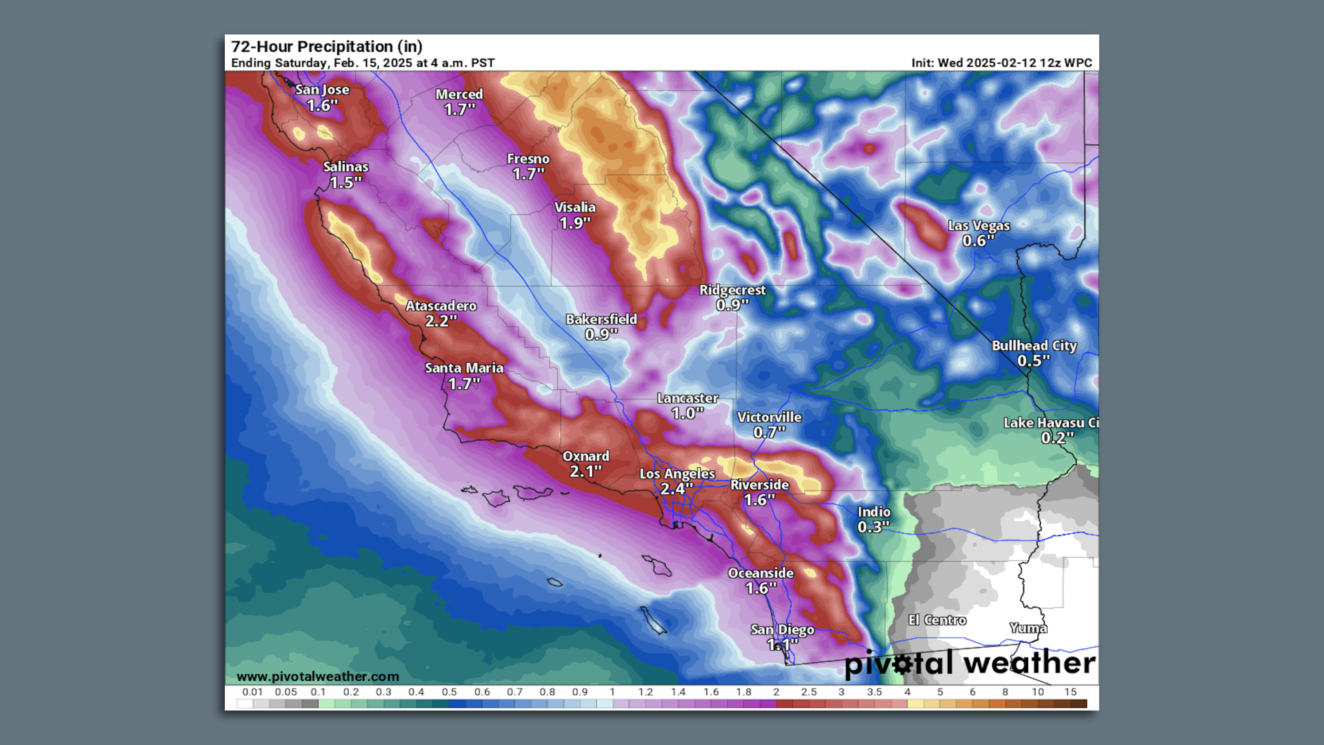
Amid a coast-to-coast barrage of winter storms, a firehose of moisture is poised Thursday to bring heavy rains and high winds to Southern California.
Threat level: The heavy rains will bring a "high likelihood" of flooding, the National Weather Service warns. The greatest risk is for mudslides and debris flows in Southern California's large, recent burn scars.
- The threat is present at each of the major fires' burn scars, including the Palisades and Eaton Fires, as well as the earlier Bridge Fire.
- The most recent blazes collectively burned more than 16,000 structures and killed more than 25 people in early January.
When heavy rain falls on recently burned hillsides, burned soils and missing vegetation can cause water to quickly run off.
- The ground can even give way during periods of intense rainfall, as "burned soil can be as water-repellant as pavement," according to the NWS.
- California has seen multiple deadly disasters involving burn scar landslides of various types, including a debris flow in Montecito that killed 23 people.
What they're saying: The NWS forecast office in Los Angeles is warning of the risk for "life-threatening" burn scar flooding and debris flows as the heaviest rain sweeps through Thursday afternoon and evening.
- Rainfall rates tend to be the determining factor for triggering debris flows, rather than total amounts.
- For this reason, forecasters are especially concerned about projections for a squall line of heavy rain and scattered thunderstorms as a powerful cold front moves through the area late Thursday.
Zoom out: The atmospheric river-linked storm has a sinuous, narrow and concentrated feed of moisture stretching westward to north of Hawaii.
- Meanwhile, two more storms are stretching across the continental U.S., with a snow storm underway from the Plains to the Midwest, and a wintry mix of precipitation from the Mid-Atlantic to the Northeast through Thursday.
- As of Wednesday morning, flash flood watches — including those in California — were in effect for about 10 million people, while winter storm warnings and advisories were in force for about 240 million people from California to Maine.
The scope of active weather across the U.S. this week is unusual, and is related to an intense clash of air masses between comparably warm and humid air across parts of the U.S., and frigid, dry Arctic air to the north.
- Such temperature contrasts influence the formation and path of storm systems.
Context: Human-caused climate change is making extreme precipitation events more common and intense across the U.S. and worldwide.
- It is predicted to make atmospheric rivers — narrow highways of concentrated water vapor in the mid-troposphere — even wetter in coming years.
- One 2022 study found that atmospheric rivers that hit California in 2017 were made up to 15% wetter due to human-caused climate change, suggesting such an influence may already be observable.
