Don't be fooled by the late July hurricane lull

Add Axios as your preferred source to
see more of our stories on Google.
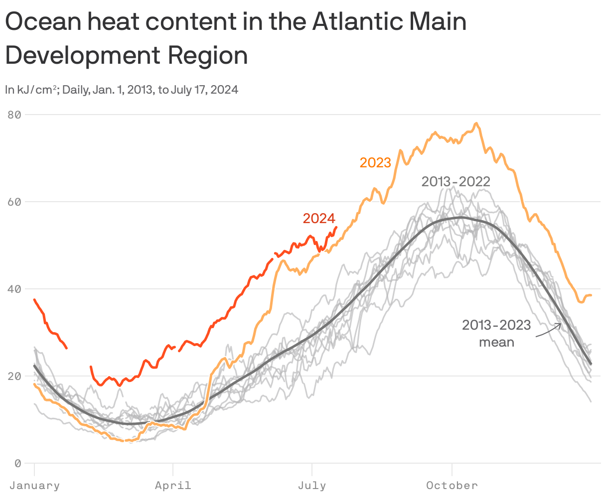
Across the so-called "Main Development Region" of the tropical Atlantic Ocean, the ocean waters contain record-high amounts of heat — and it's increasing. Typically, these waters don't fully heat up until October.
Why it matters: Such ocean conditions could give rise to additional fierce hurricanes like Hurricane Beryl, which set records for how strong it got so early in the season.
Yes, but: In the air, a thick layer of dust from the Sahara Desert is sweeping across the Main Development Region from east-to-west, and will soon reach Florida.
- The dusty air layer stifles thunderstorms and is keeping a lid on any possible tropical storms or hurricanes... for now.
- Climatologically, it isn't unusual for hurricane season to take a break during the latter half of July, only to pick up in earnest in early to mid-August.
- The African dust outbreaks tend to peak during July and decline into August, allowing groupings of thunderstorms, known as tropical waves, to emerge off the continent's west coast and go on to serve as seedlings of hurricanes.
Threat level: Computer models show about another one to two weeks of quiet time in the tropical Atlantic. After that, all bets are off in what is predicted to be a hyperactive season.
- The historical peak of the hurricane season is on Sept. 10, with many notorious storms, such as Hurricane Sandy, hitting land in October.
- The later one goes into this hurricane season, the more likely it is that conditions could be unusually favorable for storm development, with historically warm water temperatures and the effects of a developing La Niña in the tropical Pacific Ocean being felt.
- Such climate cycles tend to make the atmosphere more conducive to Atlantic storm development.
