Biden declares disaster in Texas as Beryl's flooding rains spread inland


Add Axios as your preferred source to
see more of our stories on Google.
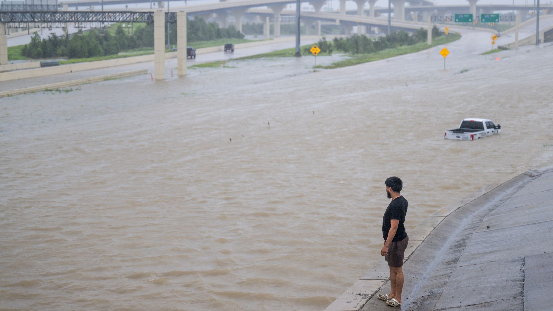
A person surveys the flooded interstate after Hurricane Beryl swept through Houston, Texas on July 8. Photo: Brandon Bell/Getty Images
Former Tropical Storm Beryl weakened into a tropical depression Monday after killing at least eight people in Texas and Louisiana and causing widespread power outages and flooding in metro Houston.
Threat level: As of Tuesday evening, there were still widespread outages in the Houston area. Portions of eastern Texas, western Louisiana and Arkansas still face the threat of flooding rains and tornadoes.
- The power outages leave millions of people without air conditioning as temperatures rise into the lower 90s and heat index values push over 100 on Tuesday — something President Biden raised concern about after approving a federal emergency disaster declaration for Texas.
- The combination of extreme heat — the leading weather-related killers in the U.S. — and lack of air conditioning will be particularly dangerous for people cleaning up after the storm.
What he's saying: "The greatest concern right now is the power outages and extreme heat that is impacting Texans. As you all know, extreme heat kills more Americans than all the other natural disasters combined," Biden said in a statement.
- "As part of the federal support, we pre-positioned generators and are moving in additional ones to support any power outages, which will help Texans as the extreme heat arrives."
The big picture: Beryl made landfall at 5am ET on Monday as a Category 1 hurricane near Matagorda, Texas.
- The storm killed at least seven people in Texas and one person in Louisiana. It spent much of Monday pummeling Galveston, Houston and other Texan towns with damaging winds, storm surge flooding and flash flooding.
- The storm produced an unusually large number of tornadoes for a landfalling hurricane, with more than 100 warnings issued well inland as the storm came onshore.
State of play: The National Hurricane Center reported Monday morning that weather stations in Freeport and San Bernard recorded wind gusts of 92 mph and 91 mph, respectively, after the storm made landfall.
- With a northeastward jog near landfall, the storm's track took its most intense winds and rains directly over Houston, bringing winds exceeding 80 mph to the fourth-largest city in the U.S.
- Parts of Houston experienced flash flooding Monday after receiving between 5 and 13 inches of rain, with over 10 inches recorded near Memorial Park.
- Hilshire Village, a suburb of Houston, received at least 13 inches of rain, according to the National Weather Service.
- An additional 4 to 8 inches of rainfall with localized amounts of 12 inches were expected across portions of eastern Texas through Monday night.
- Wind gusts up to 84 mph were recorded at the city's William P. Hobby Airport, accompanied by sustained winds between 40 and 58 mph.
- Morgan's Point in the Houston Ship Channel also experienced a storm surge of over 6.5 feet, according to preliminary NOAA data.
By the numbers: Nearly 1.9 million customers were without power in Texas as of Tuesday evening, according to Poweroutage.us.
- More than 1,200 flights to and from Houston airports were canceled on Monday, including about 80% of all flights from George Bush Intercontinental Airport, per FlightAware.
Zoom out: Beryl is the sixth hurricane to pass within 30 miles of Harris County since 1960.
- Beryl retained its intensity closer to the city center than any other storm in this group, according to meteorologist Kieran Bhatia.
Zoom in: Storm surge flooding, which occurs when hurricane winds pile water onshore, flooding areas above normally dry ground, took place along and to the northeast of where the storm's center made landfall, including Galveston Bay and the Houston Ship Channel.
- Long-term sea level rise from human-caused climate change and other factors are making storm surges in this region more damaging.
What's next: In addition to flooding and possible tornadoes, the storm is set to bring wind, potential long-lasting power outages and surge-related flooding as it moves inland.
- "The remnants of Beryl will move through the Ohio Valley and Northeast Wednesday with heavy rainfall which may bring flooding and a few severe thunderstorms with damaging winds and tornadoes," per the NWS.
Context: Tropical storms and hurricanes produce more rainfall now than just a few decades ago due to human-caused climate change, studies show.
- Warmer air temperatures and hotter seas from human-caused climate change yield greater amounts of water vapor in the atmosphere, which these storms can wring out as heavy rains.
Between the lines: The storm battled dry air as it approached the Texas coast, which disrupted its ability to form thunderstorms near the center of circulation and prevented it from rapidly intensifying over the Gulf of Mexico.
- Had that inhibiting factor not been present, the storm may have hit the Houston area as a major Category 3 storm or stronger.
Go deeper: Live updates: Tropical Storm Beryl strikes Houston
Editor's note: This story has been updated with the latest storm impacts, forecast information and comment from President Biden.
