Tropical Storm Beryl's increasing threat to Texas

Add Axios as your preferred source to
see more of our stories on Google.
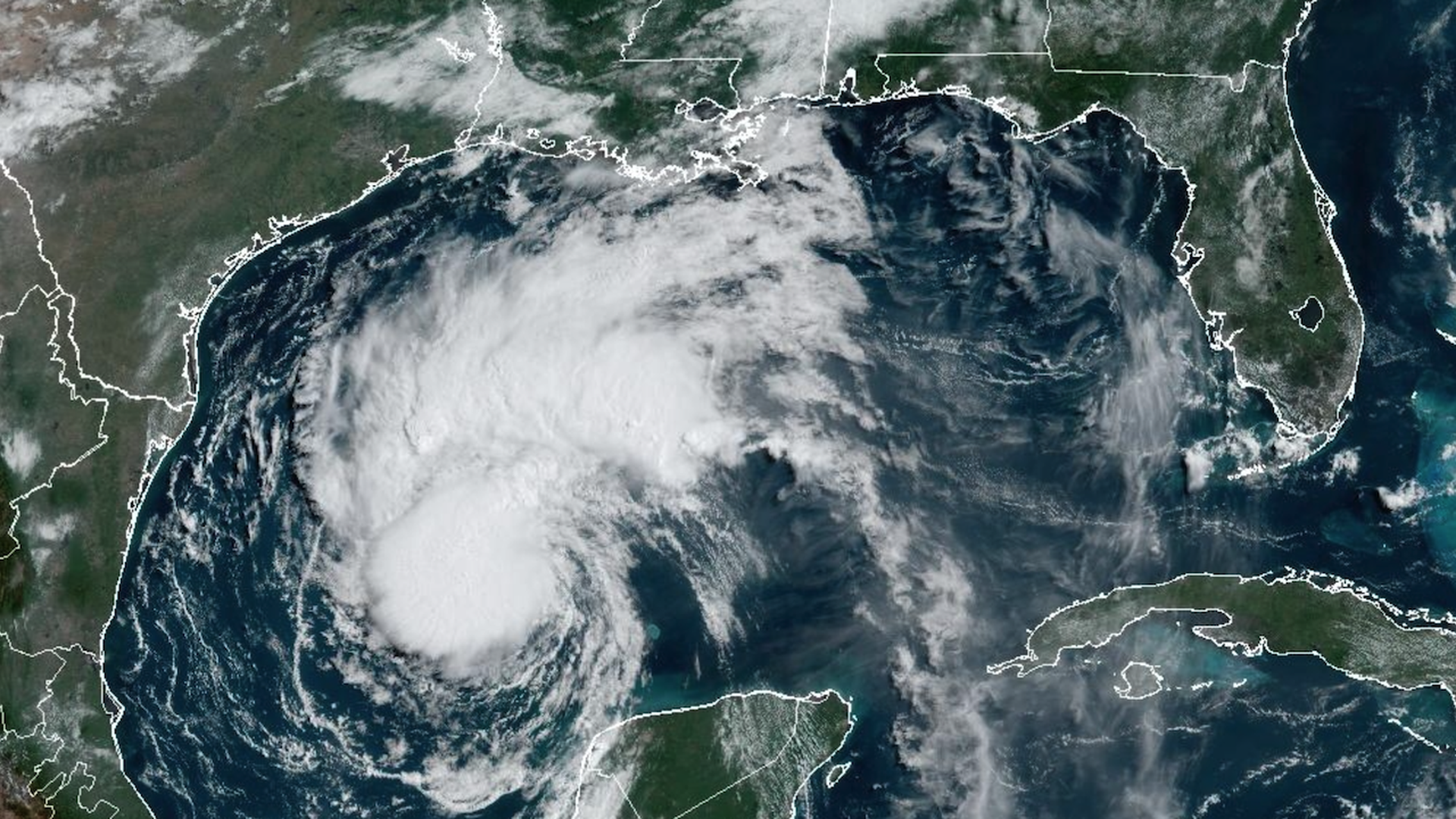
Satellite image of Tropical Storm Beryl seen on July 6. Photo: NOAA.
Forecasts for Tropical Storm Beryl put Texas in the crosshairs of a storm that has defied the odds for days.
Why it matters: While storm track forecasts for Tropical Storm Beryl have been extremely accurate, intensity projections have consistently been off target, showing too little intensification and missing a round of strengthening shortly before it came ashore near Tulum, Mexico, on Monday morning.
Threat level: Computer models have zeroed the forecast track in on the area between Corpus Cristi and Matagorda in Texas.
- This would mean any spots along and to the northeast of the storm center would see hurricane-force winds and storm surge flooding.
- Also, depending on the storm's structure as it tries to reorganize over the warm waters of the Gulf of Mexico, it is likely to re-intensify into a hurricane on Sunday.
- There is a possibility it does so rapidly, ratcheting up from a Category 1 to a Category 2 or 3 storm on Sunday into early Monday.
- "There is an increasing risk of damaging hurricane-force winds and
life-threatening storm surge along portions of the lower and middle
Texas coast late Sunday into Monday, where Hurricane and Storm Surge
Watches are in effect," the National Hurricane Center stated Saturday morning.
State of play: The storm ingested dry air into its circulation while over the Yucatan, and is struggling to reorganize Saturday. However, it is likely to persevere, based on the computer model consensus and recent observations, and make landfall in coastal Texas as a hurricane on Monday.
- The track of the center of Beryl, to near Matagorda, may be close enough to bring high winds and storm surge flooding to Houston and Galveston.
- A Hurricane Watch is in effect for the Texas coast from the mouth of the Rio Grande northward to San Luis Pass (just south of Galveston), while a Storm Surge Watch is now in effect for the same portions of the Texas coast.
- The maximum surge is forecast to be between 3 to 5 feet above normally dry ground if the storm hits at high tide.
- Heavy rains of 5 to 10 inches, with localized amounts of up to 15 inches, are likely across portions of eastern Texas beginning late Sunday. This is likely to cause flooding, with a moderate risk of flash flooding forecast for a large portion of southeastern Texas.
Between the lines: Meteorologists are closely watching for any signs of intensification on Saturday, with most computer models showing this is likely to wait to take place in earnest on Sunday.
- "The intensity guidance is in good agreement that significant strengthening should occur" at that time, the National Hurricane Center stated Saturday morning.
Context: The trend toward more frequent and larger bouts of rapid intensification, which Beryl exhibited before and could do so again on its approach to Texas, is one that studies link to human-caused global warming.
- Warmer seas, higher air temperatures and more moisture in the air helps fuel these storms.
The bottom line: Coastal Texas residents from Brownsville to the Houston area need to prepare for the potential arrival of tropical storm force winds and storm surge flooding as early as Sunday morning, while keeping in mind that this storm has rapidly intensified multiple times in its long lifetime.
Go deeper: Tracking the 2024 Hurricane Season
Editor's note: This story has been updated with the latest conditions.
