Inside an airborne quest to predict Lee, and other hurricanes

Add Axios as your preferred source to
see more of our stories on Google.
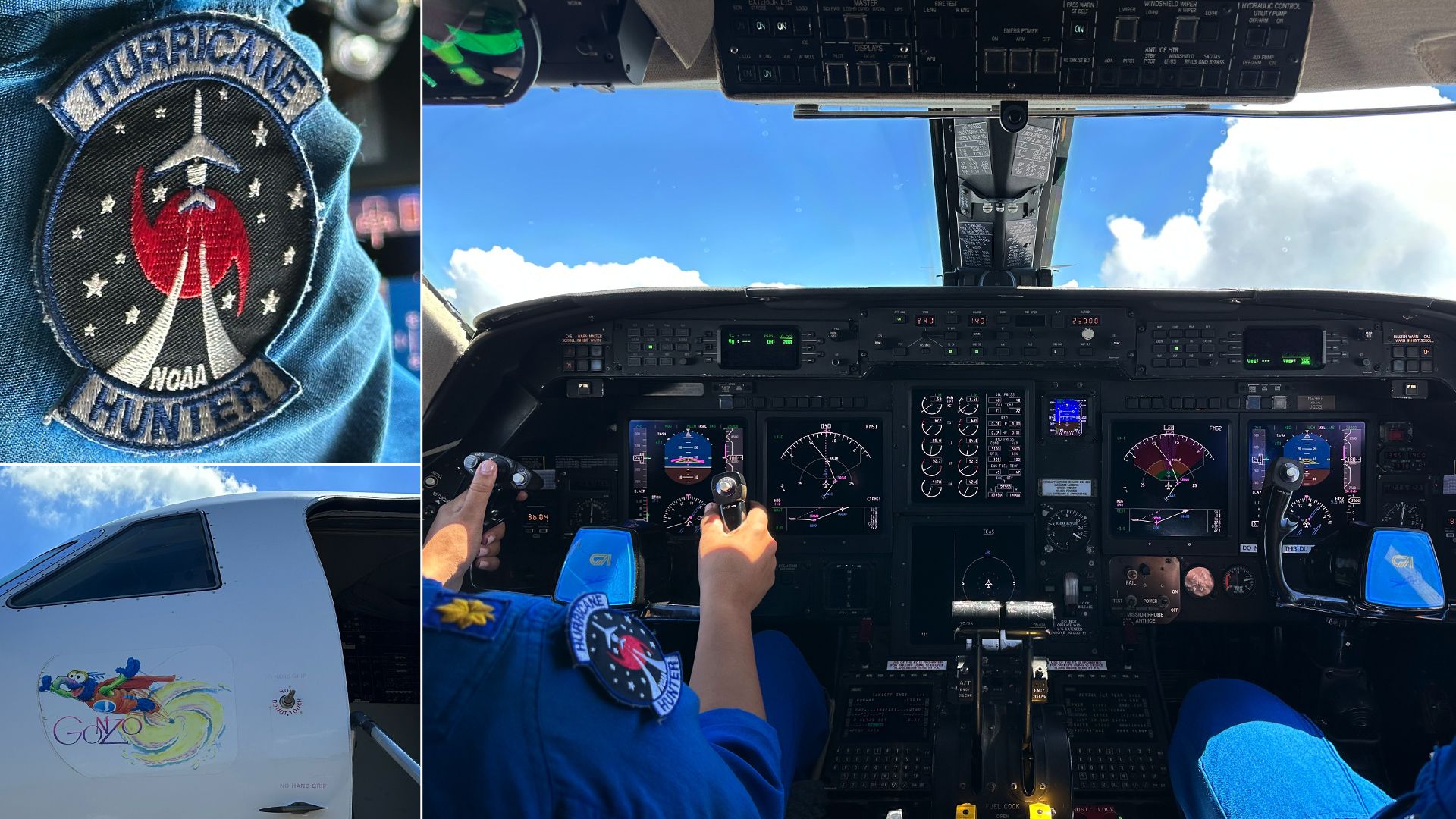
Photos of NOAA's Gulstream IV jet investigating Hurricane Lee on Monday. Photos: Andrew Freedman/Axios
An NOAA-operated Gulfstream IV jet flying 50 miles north of Hurricane Lee's eye has a key purpose: To help forecasters determine where the storm is headed.
Why it matters: One of the biggest questions with these storms is knowing where they are headed far in advance. For Lee, it is whether it will directly impact eastern New England and the Canadian Maritimes.
The big picture: During the past few decades, storm track forecasts have become far more accurate, with some gains made in intensity forecasting as well.
- The hope is that dropping instruments from the NOAA plane in and around the storm will yield data from areas where weather information is sparse and ultimately improve forecast accuracy.
- By sampling the atmosphere in and around the storm (sometimes flying 1,000 or more miles away from the hurricane itself), NOAA's Gulfstream IV (G-IV SP) can provide forecasters vital clues about the storm's path and coming changes in intensity.
Zoom in: At the moment, computer model runs keep vacillating on precisely where Hurricane Lee is headed.
- The one-of-a-kind Gulfstream is feeding the models more data as it flies not just around the storm but also far to its east and south, where NHC scientists think models would benefit from more data.
- "We're looking at the energy on the outside of the storm that is going in," said electronics technician Rocky Weinmann. In contrast, NOAA's low-flying WP-3D aircraft take more harrowing rides into the storm at lower altitudes.
- (If the Gulfstream is like taking a CT Scan of a storm and sampling the air around it, the WP-3Ds are more like giving a storm a colonoscopy.)
Flashback: A few hours before the flight, during a briefing at NOAA's aviation HQ in Lakeland, Florida, flight meteorologist Sofia de Solo described the approximately 8-hour, 3,400-nautical-mile mission near and around Lee.
- The plan, she said, would be to drop about 30 specialized instruments called dropsondes that record weather conditions from the plane's altitude of about 45,000 feet to the ocean surface.
- The probes are ejected through a tube in the back of the aircraft, which makes a whooshing sound similar to flushing the toilet on an airliner.
State of play: The data from these dropsondes as well as a specialized tail-mounted Doppler weather radar is fed into the weather models that help forecasters predict the path and intensity of the storm.
- In recent days, models have been showing a path uncomfortably close to Cape Cod and Maine as a large tropical storm or hurricane transitioning into a nor'easter-type tempest. High winds, heavy rains and potential coastal flooding are likely to affect areas far from the center.
Zoom out: NOAA scientists credit "Gonzo" as one reason for the gains in forecast accuracy in recent years.
- Whenever a hurricane threatens the U.S., NOAA tasks this aircraft to fly nearly 24/7, with crews taking off at about 1 p.m. and again at 1 a.m. the next morning.
- "I suspect this is going to be the big flight that determines where this hurricane is going to go," de Solo said, who is training to be a flight director on the G-IV SP. From turbulence to icing, she also goes over the hazards the plane might encounter.
- The high-altitude aircraft, which is a business jet stripped of all of the comforts (the tiny bathroom is approximately 40°F), is outfitted for science.
- Computer and monitor racks, along with sliding keyboards line the interior, with scientists at each station scanning the skies for how the storm is behaving, and to check if the sondes are sending valid data to NHC.
The intrigue: Data from NOAA's research fleet has helped extend track forecasts for Lee and other hurricanes from five days to seven, in conjunction with the operational launch of a new computer model known as the HAFS.
- Flight director Paul Flaherty said a lot of attention is now going toward using NOAA aircraft to help predict the rapid intensification of such storms.
- Climate change-related increases in air and sea surface temperatures are already leading to stronger, wetter storms that jump categories in short time periods, studies have shown.
- Last week, Lee went from a Category 1 to a Category 5 storm in a day. If a storm were to do that when approaching the coast, it could lead to a devastating loss of life if not properly anticipated.
- Remarkably, the Hurricane Center was able to predict Lee's rapid intensification more than a day in advance, thanks to scientific progress made over the course of years by crews such as the one in the G-IV SP.
Of note: The NOAA Corps is a uniformed service, operating ships and a variety of aircraft, but it gets little attention.
- Co-pilot Lt. Cmdr. Danielle Varwig said she served in the Air Force for years, then found out about the NOAA Corps through a friend.
- "I knew a guy who knew a guy," she said, chuckling from her perch in the modern flight deck. "We're tiny but mighty," she said of the Corps.
The bottom line: The crew's work helped refine the projections for Lee starting early Tuesday.
- The only problem? They still show a potential threat for far eastern New England, with a landfalling, large storm in the Canadian Maritimes over the weekend.
- That means more flights, and long days and nights, to come.
