Updated Aug 11, 2023 - Energy & Climate
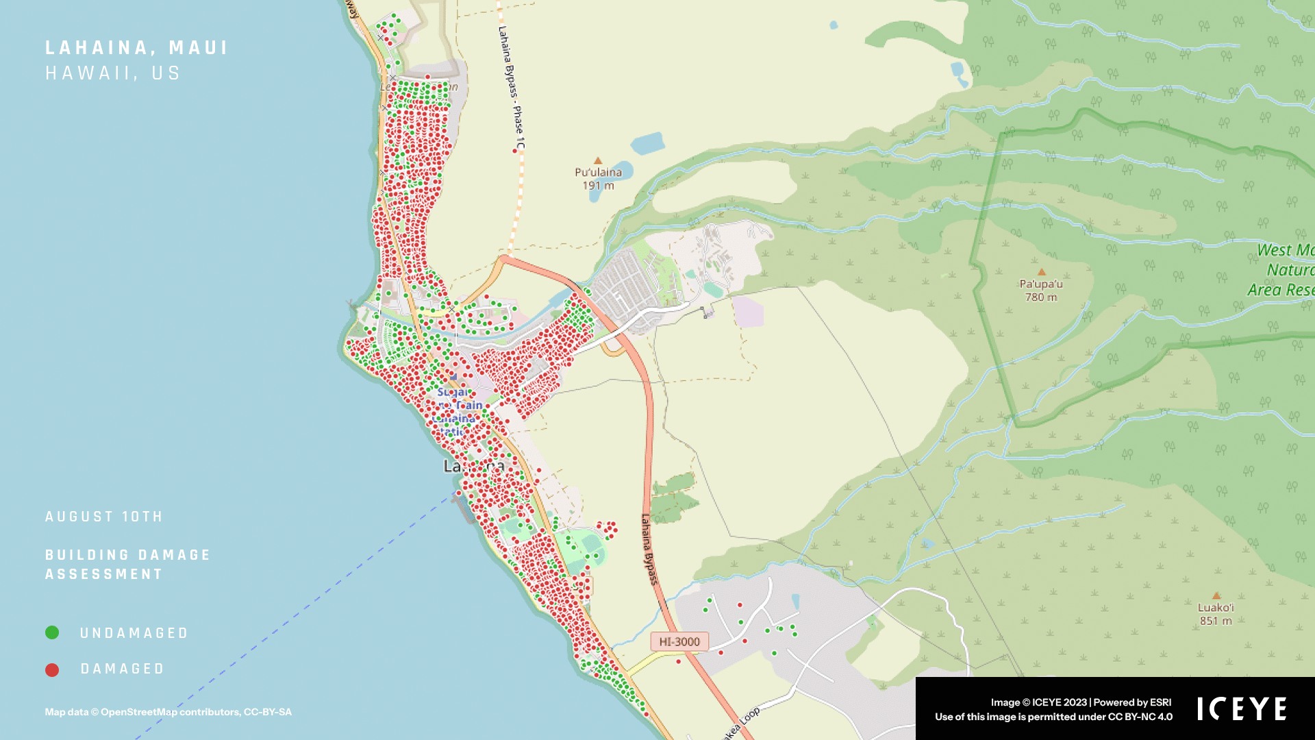
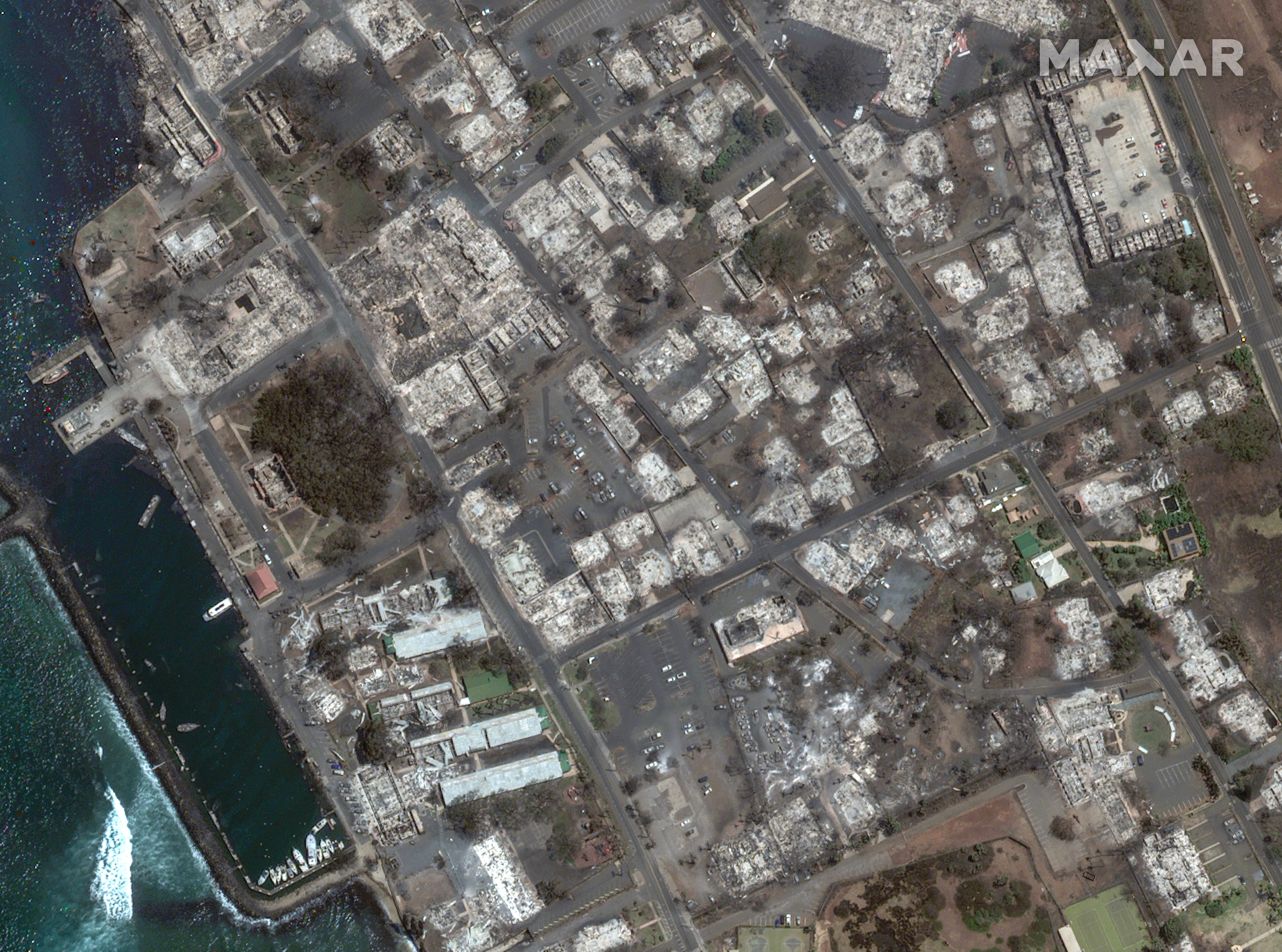
Before and after: Satellite images show Hawai'i wildfire devastation

Add Axios as your preferred source to
see more of our stories on Google.
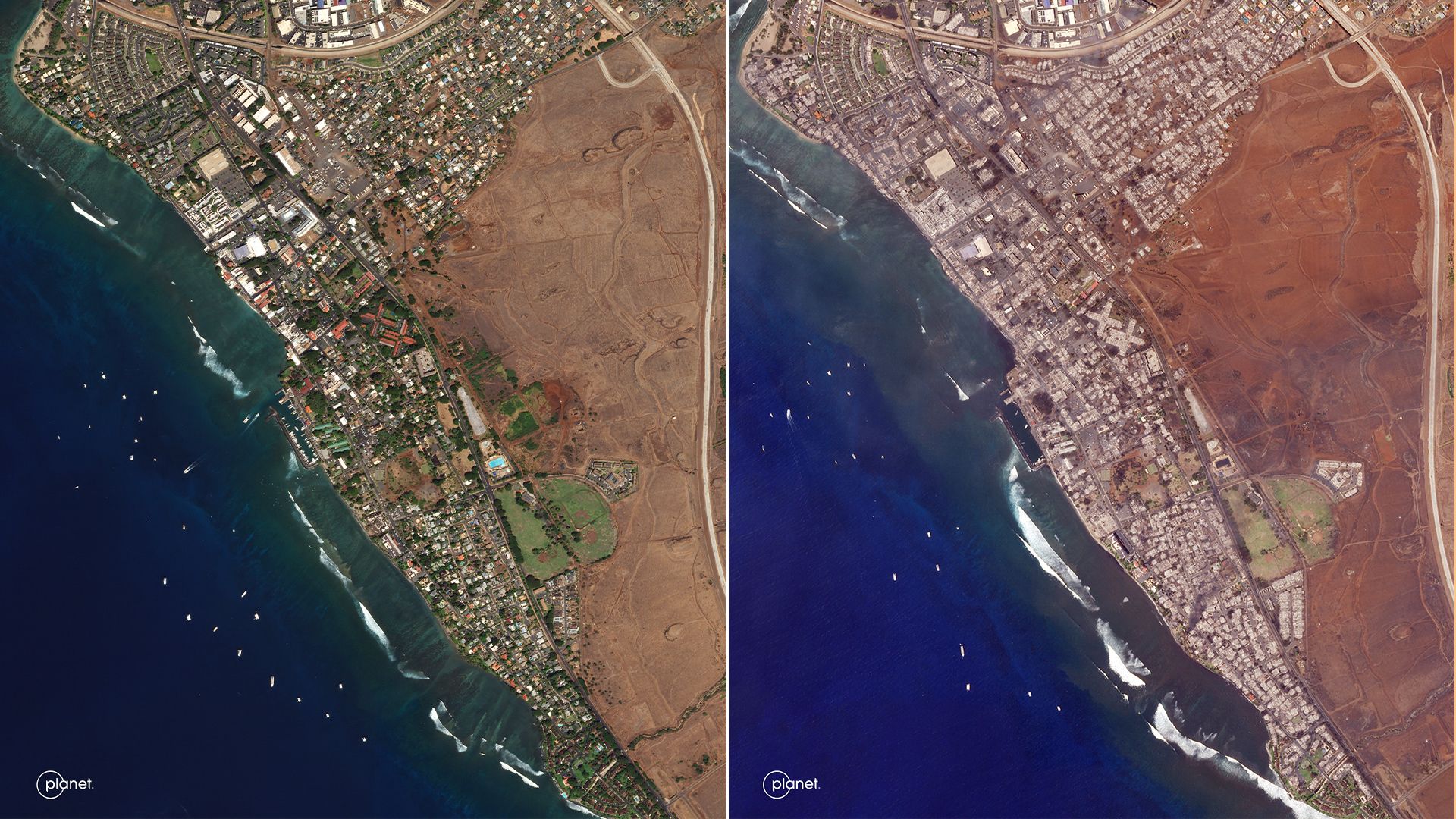
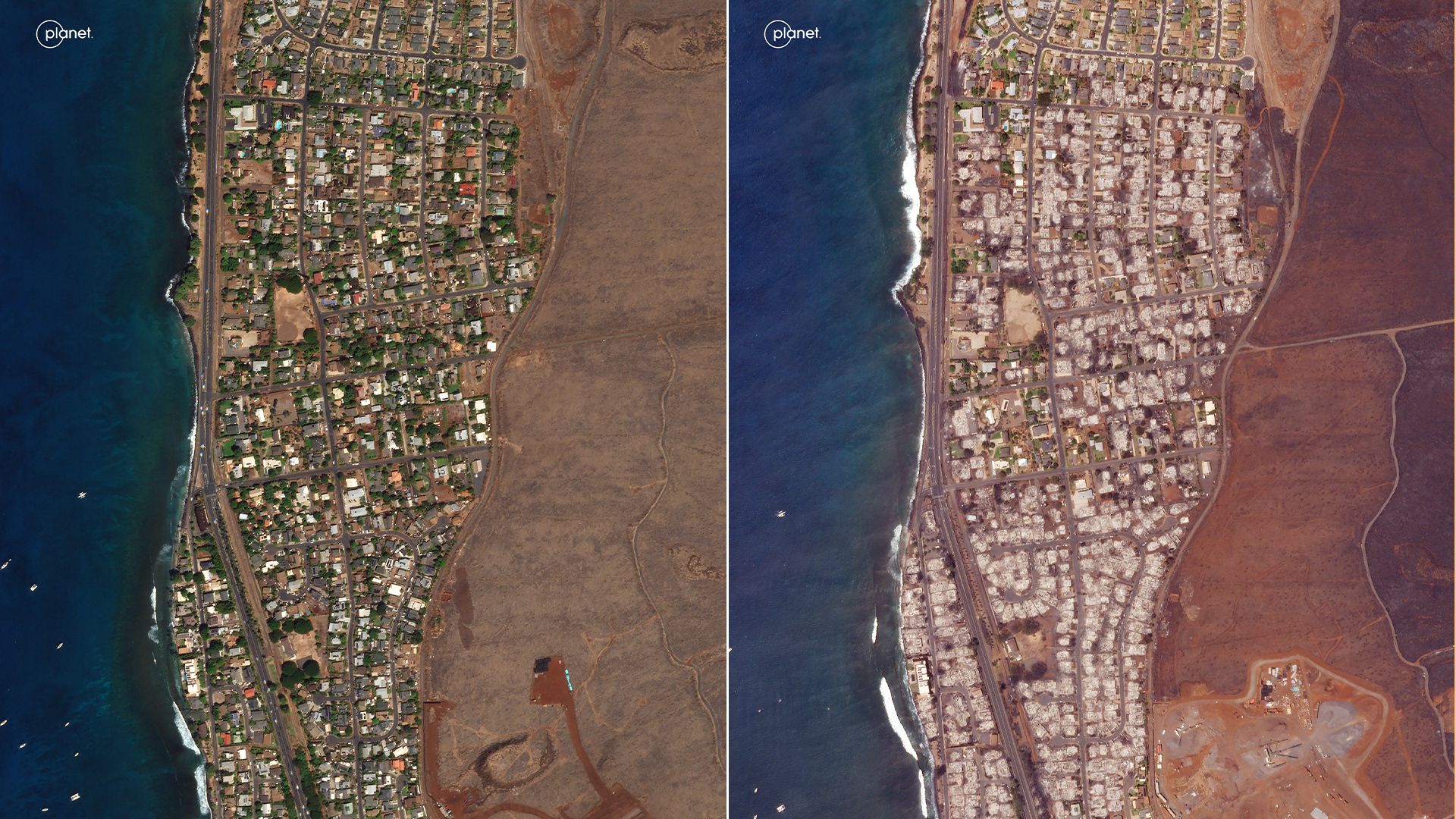
The town of Lahaina on Maui in Sept. 2022 and Aug. 2023. Photo: Planet Labs PBC
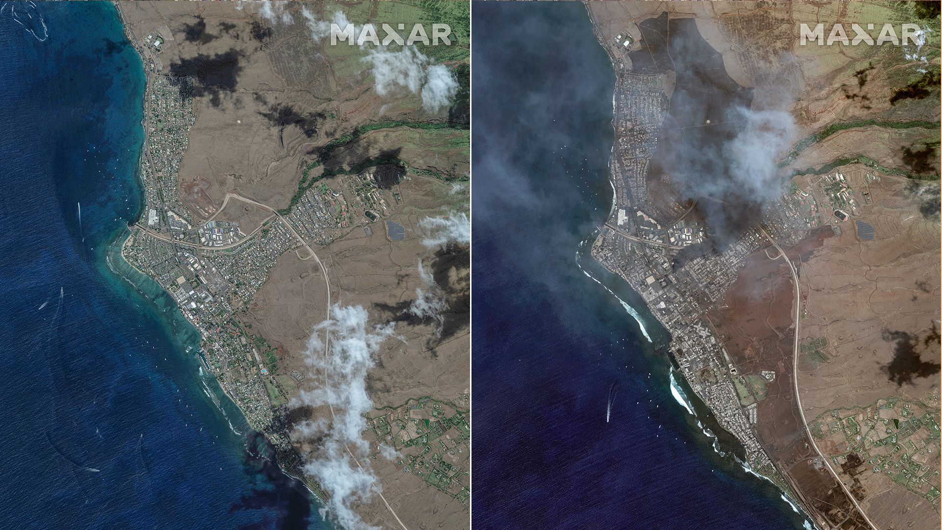
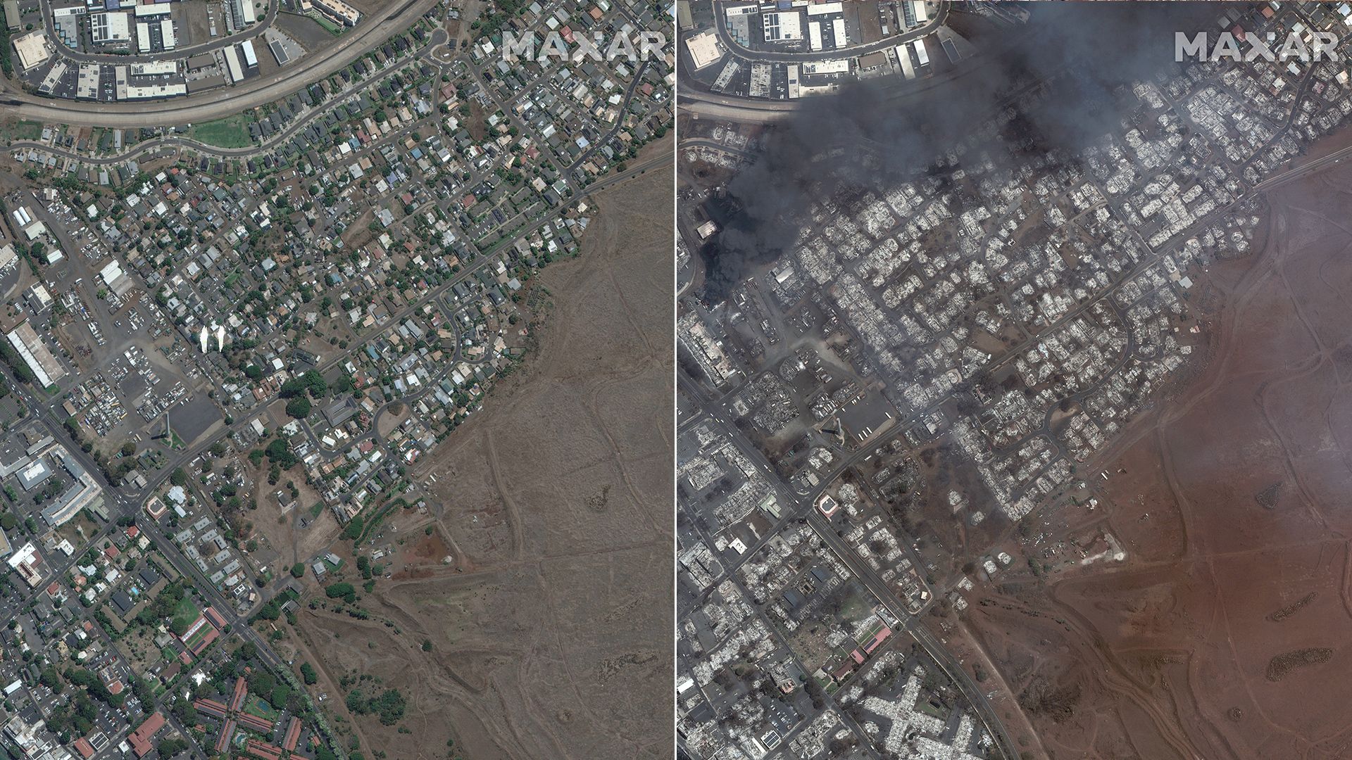
New satellite images capture the widespread destruction left in the wake of the deadly wildfires that ravaged Hawai'i this week.
The big picture: The wildfires have killed more than 90 people, wounded dozens and displaced thousands more, according to Maui County officials.
- The flames destroyed at least 1,700 buildings in Maui's historic town of Lahaina.
- Researchers believe climate change was likely a contributing factor to the wildfires.
Editor's note: This story has been updated with new images and details.
