Flood-ravaged Pacific Northwest hit by more record rainfall

Add Axios as your preferred source to
see more of our stories on Google.
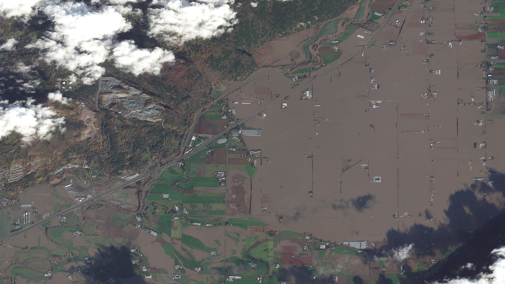
Satellite images taken last Friday of flooding in the Sumas Prairie to the east of Abbotsford in British Columbia, Canada, near the border with the U.S. Photo: Maxar Technologies
Rainfall records tumbled in Washington state on Thanksgiving night as the first of two atmospheric river events forecast for this week began threatening the Pacific Northwest, per the National Weather Service.
Why it matters: The region is still recovering from last week's atmospheric river that brought record rainfall, flooding and mudslides, with Washington and Canada's British Columbia particularly badly hit.
- The new storm was pummeling areas hit by last week's storm — with Bellingham in Whatcom County, Washington, setting a fresh rainfall record, according to the NWS. County officials assessing damage from last week's storm estimate it could have cost as much as $50 million, per AP.
- Across the border in Canada, British Columbia officials warned there could be flooding in areas where flood recovery efforts from last week's storm were continuing.
Threat level: A "new Atmospheric River containing rich subtropical Pacific moisture" taking aim at the Pacific Northwest was expected to generate moderate-to-heavy rainfall overnight and again on Saturday, according to the NWS.
- "A prolonged stretch of moderate-to-heavy rainfall combined with rapid snow melt could lead to excess runoff," the agency said.
- "This may result in quickly rising creeks and streams, making localized flooding a possibility in parts of western Washington.
"Locally heavy rainfall is also possible in far northwestern Oregon, but the heaviest rainfall totals (1 to 3 inches) are most likely to occur in the Olympics and northern Cascades. "— NWS
In British Columbia, a flood watch was issued for parts of the south coast.
- The Fraser Valley was expecting up to 2 more inches of rain to fall by Friday morning, CBC News reports.
What's next: There'll be a brief respite Friday, but more heavy rain is expected to arrive late Saturday, according to the weather service.
- "This next Atmospheric River event is expected to produce an additional 1 to 3 inches of rain across the Olympics and northern Cascades beginning Saturday afternoon, with locally higher amounts possible," the NWS said.
- "Given the recent periods of heavy rainfall, flooding and excessive runoff will undoubtedly be a concern once again."
Meanwhile, residents in Southern California are facing an intense Santa Ana wind event through Friday. High wind warnings have been posted along the mountain ranges and coastal regions.
- This combined with "dangerously low humidity levels" has triggered red flag and critical risk wildfire warnings to be issued by the Storm Prediction Center for much of the Southern California mountains and adjacent foothills.
Editor's note: This article has been updated with new details throughout.
