
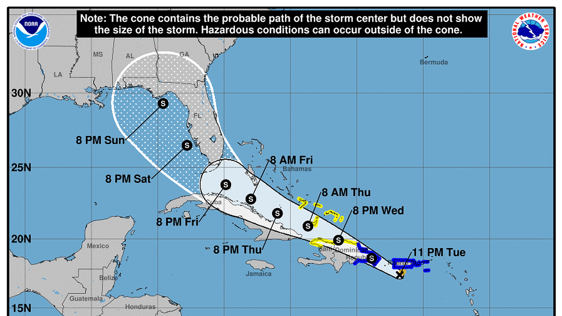
A National Hurricane Center graphic of Tropical Storm Fred's forecast path. Photo: NHC
Tropical Storm Fred formed south of Puerto Rico late Tuesday — and Florida is in its path, according to the five-day forecast.
State of play: Fred is the sixth named storm of this Atlantic hurricane season. The storm system could intensify over the eastern Gulf this weekend, possibly to a hurricane, though the National Hurricane Center said it's too early to tell for sure.
What's happening: Tropical storm watches and warnings were in effect across the Caribbean, including in Puerto Rico, the U.S. Virgin Islands and parts of the Dominican Republic.
- Fred was packing maximum sustained winds of 40 mph some 160 miles east-southeast of Santo Domingo in the Dominican Republic, the NHC said in an advisory at 2am Wednesday.
Threat level: The storm was expected to bring heavy rainfall across parts of Florida, as well as several Caribbean islands.
- There's the potential for flash flooding and mudslides across the U.S. Virgin Islands, Puerto Rico, and the Dominican Republic, the NHC warned.
What to watch: Fred was moving toward the west overnight and was expected to turn back toward the west-northwest later Wednesday, according to the agency.
- "On the forecast track, the center of Fred is expected to be near or over Hispaniola later today, and move near the Turks and Caicos Islands and the southeastern Bahamas on Thursday," the agency said.
- Most of Florida remains in the storm system's five-day forecast cone.
- "There is a risk of wind and rainfall impacts in Florida beginning Friday in the Keys and spreading northward through portions of the Peninsula and the Panhandle this weekend," the NHC said.
Go deeper: NOAA's updated hurricane outlook calls for even more storms in 2021
Editor's note: This article has been updated with further forecasts from the NHC and National Weather Service.