
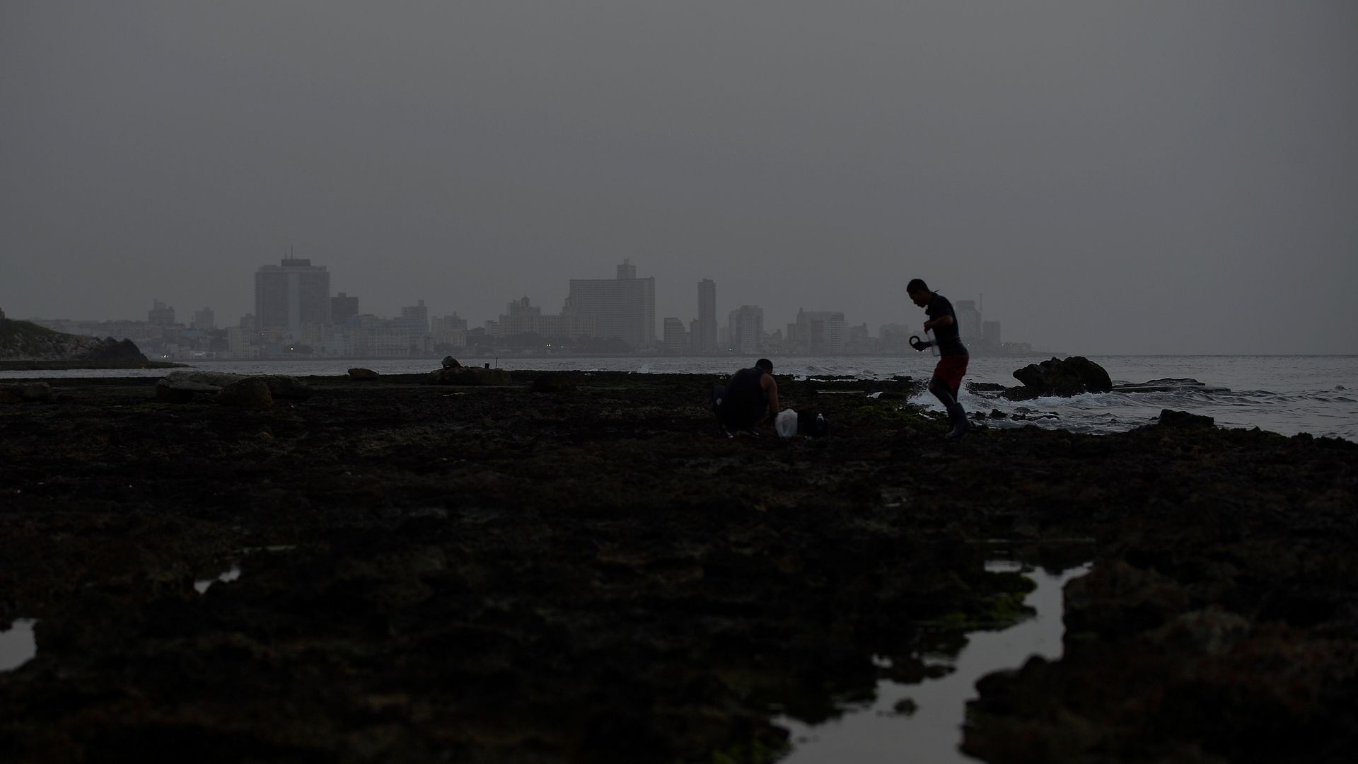
A vast cloud of Sahara dust blanketing Havana, Cuba, as people fish on Wednesday. Photo: Yamil Lage/AFP via Getty Images
A giant, dense plume of Saharan dust is shrouding much of the Caribbean as it heads westward toward Central America and the southern U.S. this week.
Why it matters: The dust cloud blanketing Puerto Rico, Jamaica, Hispaniola, and eastern Cuba on Tuesday prompted authorities to issue health warnings across the region as air quality plummeted to unhealthy levels, per Reuters.
- Pablo Méndez Lázaro, from the University of Puerto Rico's School of Public Health, told AP, "This is the most significant event in the past 50 years. Conditions are dangerous in many Caribbean islands."
- Aallergist and American College of Allergy, Asthma and Immunology president J. Allen Meadows said in a statement on Tuesday that dust storms and air pollution "can make asthma symptoms worse and make breathing more difficult."
The big picture: Per the NOAA, the Saharan Air Layer (SAL) is a mass of "very dry, dusty air" that forms over the Sahara Desert in northern Africa.
- SAL outbreaks usually occupy a two- to 2.5-mile-thick layer of the atmosphere with the base starting about one mile above the surface. It reduced visibility in some areas to five miles when it reached the eastern Caribbean over the weekend, per a NOAA statement.
- "The main impacts of the Saharan dust are a whitening of the sky during daylight hours, redder sunsets, and decreased air quality," NOAA said in a statement on Tuesday.
What to expect The Saharan dust layer is due to hit the Florida Peninsula and Gulf Coast "in the coming days," according to NOAA's Storm Prediction Center.
- In a statement posted to Twitter, Sonoma Tech meteorologist Jeff Beamish pointed to modeling showing SAL impacts for Texas and Louisiana by Thursday, "potentially spreading" into the central and eastern US by Saturday.