Google will report trends on where people are traveling amid outbreak

Add Axios as your preferred source to
see more of our stories on Google.
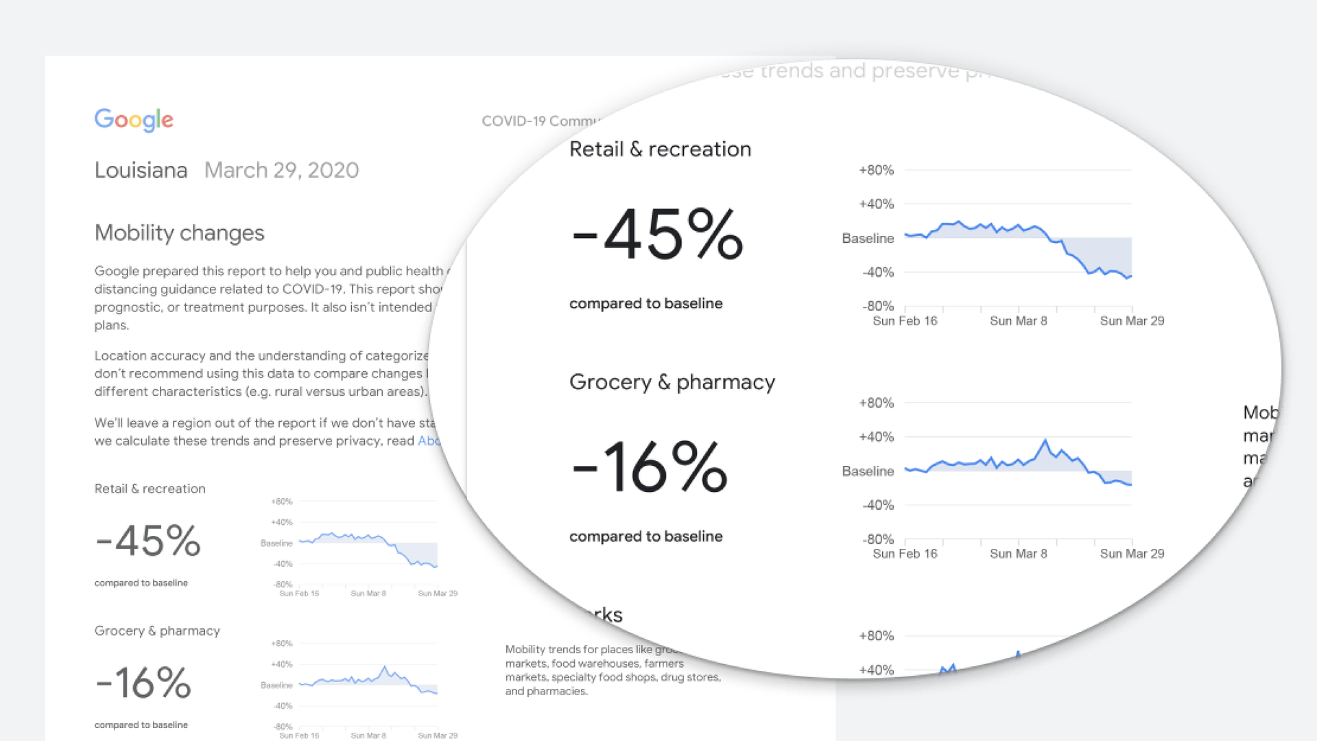
Photo: Google
Google late Thursday announced a program to give leaders around the world more data during the coronavirus crisis on where people are traveling (and where they aren't) based on aggregate, anonymous data collected by Google Maps.
Why it matters: Health experts have been asking for more location data to make decisions. This move aims to meet some of those needs without sharing sensitive individual data.
Details: The COVID-19 Community Mobility Reports, as the new documents are known, will show recent trends (over the past 48 to 72 hours) of the percentage increase or decrease in visits to places like retail stores, recreation spots, groceries and pharmacies, parks, workplaces and residential locations.
- Google will offer the reports initially for 131 countries, offering data at the regional and local level (in the U.S. it will provide data for states and counties).
- Google is sharing the reports with governments and releasing it publicly, but it is not sharing the underlying data, which comes from Google Maps users who have opted in to share data. (Google has used such data in the past to show how busy various restaurants and bars tend to be at a particular time.)
What the reports do: The new information could help leaders get a sense for how well shelter-in-place orders are working and whether different measures might be needed to reduce traffic to a particular kind of location or, say, whether more or less public transit is needed at a given time.
What they don't do: These reports won't allow authorities to track individuals, trace contacts or glean information on who is infected. Google is also only showing the percentage change for each category in the report, not the absolute number.
