El Niño tries to return, could make 2018 an even warmer year

Add Axios as your preferred source to
see more of our stories on Google.
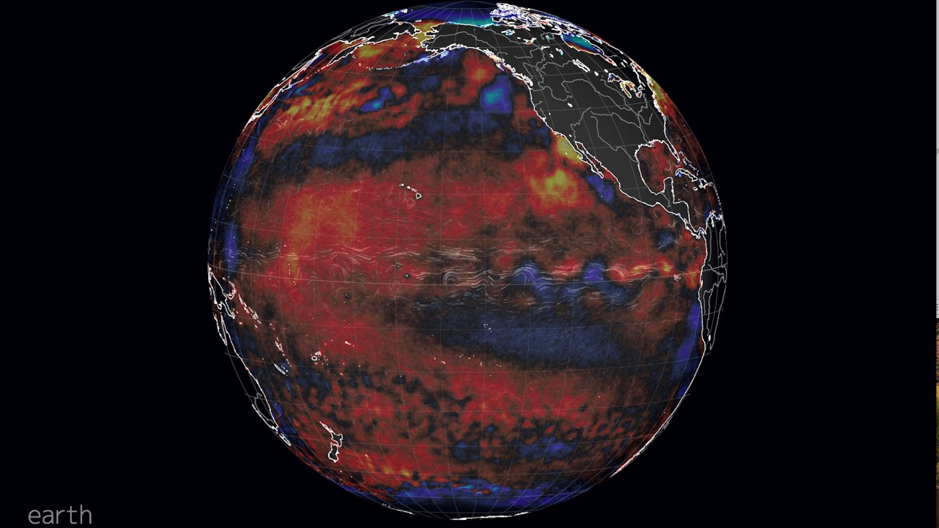
Pacific sea surface temperature anomalies, showing increasing temperatures in the eastern equatorial tropical Pacific. Image: Earth.nullschool.net.
In the tropical waters of the equatorial Pacific Ocean, conditions appear to be primed for the development of an El Niño event, with potentially far-reaching consequences.
Why it matters: If an El Niño does develop, even a weak one, it could influence weather patterns around the world — from increasing the odds of above-average winter precipitation in California to favoring drought conditions in Indonesia. It could also provide a natural boost to global average surface temperatures, nudging 2018 and possibly 2019 further up the ladder of the hottest years on record.
The big picture: El Niño events are characterized by above-average sea surface temperatures in the equatorial tropical Pacific Ocean. These elevated ocean temperatures effect the location and intensity of tropical showers and thunderstorms across the Pacific.
- In order to get a fully-fledged El Niño event started, though, a series of events in the atmosphere and the ocean has to take place.
- Wind patterns across the Pacific, for example, need to help bring the elevated ocean heat lurking in the deep up to the surface of the sea.
- "Westerly wind bursts" — which blow in the opposite direction from normal trade winds north of the equator — can help bring above-average ocean temperatures.
The details: Right now, the Climate Prediction Center is forecasting a 70% likelihood of El Niño conditions developing by fall and winter, which is when such events typically peak.
Michelle L’Heureux, a meteorologist at NOAA's Climate Prediction Center in Maryland, tells Axios that the upcoming event — which has about a 70% likelihood of occurring by the upcoming winter — is unlikely to be as potent as the last El Niño was in 2015 and 2016. But that was one of the most intense events on record.
- "If something forms it’s likely to be on the weaker side of things," she told Axios. "In general, weaker events tend to be a bit tougher to predict than stronger events.”
Ben Kirtman, professor of atmospheric sciences at University of Miami's Rosenstiel School of Marine and Atmospheric Science, told Axios that he's confident an El Niño is developing: “The evidence is truly mounting."
The back story: L'Heureux is haunted by what happened in 2014, when sea surface temperatures increased in the tropical Pacific Ocean, much as they are now, and heat built up. Yet that year, the wind patterns didn't change, and no El Niño event occurred. Forecasters who had projected that one would likely form were burned.
Kirtman has researched what happened that year, and says there is an increased appreciation for the role that the atmosphere plays in kicking off an El Niño event.
- “We have actually done some after the fact studies to show that with some of our modeling tools we may not have fully resolved the probability of that event not materializing in that case,” he said.
L'Heureux said climate forecasting is a tricky business, and always will be.
"There is intrinsic uncertainty when you’re making climate predictions. We’ll always be grappling a little bit with that. We’re never going to get to the point where we can say with 100 percent probability that this is definitely going to happen.”— Michele L'Heureux, NOAA meteorologist
Our thought bubble: One of the main reasons why an El Niño event is relevant right now is that they tend to increase the amount of heat released from the oceans into the atmosphere, thereby providing a natural boost to human-caused global warming. The El Niño year of 2016 was the warmest year on record, for example.
“It wouldn’t surprise me at all if we see larger global mean temps just because of this natural signal," Kirtman said. He noted that ocean temperatures have risen worldwide in the past few decades, due largely to human-caused global warming.
