Dakota County's street grid is the key that unlocks the suburbs

Add Axios as your preferred source to
see more of our stories on Google.
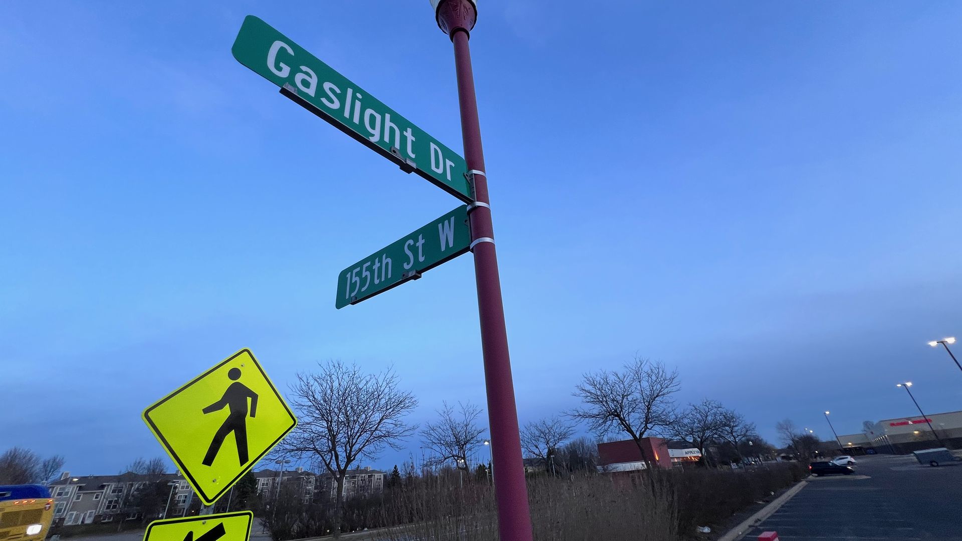
One of Kyle's favorite street names in Apple Valley, Gaslight Drive. Photo: Kyle Stokes/Axios
Dakota County Commissioner Joe Atkins can find almost any house in Inver Grove Heights without a phone or GPS, which once made his daughter think he was "some kind of savant."
- He's not — he just knows the system that much of Dakota County has used to name streets since the 1960s.
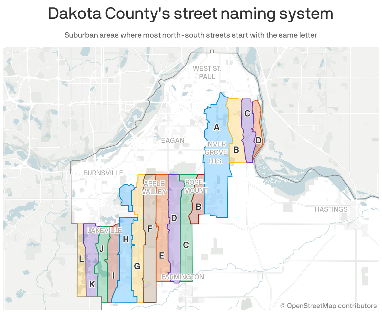
The big picture: Once you learn the alphanumerical criss-cross, you can navigate huge swaths of the south metro — and see how the suburbs grew.
 Open embedded content from datawrapper.dwcdn.net
How it works: In mile-wide strips ribboned across nine cities, every north-south street starts with the same county-assigned letter.
- It's why, for example, most street names on either side of Cedar Avenue start with a G.
😵💫 Kyle's thought bubble: Growing up in this grid felt like living in a dictionary.
- I have always wondered why every street in my neighborhood was named after obscure "J" words like "Jaffna", "Jarosite" … and what exactly is "Jacquara"?
- It wasn't just a curiosity, it was a problem: These street names blurred together, turning neighborhoods — with one McMansion after another, and few distinguishing landmarks — into mazes.
Yes, but: There is a method to the madness: The farther east or west you travel, street names progress alphabetically.
- So Gaslight Drive is west of Garrett Drive, but east of Gladstone Path.
Plus: A numerical grid of east-west streets — based on their distance from the State Capitol — is also used to number houses.
- That's how Atkins can find his way to any address.
Between the lines: Before GPS and cell phones, the alphabetical rules helped first responders navigate through gnarled subdivision streets, Atkins tells Axios.
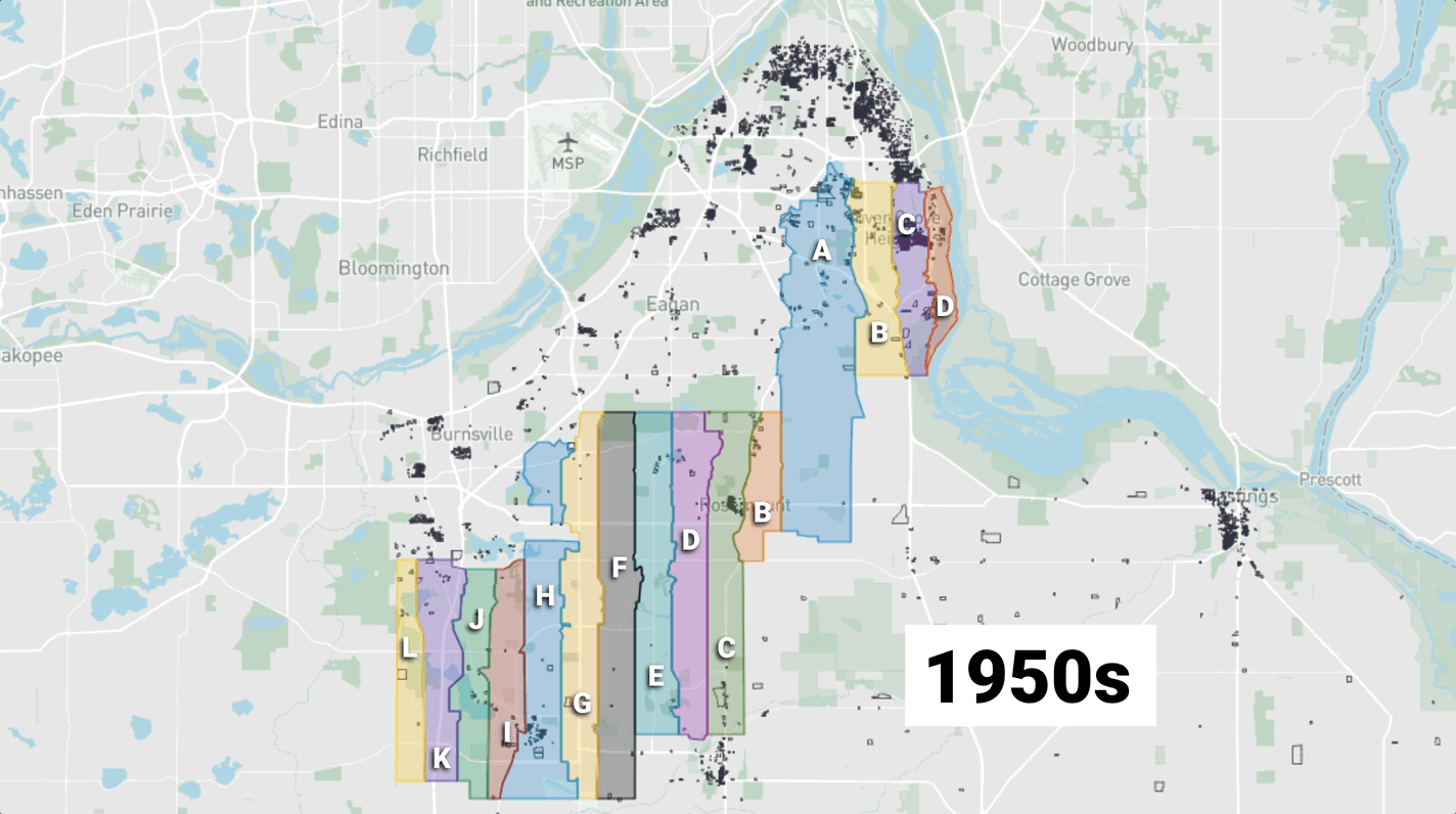
The intrigue: Street names help trace the county's development.
- Nearly 20% of the parcels built since 2020 are on "A" streets, reflecting Rosemount's swell in housing construction.
- In the 2010s, "E" names were the most popular, reflecting Lakeville's boom.
- The Inver Grove Heights B's were the story of the 2000s — and before that, it was the F's and G's of Apple Valley in the '90s.
The other side: The county allows cities to opt out of the grid — and when the system was adopted, "cities like Eagan and Burnsville were already built out or had established addressing patterns," Dakota County GIS specialist Todd Lusk tells Axios.
- So Burnsville's system borrows north-south street names from Minneapolis' grid. (You know, Aldrich, Bryant, Colfax…)
- Older cities like West St. Paul, South St. Paul, and Hastings also kept their own grids — and downtown Farmington does its own thing, too.
- Eagan is a wild child, with no discernible system. (It has one Monopoly-themed corner where the Boardwalk, Baltic Avenue, and Pacific Avenue all meet.)
Zoom out: Washington County also adopted a similar system in 1967, evident in the G's, H's, I's and a few J streets criss-crossing Oakdale and Cottage Grove.
- But Woodbury's lack of participation punches a big hole in the grid's continuity.
The bottom line: Street names are the key to decoding the south metro's suburban sprawl.
- "It's like this revelation," Atkins jokes. "Like in a movie scene … 'A Beautiful Mind,' where, you know, everything is spinning around — and all of a sudden it all seems to make sense."