Feb 13, 2025 - News
Grand Rounds' missing link

Add Axios as your preferred source to
see more of our stories on Google.
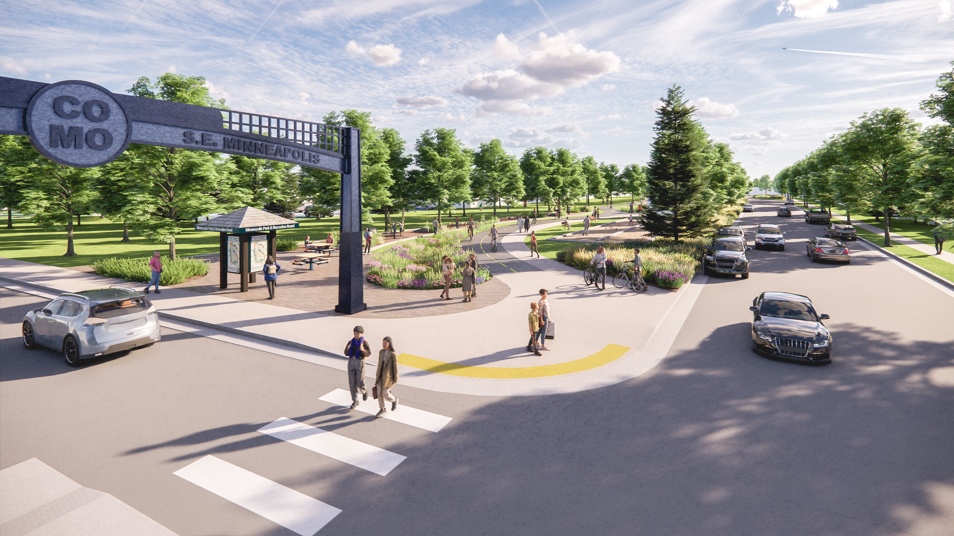
The missing link to the Minneapolis Grand Rounds trail system would be solved under an ambitious design plan released by the Minneapolis Park & Recreation Board.
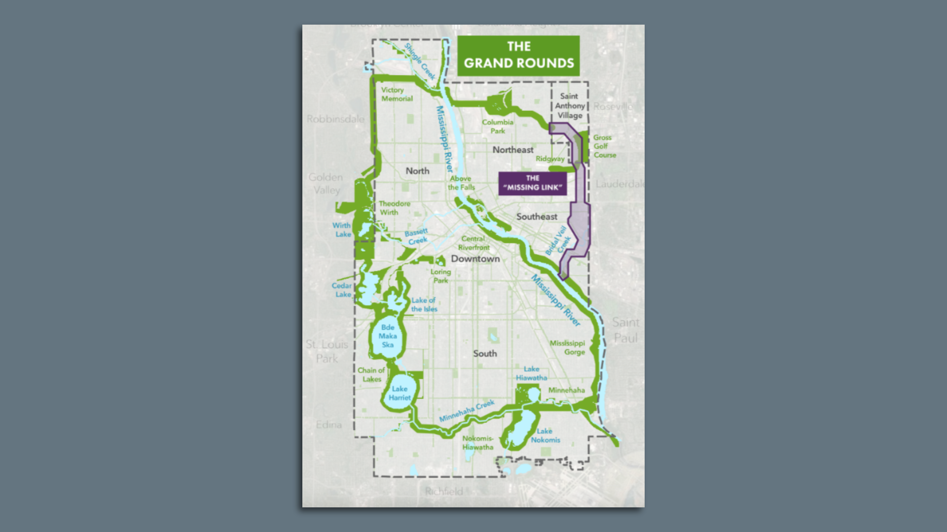
State of play: The 51-mile system that hugs the Mississippi River, Minnehaha Creek and Chain of Lakes is interrupted by a 140-year-old gap in Northeast and Southeast Minneapolis.
Details: If approved by Park Board commissioners, the new design would create trails and parkland in Saint Anthony Village, Mid-City Industrial, Como and Prospect Park in increments over the next decade, according to a press release.
- A future study will determine the feasibility of building a bridge over the wide rail yards of Southeast Minneapolis
Go deeper: Explore an interactive map of the proposed design and see where the trail would weave.