Winter is getting warmer in the Twin Cities

Add Axios as your preferred source to
see more of our stories on Google.
After a cold snap earlier this week, warm air is moving back into the Twin Cities and the metro could set records mid-next week.
What's happening: Models vary, but some are predicting highs in the 60s, according to meteorologist Paul Douglas. Others are predicting highs to only reach the 40s.
- But either way, it will be warmer than the low-30s temperatures that are average for this time of year.
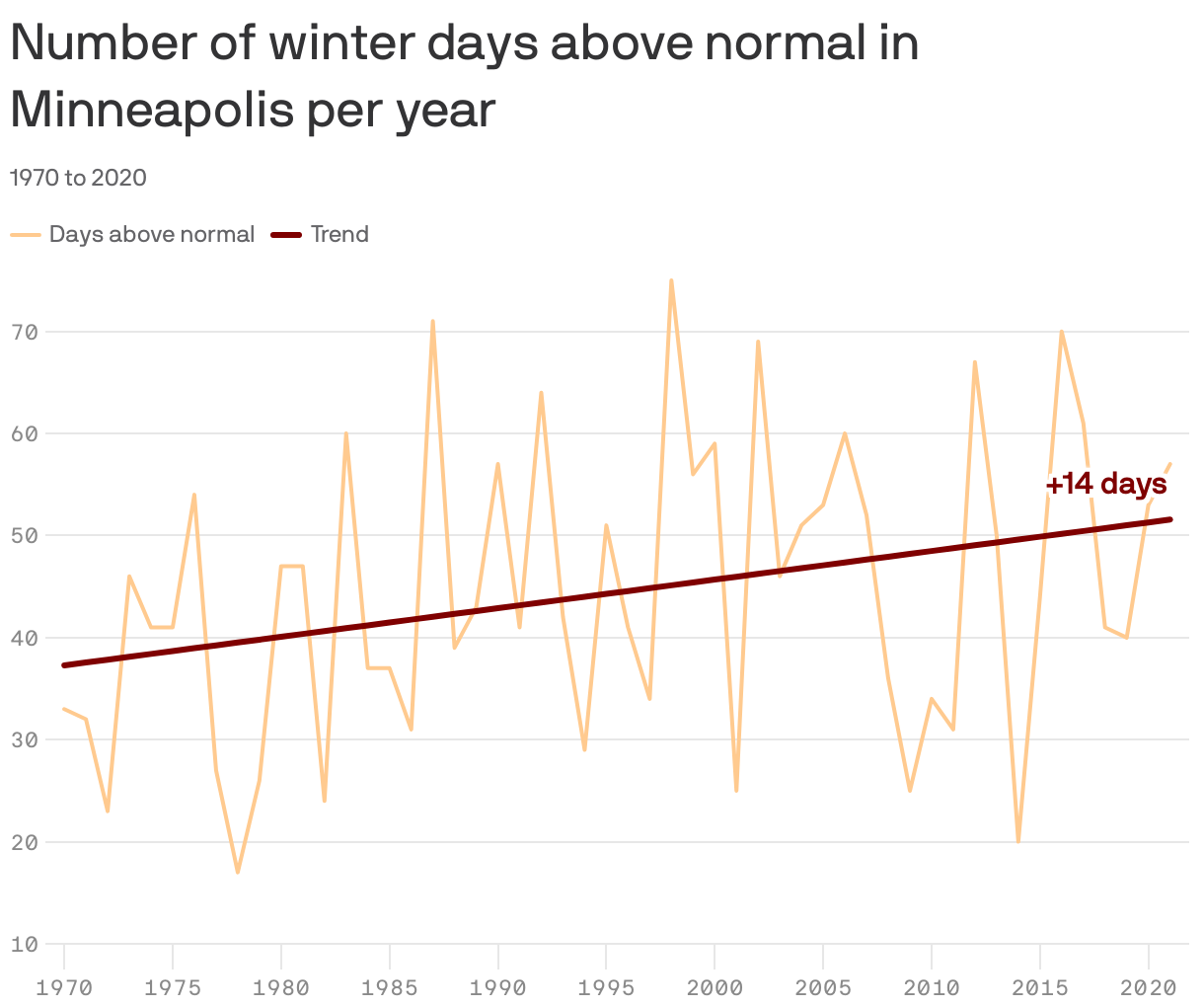
Why it matters: Winter is getting warmer in the Twin Cities. In recent years, the metro has been averaging 51 days with above-normal temps in winter, up from about 37 days back in 1970, according to nonprofit news organization Climate Central.
- Winter is the fastest-warming season due to climate change, per Climate Central.
State of play: Many metro lakes finally froze over this week, but the ice coverage might not stay long.
- National Weather Service meteorologist Nick Carletta said that with temps warming again, "it might still be a while before the ice is thick enough for anyone to walk or drive on."
- The median ice-in dates for most metro lakes is early December, according to the Minnesota Department of Natural Resources, which tracks ice-in on its website.
Be smart: Just because there's ice doesn't mean it's safe. The DNR has tips on when it's safe enough to walk or drive on ice.
Editor's note: This story has been updated to clarify that winter is the fastest-warming season. It previously said it was the fastest-warming month.