How close will the Twin Cities get to the 1936 heat wave?

Add Axios as your preferred source to
see more of our stories on Google.
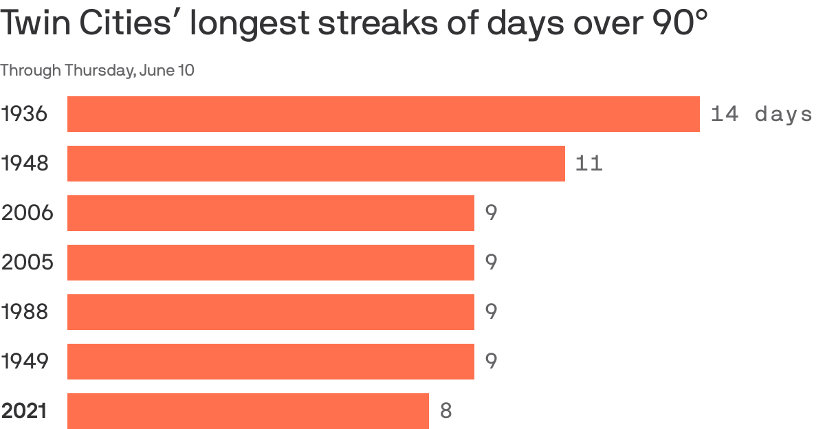
Five days into a stretch of 90-degree heat, the Twin Cities are poised to make it into the top three longest heat waves in the area's history if the forecast holds true.
Driving the news: Highs have hit 90 or above every day since last Thursday, and forecasters expect temps in the 90s through Friday. That would put the area at nine straight days of 90-degree weather.
- That's still short of the record in 1936, when Minneapolis-St. Paul International Airport recorded 14 consecutive days in the 90s.
Yes, but: The forecast calls for upper 80s Saturday through next Wednesday. A couple more degrees warmer and that's flirting with 1936.
Flashback: That heat wave 85 years ago was really something. It hit 108 on July 14, 1936, and 51 people died from the heat on that day alone, according to a Pioneer Press story.
- "It was so oppressive that notorious criminal Alvin Karpis pleaded guilty to kidnapping St. Paul brewery president William Hamm Jr., preferring to face a possible life sentence instead of enduring a trial in the stifling federal courthouse (now Landmark Center)," the paper reported.
What's ahead: Meteorologist Paul Douglas, who warned of a hot and dry summer weeks ago, is doubling down, saying the climate models "predict excessive heat into August."
The big picture: "One of the most robust conclusions of climate studies is that as average temperatures increase, heat waves are becoming more likely and more severe not just in the Upper Midwest, but worldwide," said Axios' Andrew Freedman.