A biker's guide to Pittsburgh's side streets

Add Axios as your preferred source to
see more of our stories on Google.
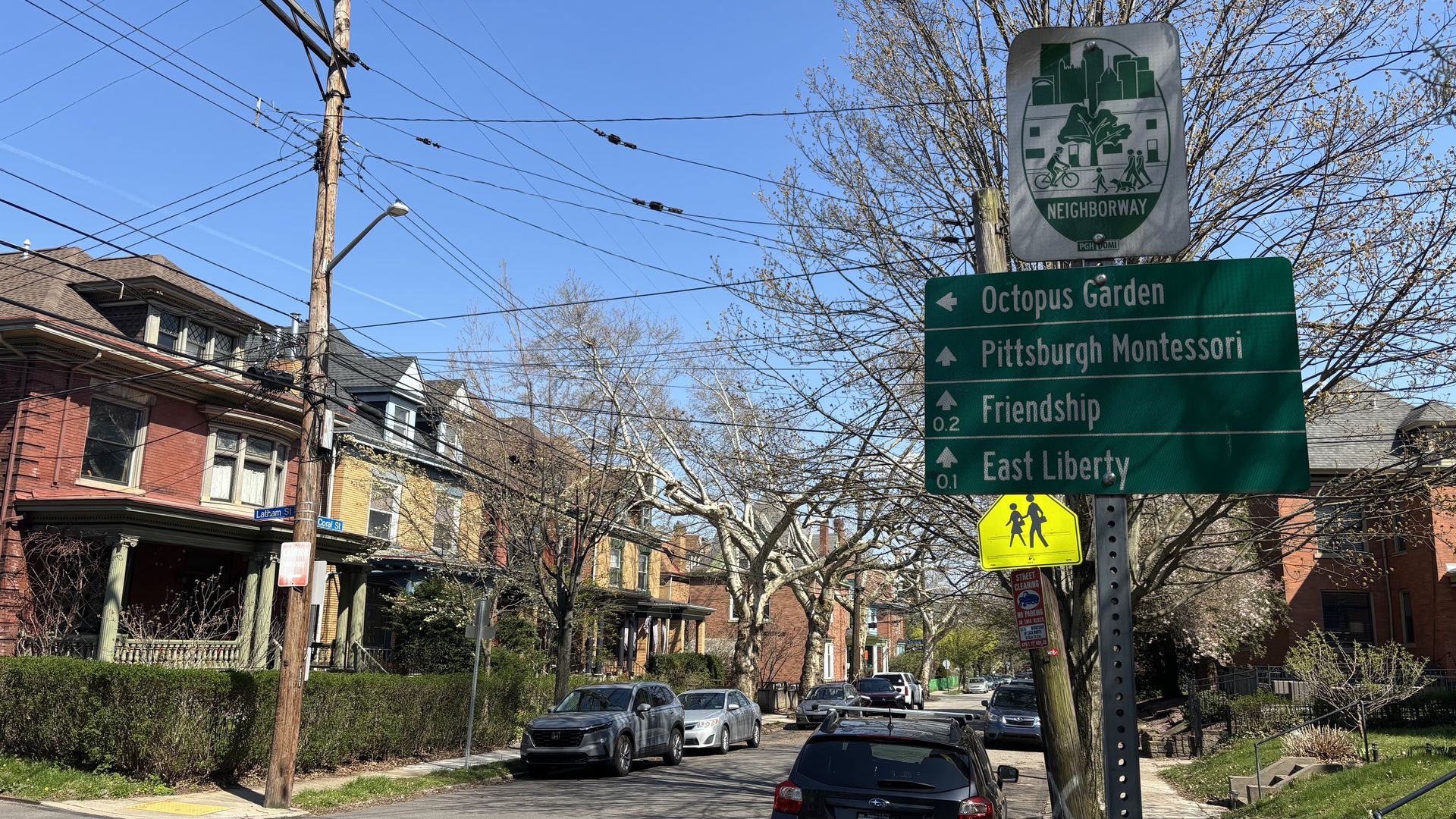
The Bloomfield-Friendship Neighborway is a much nicer ride than busy Penn Avenue, a block to the north. Photo: Ryan Deto/Axios
The city's roads can be challenging to navigate by car, and often even harder by bike.
Why it matters: Spring is here, and more Pittsburghers will be hitting the streets on two wheels, so it's important to know where riding is the safest and most stress-free.
The big picture: Not much of Pittsburgh is laid out on a grid, and there often aren't many alternative routes, which sets up conflicts with drivers and cyclists on the city's narrow streets.
- Enter Neighborways, a bike infrastructure program that started in 2020.
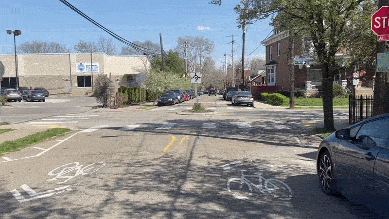
- Select side streets are marked with signage as good bike routes and provide infrastructure like mini roundabouts, curb bumpouts and speed humps, but they aren't wide enough to get dedicated bike lanes without removing parking spaces.
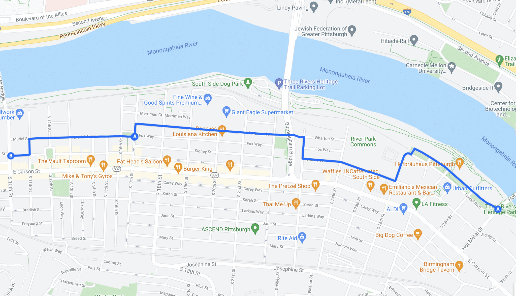
Case in point: East Carson Street is often crowded with vehicles, buses and busy nightlife. But a block or two south, a different road is quiet, slow-moving and perfect for a bike ride.
- The South Side Neighborway was the city's first, and it starts at Oliver Bath House and traverses Muriel, Wharton and Sydney streets to make riding through the neighborhood easier.
Zoom in: The Bloomfield-Friendship Neighborway takes riders off Penn Avenue and onto Coral Street and Comrie Way.
- Central Lawrenceville: Willow and Hatfield streets to avoid Butler.
- Melwood Gold: Offers a hill-free, car-light route connecting Polish Hill and North Oakland.
- Euclid Neighborway: Installed mini roundabouts on Euclid Avenue in Highland Park to slow down cars and keep cyclists off Highland Avenue.
- Reynolds: Connects Mellon Park with Frick Park in Point Breeze along Reynolds Street.
- Ellsworth Avenue in Shadyside: Now a Neighborway after some recent traffic-calming infrastructure.
Pro tip: These routes won't show up on Google or Apple maps because they don't actually have bike lanes or bike trails.
- Check Bike Pittsburgh's official bike map for exact Neighborway routes.
Between the lines: To be considered a Neighborway by the city, the streets must be owned by the city, have no more than two travel lanes, a speed limit of 25 mph, and no more than 3,000 vehicles travel on them per day, according to the city's Department of Mobility and Infrastructure.
The bottom line: Neighborways fill in some of the gaps between the city's bike lanes and trails, but if you want to ride the whole city on a bike, you're going to have to ride with cars at some — and often many — points.